Will it Ever Rain in California again???? 2nd Week of March looks Promising! Cross Fingers
Weather Followers,
Been a few weeks since I have posted a discussion, but honestly, there hasn’t been anything to post. Wanted to post a quick update this evening on the pending weather pattern that might help the drought issue in California. Since the rain/snow was very scarce in California in Feb, most of us are waiting for a March miracle. Southern California has fared better than NorCal this winter, due to several cut-off lows dropping down to SoCal in the past month, which as given the region scattered showers and some snow in the mountains. Today was one of those examples in SoCal, as rain in the Inland Empire fell and mountain snow in BigBear and Mountain high had some decent totals. However, things might be changing around the 2nd week of March, as the North Pacific high pressure ridge (which has blocked/deflected most weather system in the past 2 months into California) seems to migrating northwest in the north pacific. This will allow the jet stream to undercut the ridge and aim it into California. As you can see on the models below, this is what they are forecasting. Again, this is 7+ days out, so take it with a grain of salt. Currently, this upcoming week will be warm and dry in California, with above average temps, and/or near normal in some areas. Below are a few models and what they are showing rain wise for California for the next few weeks:
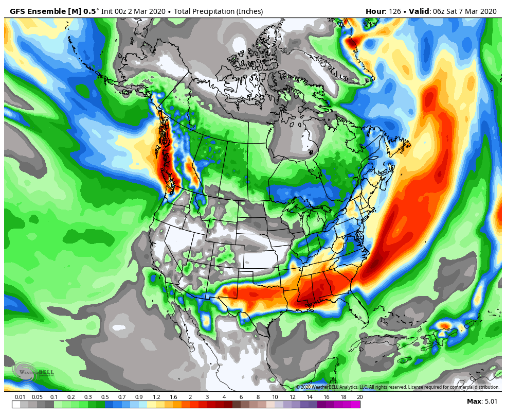
GEFS model below showing not much rain in California before the 2nd week of March. This is the accumulated model through March 7, which is next Saturday:
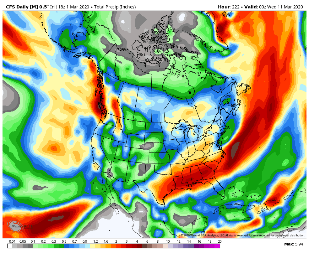
Now, here is the GEFS through March 11, a little more rain is forecasted in California:
Now moving on through the week of March 9th, things get interesting, as an upper level low pressure sits off the California coast and delivers a much progressive wet pattern for the state. See the GEFS model below through the middle of March:
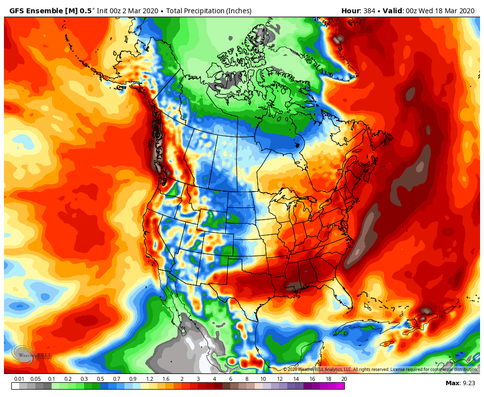
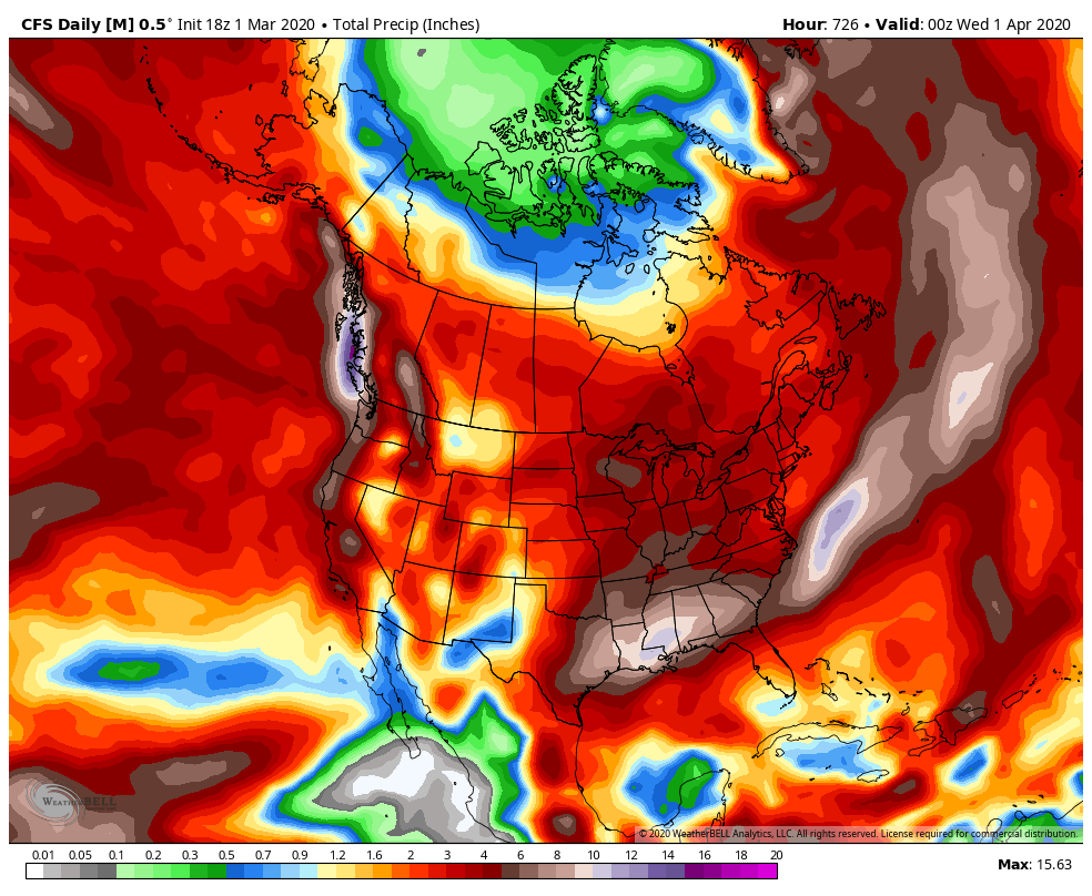
As you can see, much of the state of California is forecasted to be very wet, a good amount of mountain snow will fall. The CFS model is also showing a lot of rain through April 1st. See below, as there is a lot of red and brown on this image below:
The message here is that most of the models are forecasting a pattern change by next weekend. How much rain/snow and when it will start is still up in the air. I have seen this pattern form time and time again this winter on the long range models, only to disappear 5+ days before a pattern change was suppose to take place. Therefore, I will keep my eye on this and update throughout the week. I will also check out the European models tomorrow, and see if they show the same change. As of last night, they did.
Stay Tuned!
-JM
