Record Snow/Polar Vortex in Texas, as California is Mild, Dry and Windy
Well, what a week weather wise it has been. From Seattle, to Chicago, to record 100 year snow/ice storms in Texas, we have seen it all. As we progress with climate change, more extreme weather will occur. Snow in places that hasn’t seen snow in 100+ years have fallen, and now Texas is under the gun with a state of emergency, as some areas that are not used to extreme cold temps got hit pretty hard, and are struggling with no power, broken pipes and no water. La Nina has hit with a vengeance, sparing California for the most part this winter. Lets get into it….
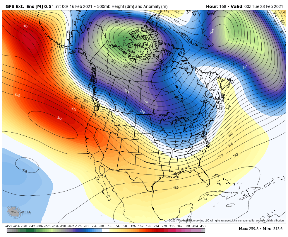
All the talk has been La Nina this winter, and the extreme weather it has caused across the country and world. However, California, especially SoCal, it has been a very dry winter. Although the SoCal mountains have faired pretty well snow wise, downtown LA has just over 4″ of rain for this water year, which started on October 1st….way below normal. With the exception of the two storms that have hit SoCal at the end of December and January, it has been bone dry. Replacing rain/snow, it has been very dry/windy weather throughout the winter. Other than the atmospheric river that hit Central and Northern California last month, it has been dry throughout the state. The Sierra’s have gotten marginal storms this season, with the exception of the storm cycle at the end of January. So, what does it mean for the rest of the winter? Well, if you like rain/snow in California, the short term forecast will be tough to swallow. As you can see on the map below, high pressure is locked in, and 80’s will be in the cards for some inland spots next week all over California, depicted on the map below.
As we progress into March, There are signs that the weather pattern might be flipping, but I think it might be delayed a bit. Currently, the teleconnection patterns point to an active pattern in the west starting the first week in March, but will know more this weekend.
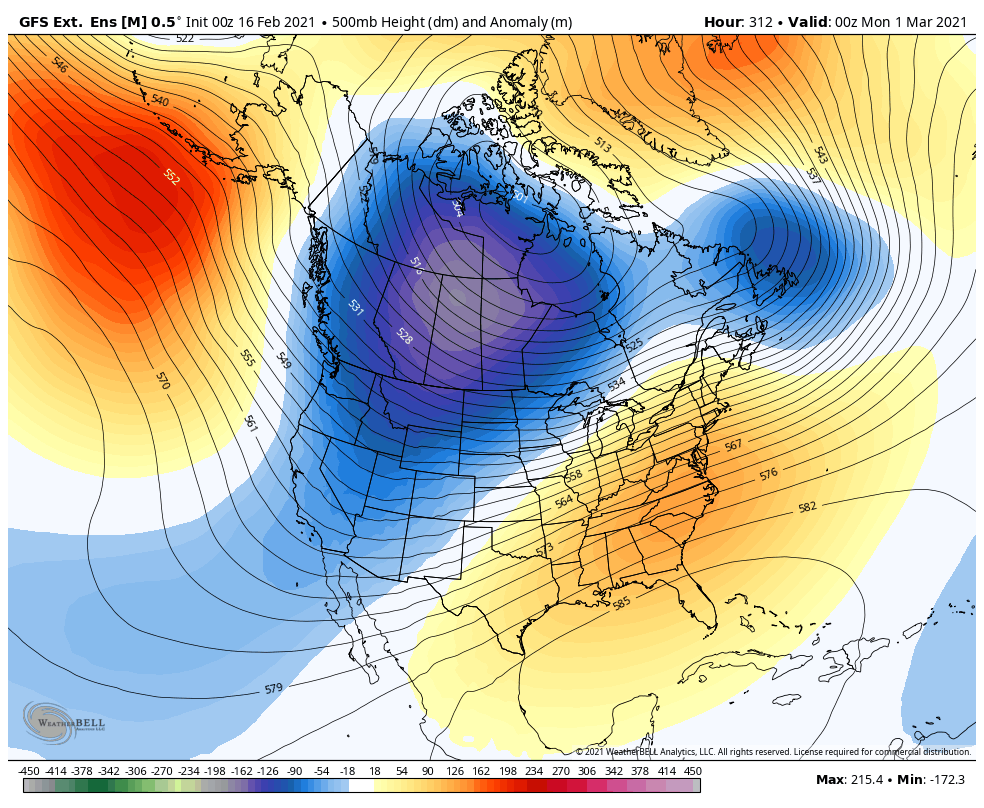
In addition to the models showing the pattern above, the PNA teleconnection pattern is flipping to negative in the long range, which means a west coast trough and east coast ridge. See below

As you can see above, there are changes on the way, but it might be two weeks before California’s persistent ridge of high pressure breaks down and active weather resumes sometime in the beginning of March. In the meantime, look for the artic weather to moderate in Texas thru the Midwest/Northeast by the end of the month. But, this La Nina year has been one to remember. For those of you who are in SoCal, enjoy the 80+ degree weather for the next 10 days or so.
Next Update this weekend for the pattern change for the first week of March. Keep your fingers crossed for this pattern change to happen, as California needs the rain/snow very badly.
Stay Safe!
-JM
