Weather Prediction 2022-2023
Hope all of you are safe and healthy. Been awhile since I have posted on my blog, as I ususally use twitter to discuss the weather. However, I figured I use the blog to give my predictions of this upcoming winters, as it is that time of the year again when everyone makes their predictions of the winter. So why not me?
With La Nina going onto it’s 3rd season, the knee jerk forecast is the West Coast, espcially California, is going to be warm and below average precipitation for the season, further making our drought worse. As you can see what happened earlier this week, everything is in play this winter, as California got drentched by a very early season storm, that dumped heavy rain in most areas of CA, espcially SoCal, and heavy snow in the Sierra’s. Personally, this shows you that mother nature is in control, and we have no way to predict what is going to happen. What I can do is help, and give you come context of where things are currently, and what might happen in the months ahead. Lets get into it.
Sea Surface Temps:

For most of you that follow me on Twitter, I am very into the SST, and how the conditions effect our weather. This is effects La Nina, El Ninos, teleconnection patterns, upwelling and downwelling of ocean currents. It is a big complex, but let me make it easier for you to understand. As you can see above, there is a moderate la Nina at the equator, that has been around for 3 years. What is interesting, is the very warm water on top of it (north), in the eastern pacific. The very warm (red) blob is just on the date line at 180 degrees West. This is a much different setup then in the previous 2 years of La Nina, and not your A-typical La Nina forecast. Keep an eye on this, as you don’t want the red blob migrating east towards the Gulf of Alaska. This is what happened earlier this year from January to March, and created a high pressure dome, and California had 90 days of dry, mild weather with no rain/snow to speak of. A lot of the models are predicting the La Nina to fade as we get into the middle of winter 2023, and go into the netural phase. I will be watching this weaken, which it has a little bit the last few weeks.
Moving forward, I do think we will have a very active season in California at times, and dry periods, at times. As you see below from the CFS climo forecast models (which are sometimes not very reliable), they give you a snap shot as to what the winter might be like each month. I use it has a climate possibilty, and not a forecast, and they change daily, so I am putting some context into these graphics:
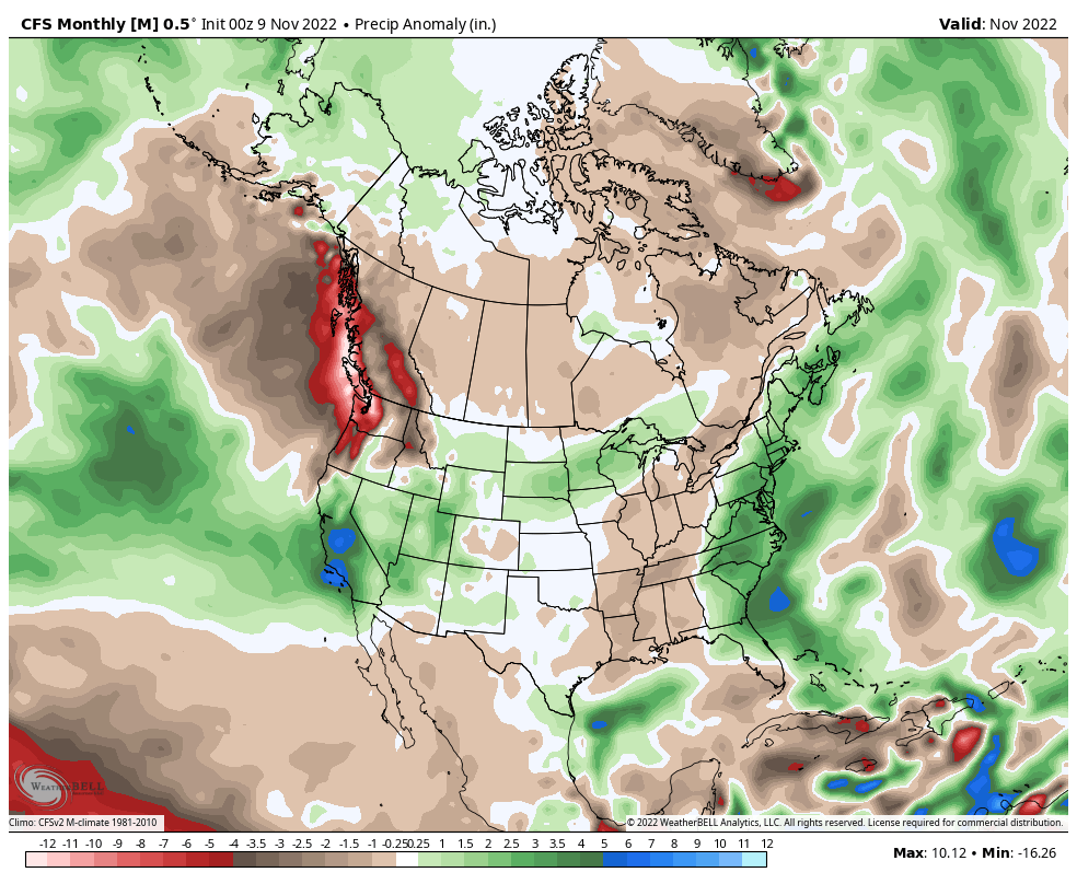
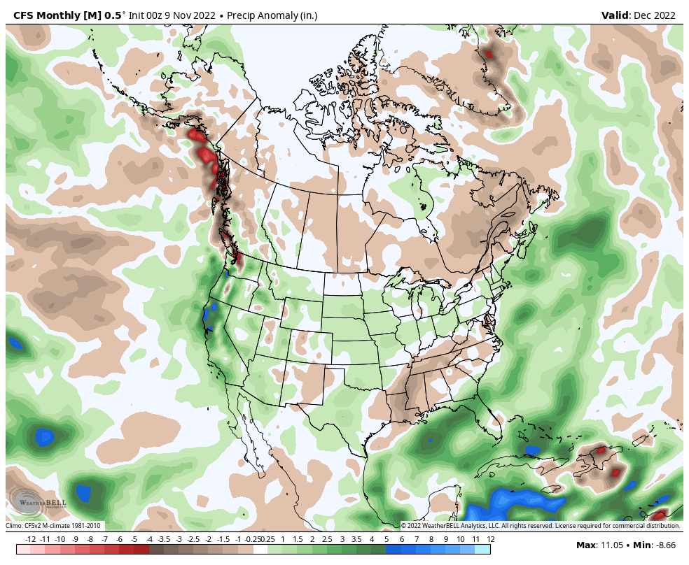
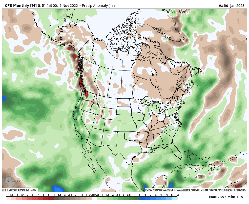
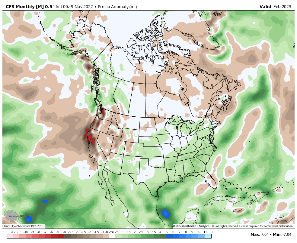
As you can see above, this month, December and January looks fairly active. Now it might not rain/snow all the time, but these models show an increase of an active pattern. February looks dry. So again, it is all over the map, but the message here is we will have active weather more often than not, compared to previous years.
In doing these forecasts, last year I went 10-14″ of rainfall for DTLA/USC station. We ended up in the 12″ range, smack in the middle. This was even during a strong La Nina, with a very active December of 2021, then dry thru the end of March 2022, and then the faucet turned on again with rain snow.
So what about this season? What does it looks like? After this past week, all the cards are on the table for an active season with some prolonged dry periods in the middle. I think the southern jet stream will be stronger than in previous years (and predicted), with more pineapple express systems ( Atomspheric Rivers). This will create problems for the burn scars areas, as it has this past week in SoCal. Therefore, I am going on a limb here at predictng anywhere from 13″ to 20″ of rain in DTLA for this winter. This will be easy to achieve, as DTLA already got close to 1.5″ of rain this past week. I believe the snow pack in the Sierra’s on April 1st will be close to average, and may even be above average. As we progress into spring, I feel the season will be prolonged, as La Nina will fade and more active weather will occur later in the season, with the southen jet stream. As for the temps, it is currently below average in California currently, and will remain below most of the month. December, looks to be about the same, so stay tuned. I will update you as we head into December.
–JM
