Cold/Windy Out West – Rain and Sleet in the Northeast
Weather Followers – it has been a very unusual winter, weather wise. From the lack of snow in the northeast, to 85 degree weather in Los Angeles this past weekend, to record snow in Utah & Colorado, it is a bit out of phase. The pattern that started this winter hasn’t really changed much, as the ridge of high pressure has remained off the west coast for most of the winter, and given most of California dry and very warm temps, with below average temps. For the Northeast, they are still looking for snow, only to be disappointed when some models show snow in the forecast. Case in point, this week, there is forecasted to be a sleet/rain storm in NYC, but Boston might end up with snow. Crazy stuff. Below are some specifics for the week and the long range fantasyland
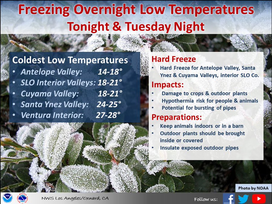
Caliornia – Most of you in the LA experienced a massive cold and dangerous winds last night and into today. The wind and cold will stay around until Wednesday as high pressure takes over again. See the warning from the NWS LAX below:
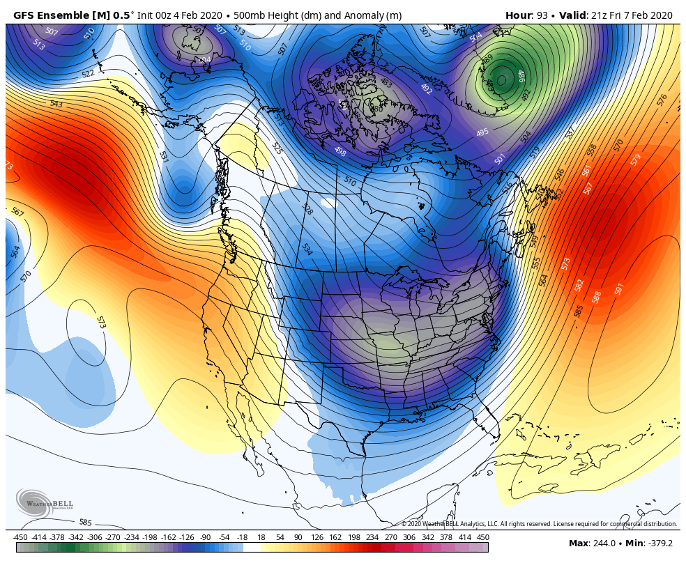
After Tuesday, high pressure kicks in for the West Coast again, and a low pressure system heads into the northeast. Look for sleet, freezing rain in NY and some possible snow in some areas in the northeast. See the GFS Ensemble below. Pattern flips.
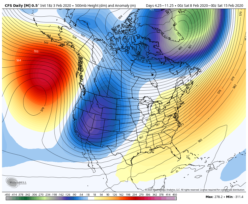
After this weekend, the ridge in the eastern Pacific really gets amplified, as more inside sliders are forecasted to ride over the ridge and head down the interior portions of CA/NV, bringing more wind, colder temps, and some light snow to the Sierra’s. Utah and Colorado might get some good storms out of this setup.
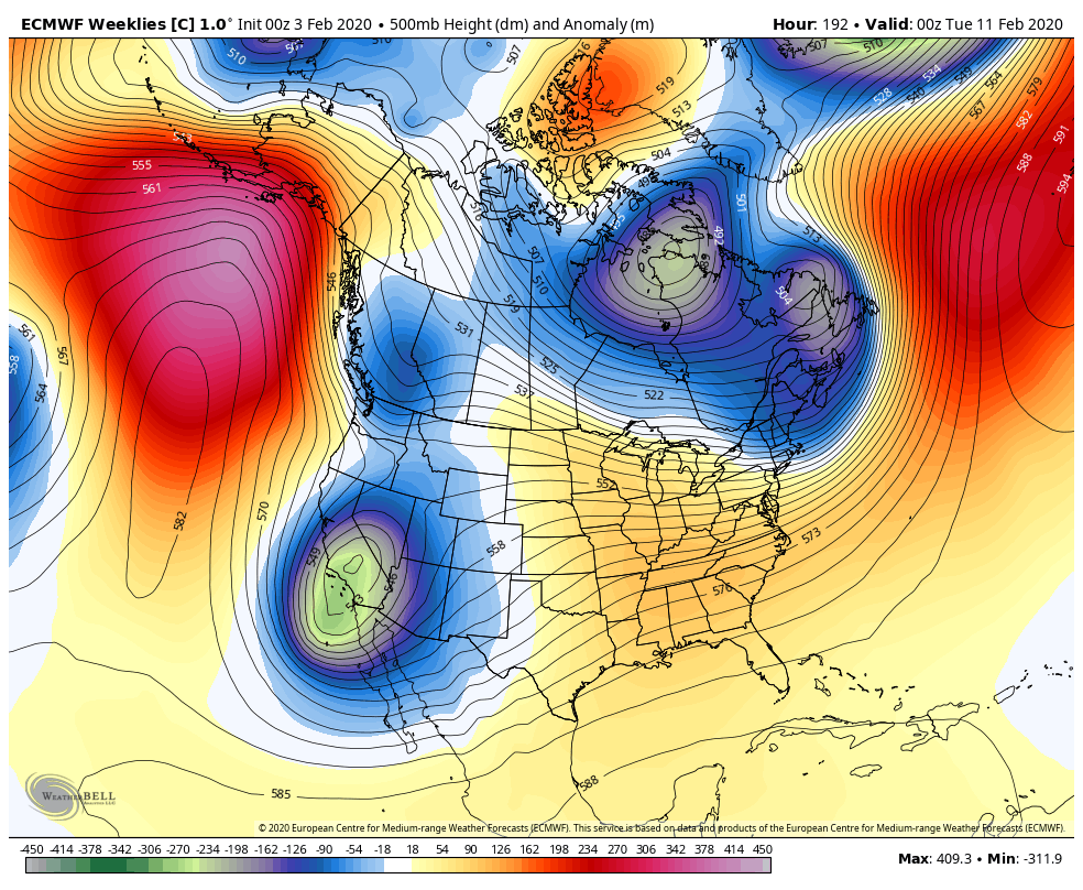
As the month of February goes into President’s weekend, the long range models, AKA Fantasyland, are showing the ridge migrating a bit further north under Alaska, and the jet stream undercutting the high pressure ridge, giving the West Coast more of a over-water trajectory jet stream, which is something we haven’t see much of this winter. If this occurs, there will be some good storms in the next week or so in California. See the graphic below:
The Euro models are showing this setup too, but the ridge of high pressure is a big stronger, which is less rain/snow in CA but colder.
I am curious how this pattern evolves in the long range, as California is becoming below average in snow/rain for date of the winter. This pattern would also allow warm air in the northeast and prevent any wintry weather to occur. For California, I suspect after this weekend, the temps will be below average for February, but rain/snow is TBD.
Stay Tuned! I will update later this week.
-JM
