Major Christmas Storm to Slam into SoCal; East Coast waiting for Snow!!
Weather Followers,
Want to wish all of you Happy Holidays from Lone Mountain, Big Sky Resort, Montana:
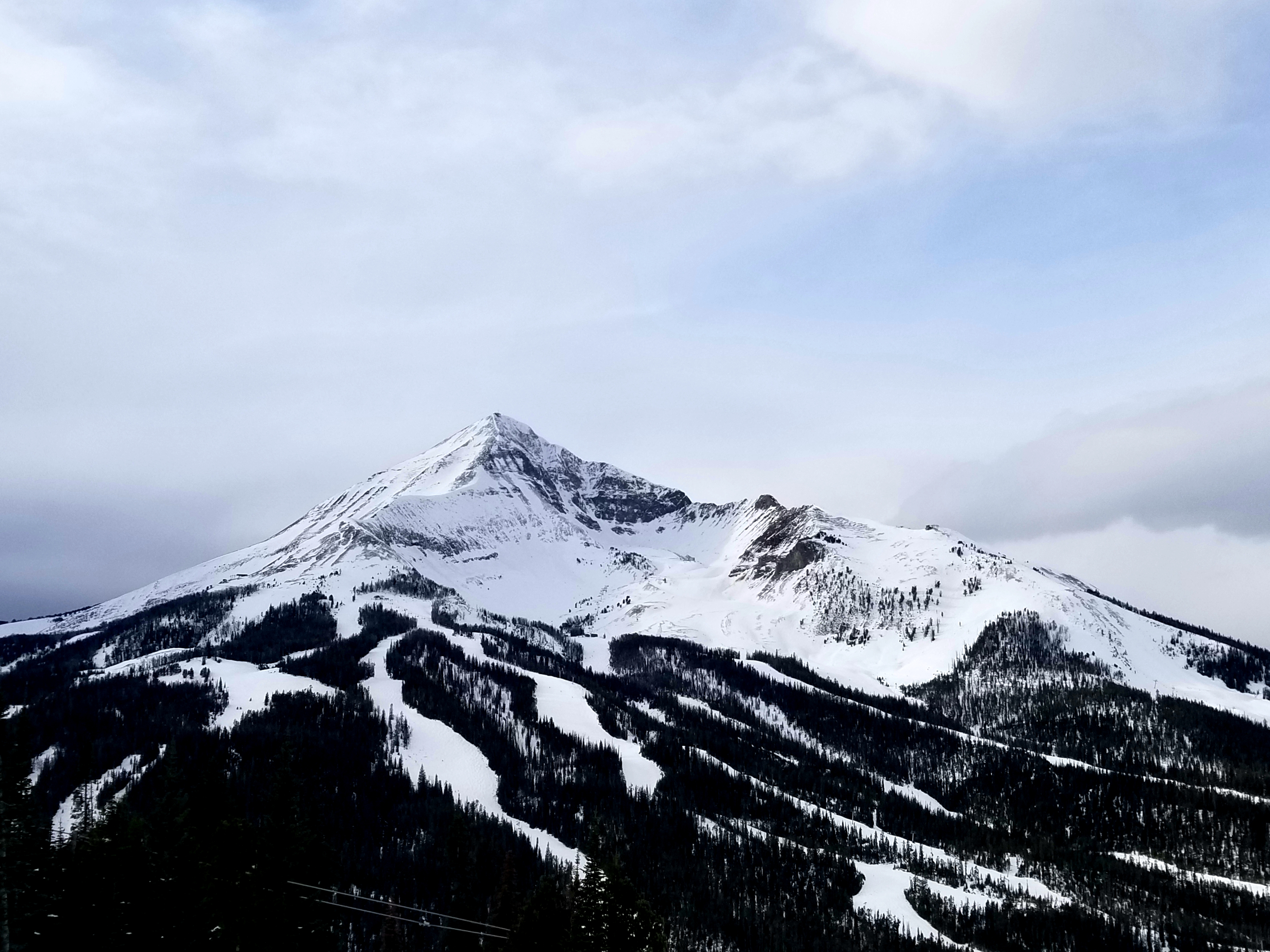
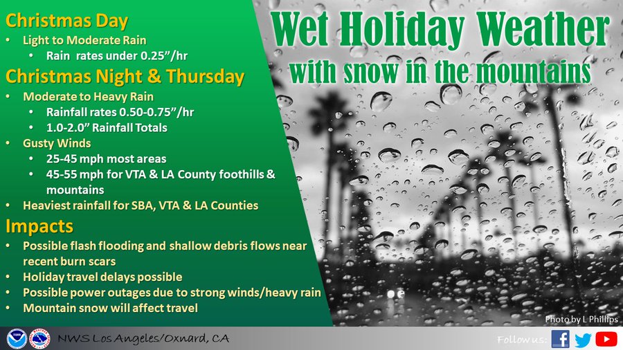
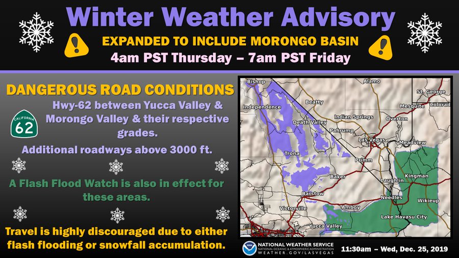
Montana is gods country…… as the town, people and skiing are fabulous. I would highly recommend visiting this area, if you haven’t been up here before. The weather patterns up here are interesting, as the current split flow of the jet has given the Big Sky region light snow the past couple of days, as the direct impact of the jet is headed for the Southwest of the US. For all of my followers, I am sure y9u know there is a major storm poised to slam into SoCal tonight. Major rain, snow, and hydrological issues might occur. As usual, the storm is poised to hit hard between midnight and 6 am. Funny how that always occurs. Below are some graphics on the pending storm:
![]()
![]()
![]() (From the NWS Office)
(From the NWS Office)
(From the NWS Office)
(From the NWS Office)
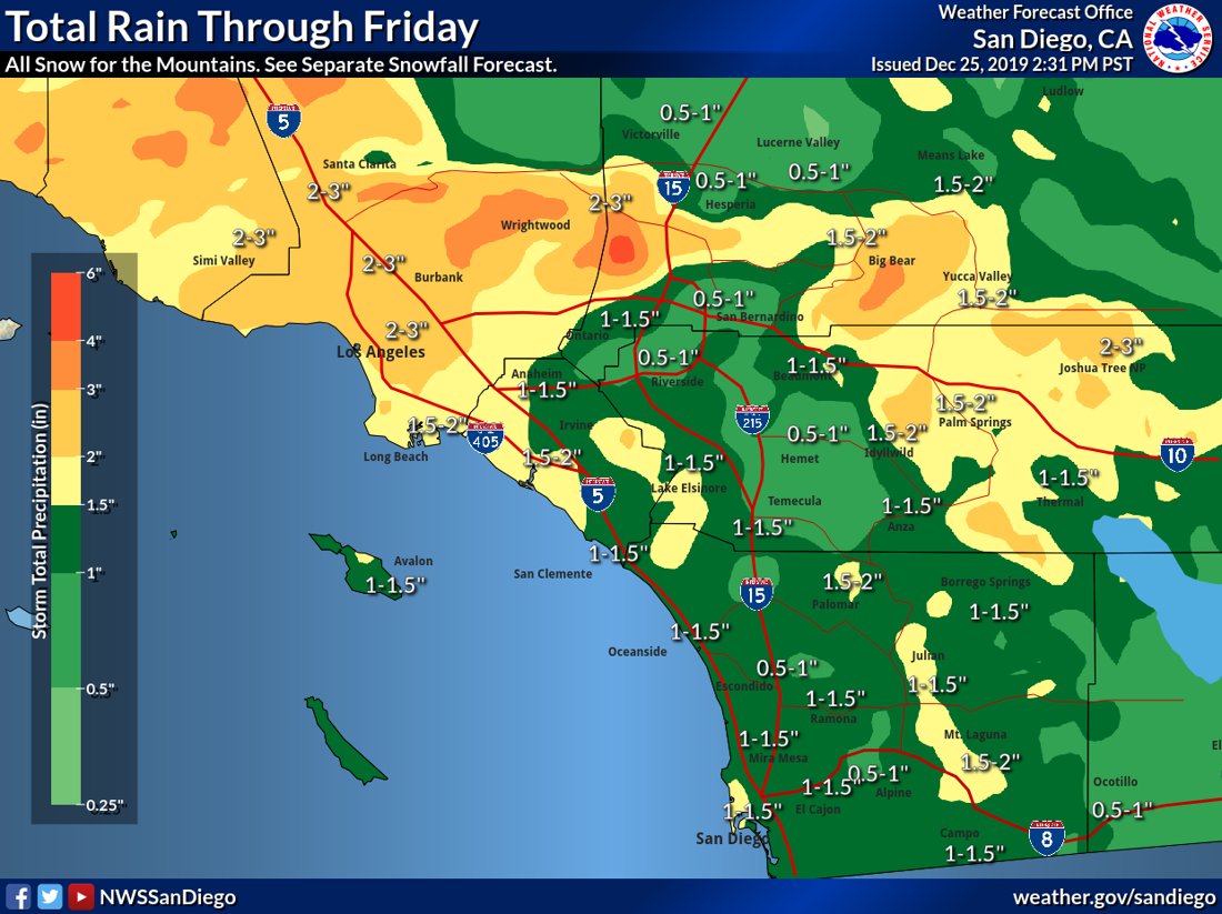
Major snow will hit SoCal. See the total below from the NWS office. I think this is the most snow that has fallen in the last 30 days ever in the local mountains. I will have to research that.
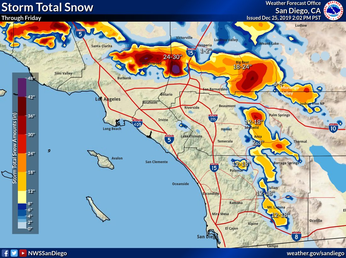
Some highlights:
– The jet has split and it headed down to the southwest with major snow and rain. The totals above look good, and this will be a major storm, similar to Thanksgiving week storms. Since this will be cold in nature, the snow levels will drop down close to 2500 ft, which impact all the major roads in and out of SoCal. Make sure you tune into your NWS forecast office and Caltrans to get the updated road conditions. If you traveling tomorrow through the weekend, be prepared for major weather issues.
After this storm blows through, there is another storm on the models for around New Years. Time will tell what develops, but the active pattern should cease around New Years, if not before. Looking at a break afterwards for about a 10 day period, pushing into the 2nd week of January. Will post a quick discussion on Friday regarding the long range forecast. I do believe this season SoCal will get more of these types of storms, as the jet is split with a lot of the energy normally focused north of Pt. conception. This season, they storm track could be headed more often than not south of pt. conception into the southwest. Interesting stuff.
New York – Above average temps (50’s) have settled in over the Northeast. Look at the blow torch aimed at the Northeast below through the 29th. Crazy stuff. I don’t see any snow or any Polar Vortex (PV) until maybe sometimes after the new year. I saw on the models a possible Nor’easter the first weekend of January, but it is a ways out on the model. Time will tell.
(Look at the Northeast blow torch through this weekend. No snow on the horizon for the Northeast.

Again, happy holidays to and your family from Real Weather Forecast!!
–JM
