Major Storm Brewing on the West Coast! Be Prepared!
Followers,
Hope all of you are having a good weekend. As most of you have heard on the West Coast, there is a major storm bearing down on the West Coast. Let’s get into it.
THANKSGIVING WEEK STORM:
The latest models are showing a very powerful fall storm (Cyclogenesis) headed for the California starting Tuesday night, and will continue thru the upcoming Thanksgiving holiday week.
<Look at the Euro Model with the Cyclogenesis low hitting California on Wednesday. Impressive>
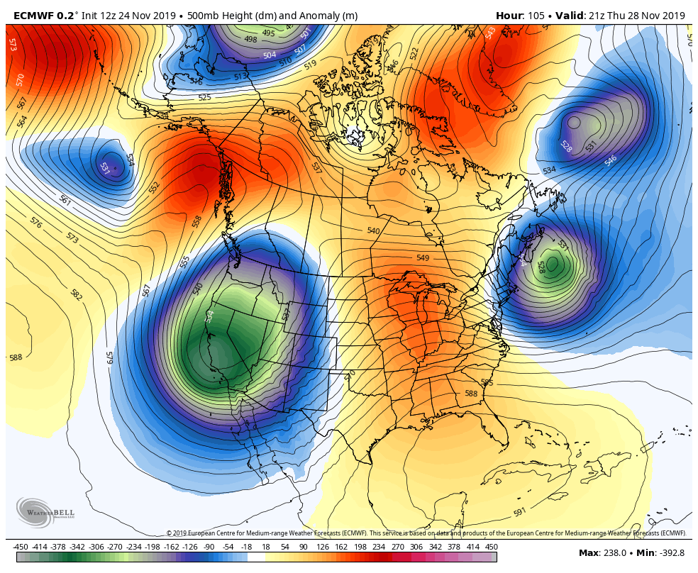
As impressive as this low pressure is, a few days ago, the forecast models were showing copious amounts of rain for California, especially Southern California with feet of snow in the mountains. Since then, the models have backed off on that solutions, as the the main difference for this upcoming storm is this low pressure system will not stall off the coast of CA for a few days. Instead, the low pressure system moves through with a more of an inside track on Tuesday night/Wednesday morning, as it’s more progressive and will blow through with a front. This will limit the long period of heavy rainfall that was forecasted for the LA/SD, earlier in the week. LA & SD will get a good shot of rain, but the 3 to 5 inches forecasted on the models will not happen.
Below are some graphics from the NWS offices in San Diego/Los Angeles/Sacramento/Reno about the upcoming storm:
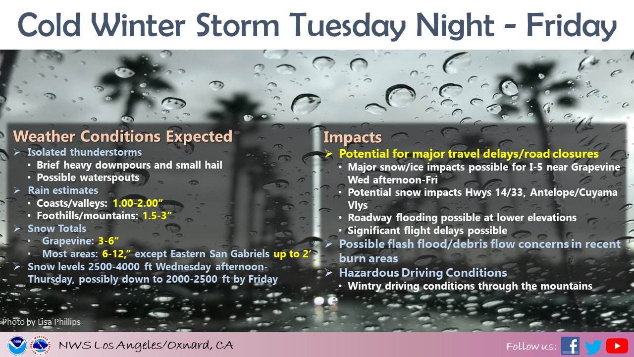
<Highlights of the Storm from the NWS LA>
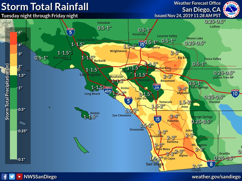
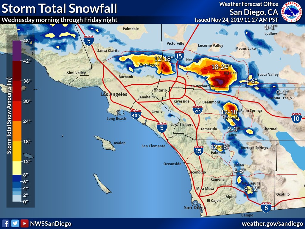
<Rain/Snow forecasted totals from NWS SD>
Snow totals through Friday for the SoCal Mountains. Impressive.
In addition to snow in SoCal, Northern California is going to get slammed with rain and snow. Major accumulations will fall, as anywhere from 2′-5’+ of snow could fall in the Sierra’s. Snow levels might be as low as 1500 ft with this storm….wow!! Look at these projections with the major passes in the Sierra from the NWS Sacramento. Good stuff. I believe that all ski resorts in California will be open by this weekend.

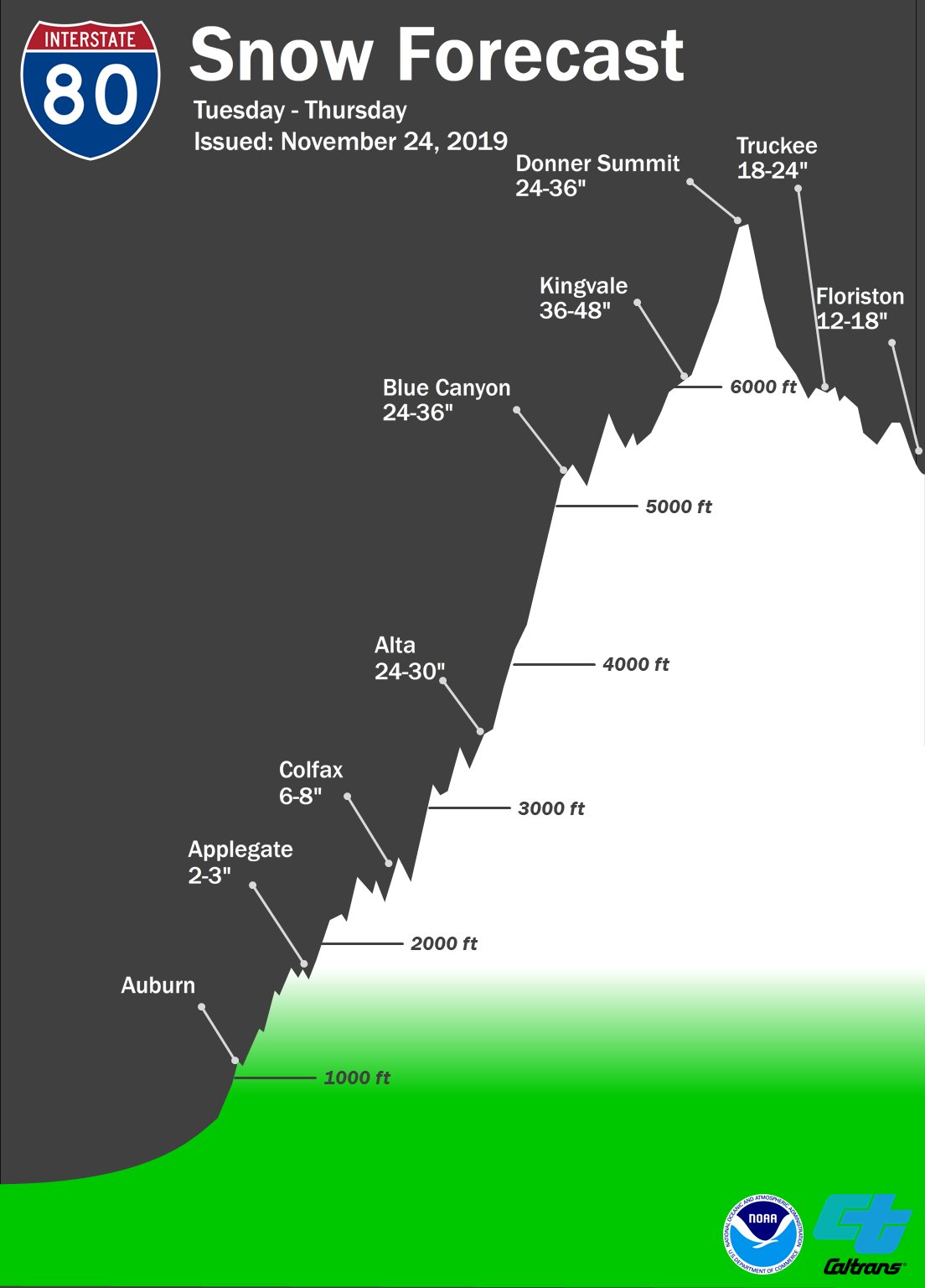
If you are traveling through the Donner Summit to Tahoe this week, be prepared. See below the amount of snow forecasted for the area. Insane!!
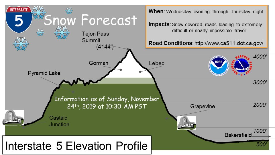
If you are traveling through the Tejon Pass this week on I-5, be prepared. See below the amount of snow forecasted for the area.
Long Range:
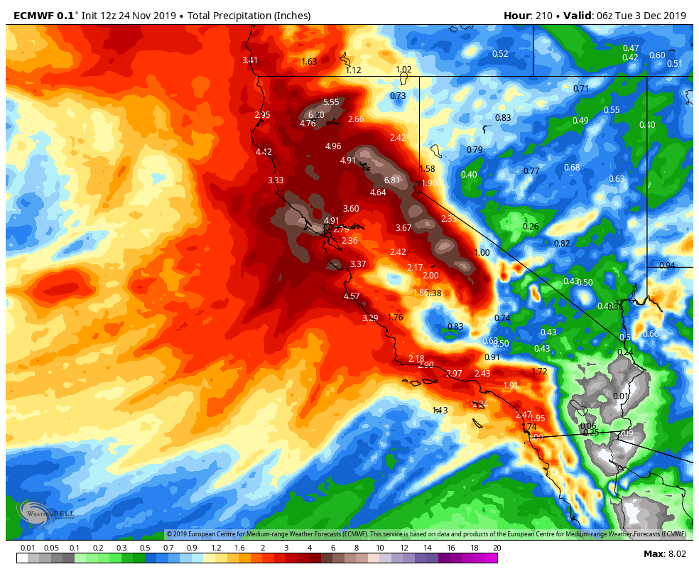
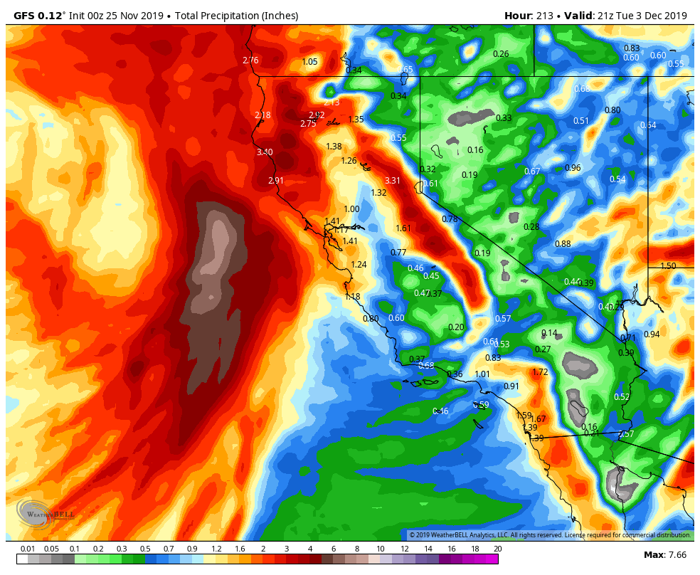
- Both the GFS and Euro are showing another store hitting around December 1st/December 2nd time frame. See the rain totals below from the Euro/GFS model through the 3rd of December. GFS is definitely drier. I don’t much stock in anything over 5 days out, so this is fantasyland currently.
2. The warm blob of warm SST’s off the coast of CA moved west which is good news. As long as the blob moves away from the California coast, I think California will get its share of rain/snow this winter.
Be prepared this week traveling. If you need local forecasts, go to www.weather.gov, and type in your zip code/city. It might save your life. Will update the storm upcoming storm on Tuesday, and discuss the following week’s possible storm.
–JM
