First Storm for California, and first Snow/Wintry Mix for Northeast
Quick update today:
Synopsis:
CA
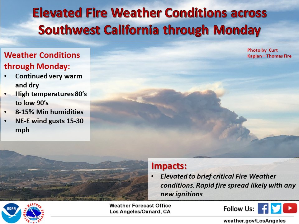
– A lot of high temp records broke yesterday, due to the extreme heat/fire danger/high pressure ridge. Today is still very warm, but a transition to a brief winter weather is headed our way. However, do stay alert, fire danger, light winds and super dry/hot weather will persist until tomorrow.
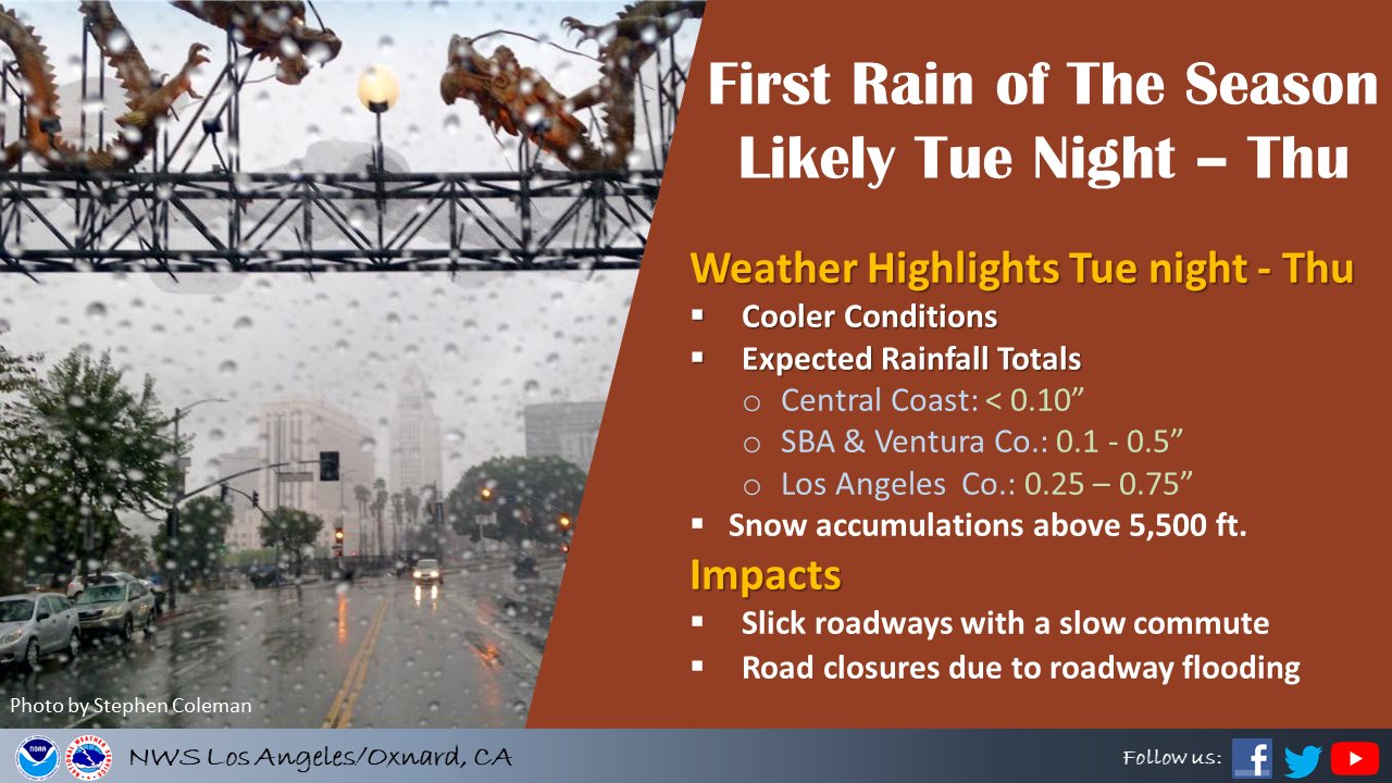
Once tomorrow night rolls around, there is a cut-off low system off the coast, merging with an upper level low. Bottom line is it is going to rain from Pt. conception southward (for a change) and snow above 6000 ft. Anything above Pt. Conception will have marginal rain fall at all, but very windy weather due to the inland nature of the upper level low. The rain down in SoCal however is a welcome change, as the conditions all over California have been miserable for the past 6 weeks. The NWA LAX graphic below shows their estimated rain totals :
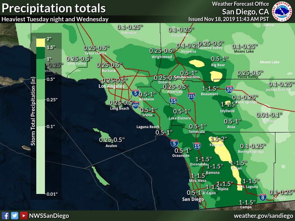
Here are the NWS SD office’s projected rain/snow totals in the local mountains:
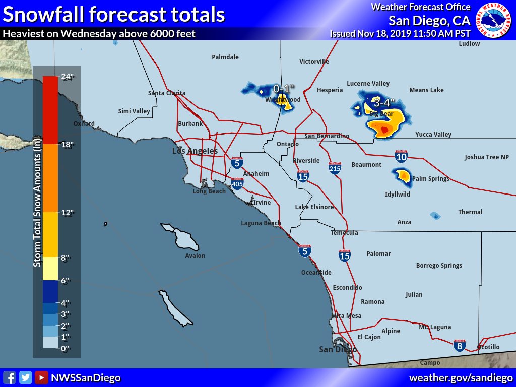
This is all good stuff and look forward to the change in the weather pattern. What has been a challenge the past few days have been the American model (GFS) and the Euro Model (EC) have not agreed with how much rain will fall. Case in point, through Thursday night, the GFS shows barley anything from LAC northward:

Whereas the Euro Model shows San Diego County getting nailed, and more rain north of LA County. Much uncertainty in the forecast and rain totals depending on which models you look at and which one is correct.
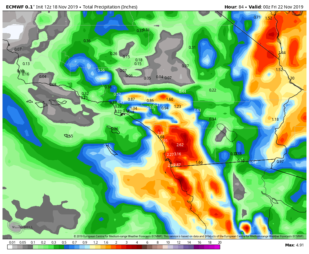
I do think by Thursday, the rain will be out of the area for SoCal and California. Hope the Sierra’s get something out of this, as it definitely not your typical weather pattern and we have been bone dry since September’s early snow fall. Do you rain dances everyone.
Northeast Weather:
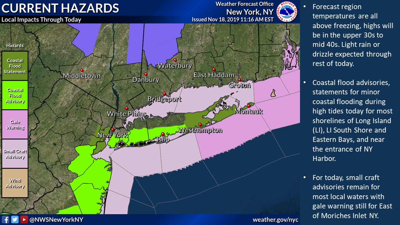
Some images about the coastal storm that brushed the northeast. This is going to be the norm, rather than the exception this winter.
Temps have been a rollercoaster in NY for the past few weeks. 40s/30s look to be the norm moving forward as we head into Thanksgiving.

Winter Thoughts as of today:
CA
– 60% to 85% of Average rain/snow fall this winter.
– Late start to the winter season, as I believe it will be below average rain/snow through the end of the year.
– Above normal temps off and on throughout the winter.
– Jan/Feb/March; winter will pick up
– Snow will be very below normal through the end of 2019, and then pick up around New Years!!
– Santa Ana winds will occur off and on through the end of 2019
NY/Tri-States:
– 90% to 125% of Average rain/snow fall this winter.
– Winter came a few weeks ago and will stick around with below average temps until April.
– December might have one snow storm/Coastal storm.
– Jan/Feb will be cold and snowy. Due to the pattern setting up in the pacific, and Meridional Flow, I am looking at a few coastal storms/Nor-easters setting up.
– Get gas for your snow blowers.
Next update in a few days!
–JM
