Spring has Settled in for Most of the Country….but the Rollercoaster Ride Continues in the West and East!!
Weather Followers,
Hope all of you are well and had a good Easter/Passover weekend. I have been on the road the past few weeks, and haven’t had time to post a discussion. I am now back and ready to see what lies ahead weather wise.
In the beginning of the month, I was in the northeast and had temps range from 80 degrees, all the way to the high 20’s in NY. in 24 hours. Insane. No question spring time with the high sun angles and weather patterns dictate such swings weather wise. As we transition from April to May, I am seeing some unsettled weather on the horizon, that might give some California some unsettled weather…..maybe some rain and maybe high elevation snow in the Sierra’s???
Climate Update – The May gray pattern is setting up for coastal areas in CA to be 20 to 30 degrees cooler than inland areas. In fact, Palm Springs I believe reached 100 degrees on Monday, while Santa Monica was close to 70 degrees yesterday. As I look at the models and the teleconnection patterns for the next 10+ days, the pattern is shifting, and the West Coast will have below normal temps and might event get in some rain/snow by this weekend through the end of next weekend. Below are some forecast models showing the change in the pattern, and how the PNA index is crashing to well below normal:
<Click to Enlarge> European Model showing the PNA Index crashing by May 1:

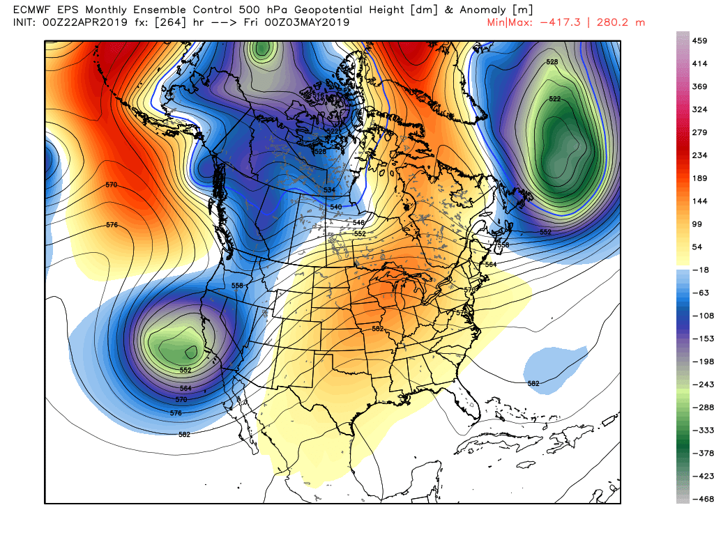
Below is the EPS Model. This model really is showing the jet stream diving down to California and even SoCal, bringing scattered showers, below average temps, and high elevation snow starting this weekend through the end of next weekend. This pattern is still being driven by the southern jet stream, which has been the common pattern this winter on the West Coast.
<Click to Enlarge> EPS Daily Long range Model
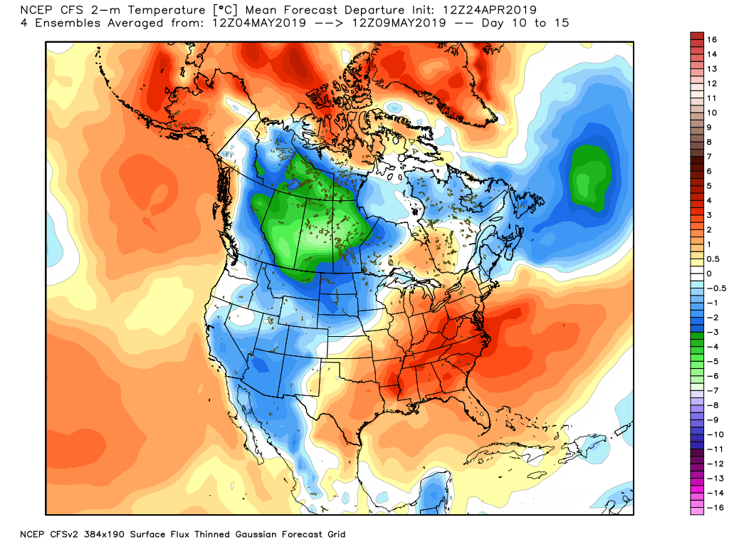
Even the sometimes janky, CFS model is picking up on this pattern change:
And last but not least, NOAA’s CPC 8 to 14 Day forecast is showing the pattern change too:


This is all good stuff. On the flip side, there will be more volatile weather from the great plains to the Northeast, as the southern jet will be very active during this period. As you can see on the GFS model below thru the 16 day period, the amount of precipitation west of the continental divide is pretty impressive.
<Click to Enlarge>

Although on the southern end of jet sagging down, SoCal might get in on the some of the action in the next week or so. New York looks to very wet with above average temps in the long range. Get your umbrellas ready!!!
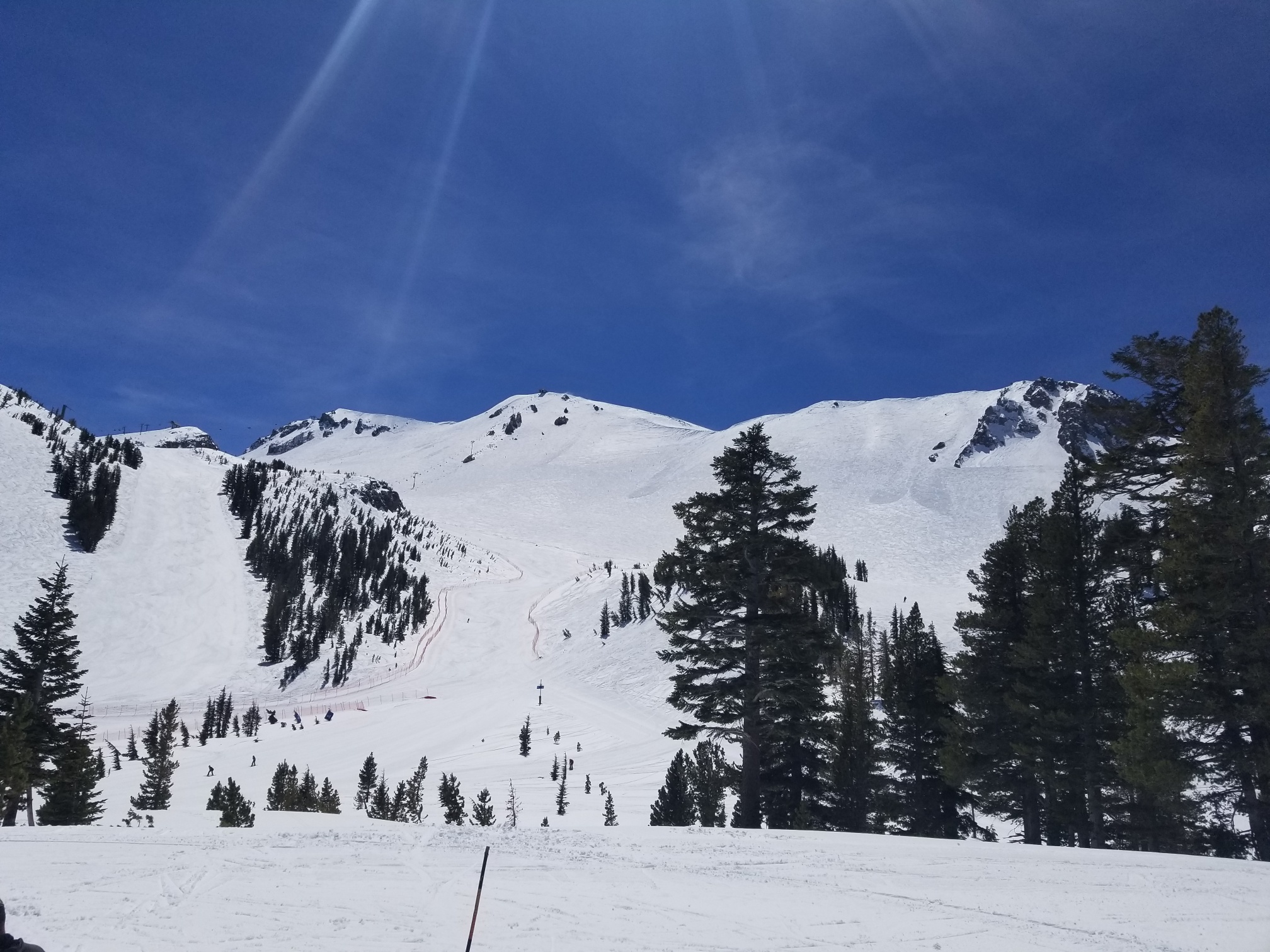
Snow Update – Part of my 3 weeks on the road was going up to Mammoth. The amount of snow up there was equivalent to early March based what I saw, as the snow pack was massive. Below are some pictures from up our time up there and how much snow there is in Tahoe. These pictures were after 1′ of snow fell last week. Truly a Blue Bird Day!
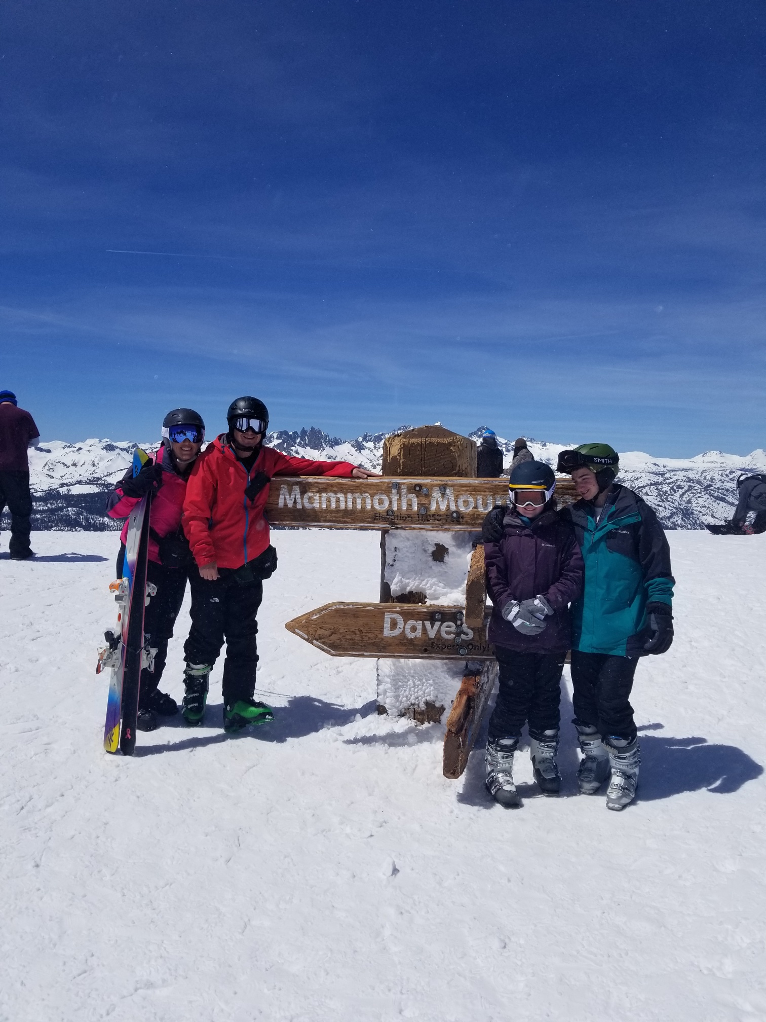
Pictures from Mammoth – Click to Enlarge.
Kids on Top of Mammoth Mountain
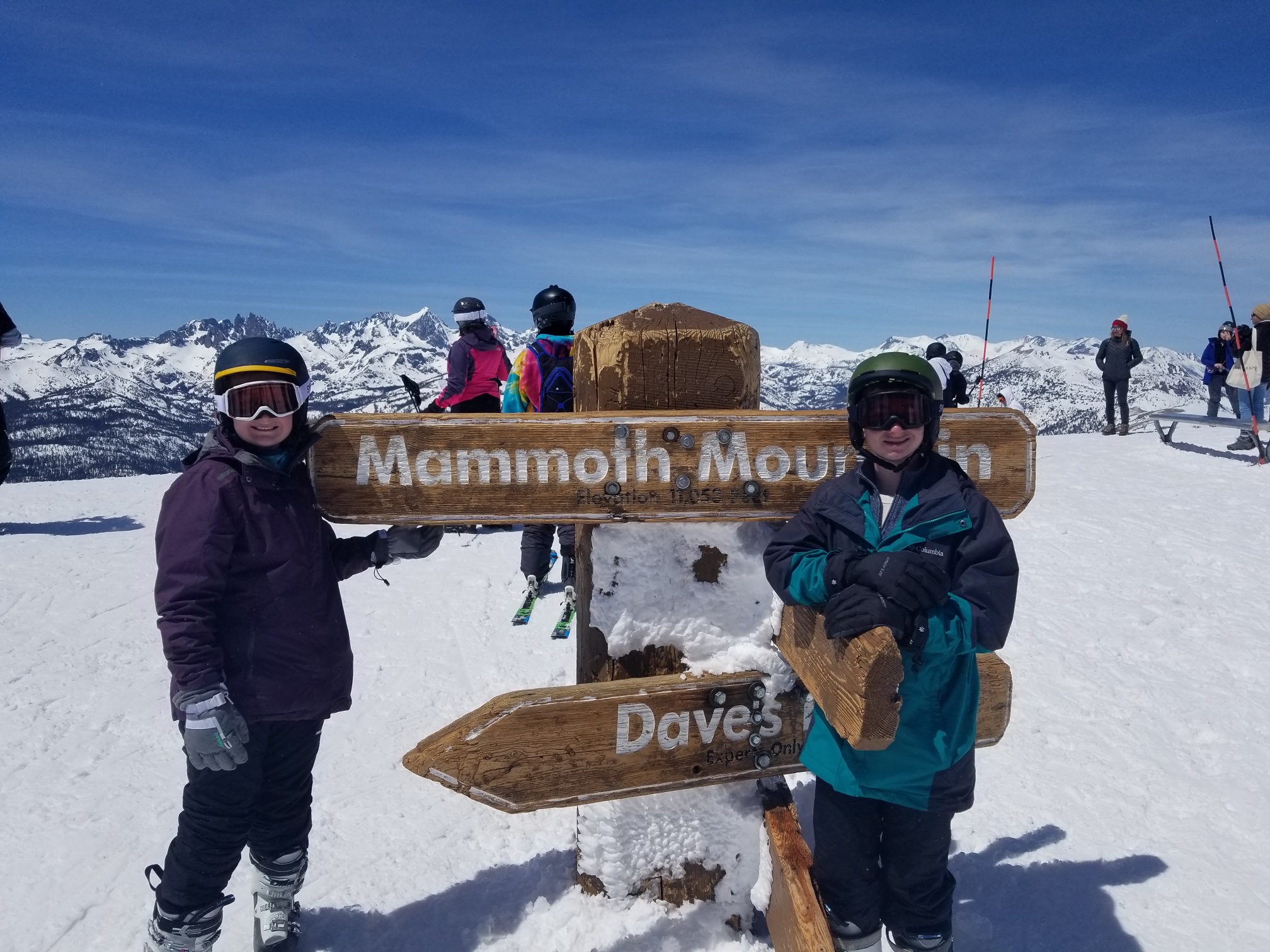
All of us on the Top Mammoth
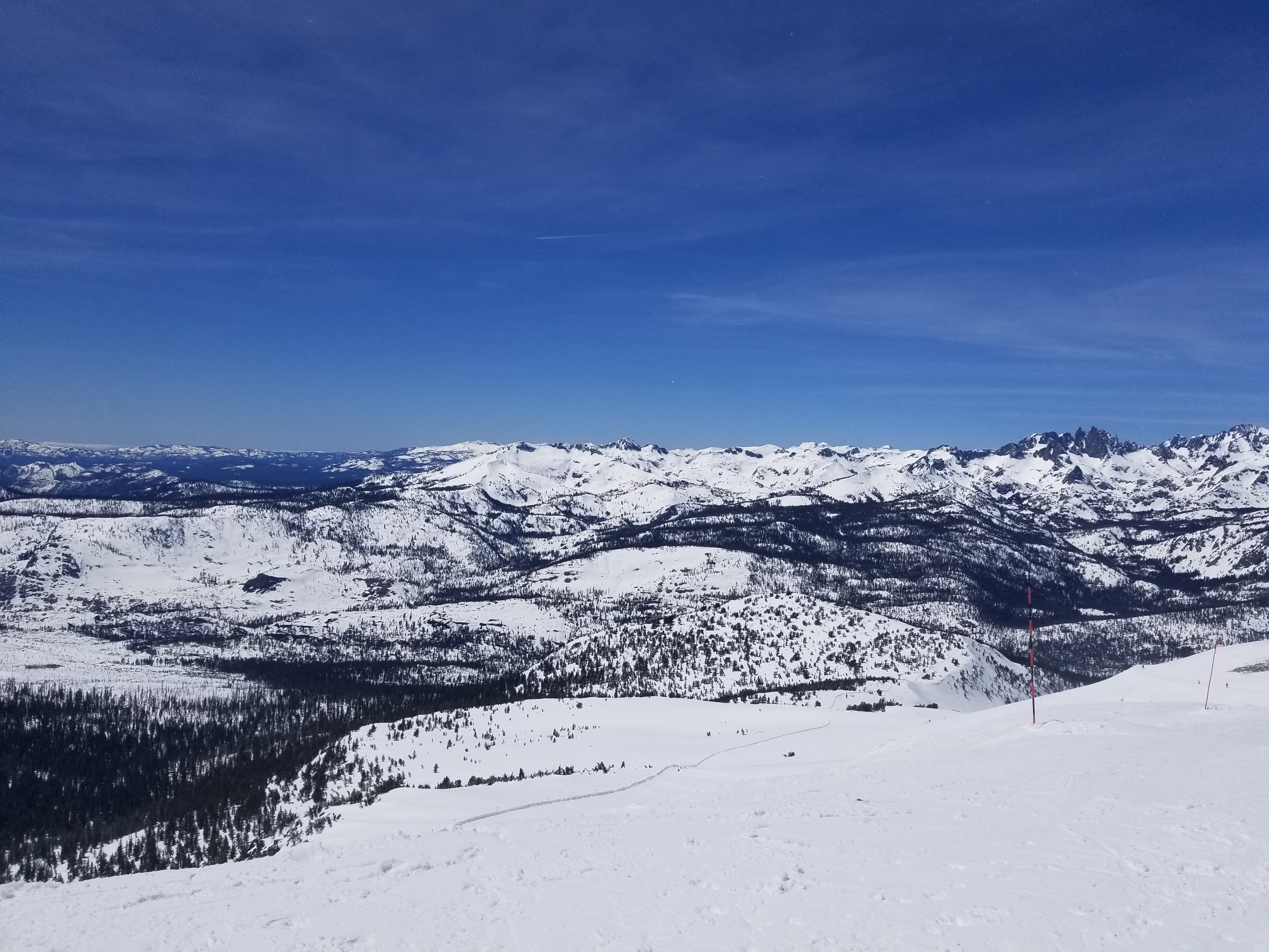
Look at how much snow there is in the Sierra!!
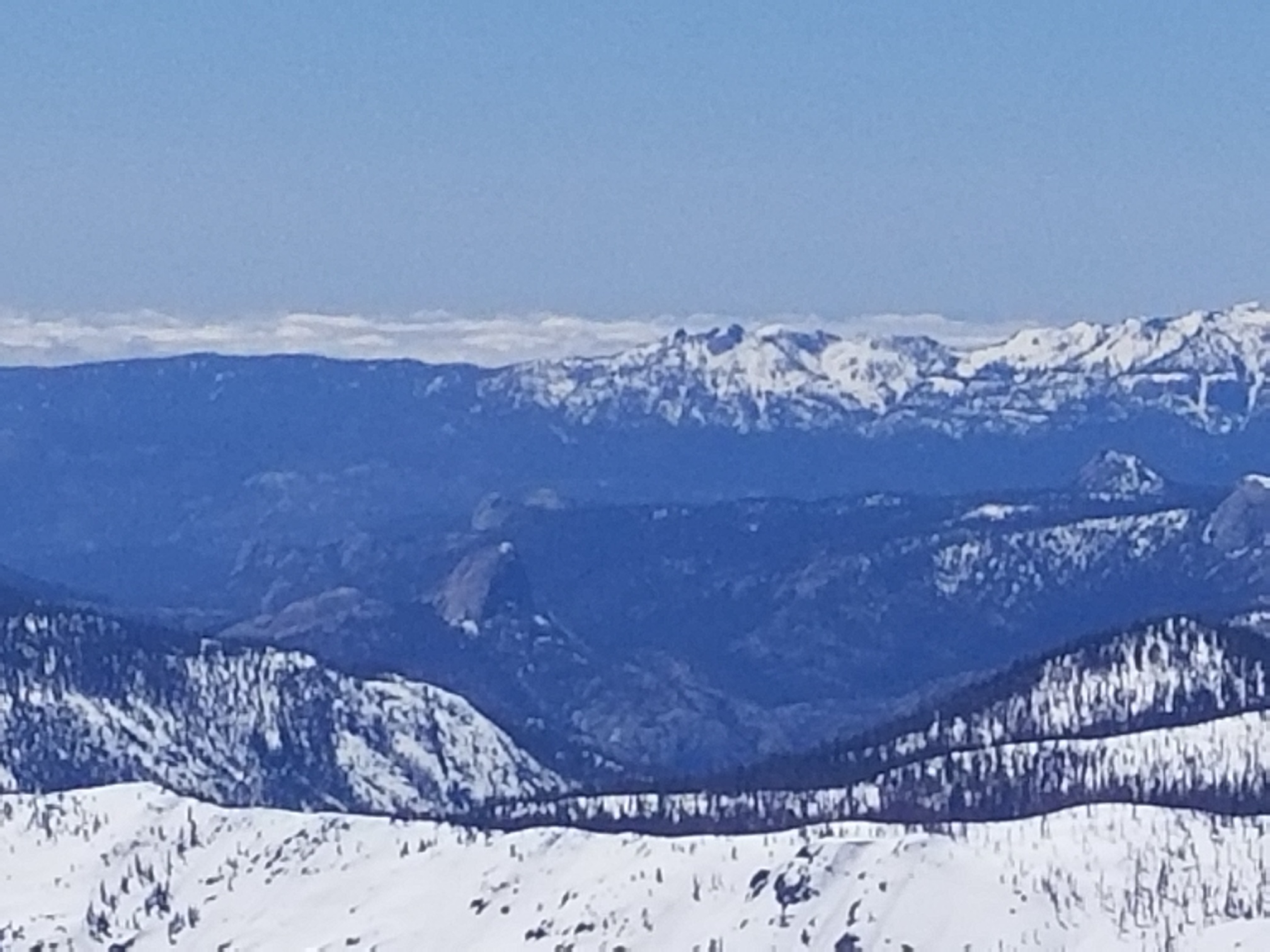
Below is a picture from the top of Mammoth looking West. At first glance, I thought this was Half Dome in Yosemite, but after posting these pictures on Twitter, I was wrong. This is actually Balloon Dome in the Sierra National Forrest. You can’t see Yosemite Valley from the top of Mammoth, but still this is spectacular picture! Just epic! Thank you Mammoth Mountain and others on twitter for correcting me!
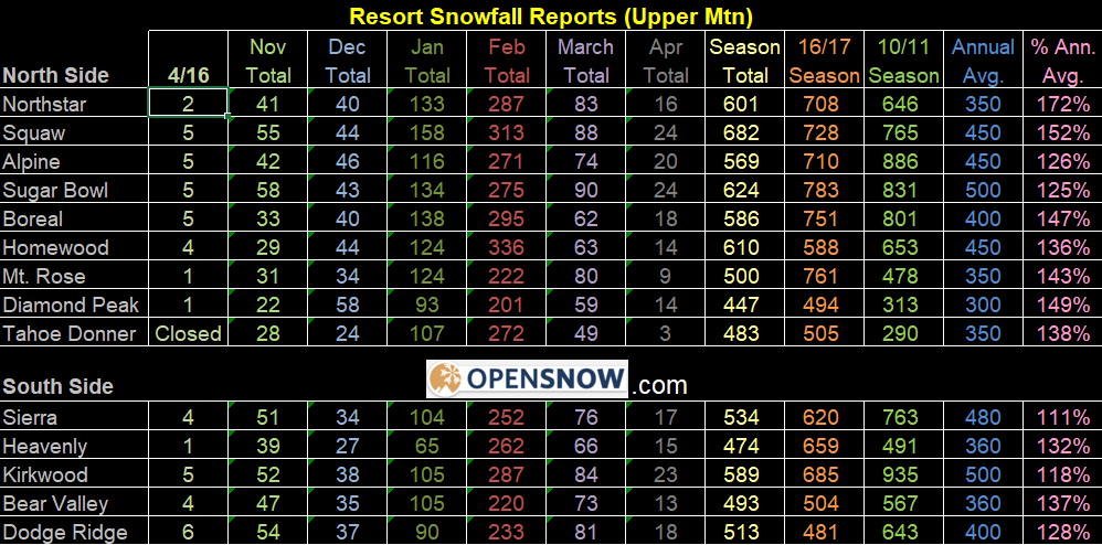
Below are the totals through this past weekend from BA at Open Snow. Curious how much we will add to this in the next week or so. Been truly a memorable 2018/2019 winter:
Sea Surface Temps – As most of you know I have taken numerous oceanography classes. After looking at these temps, you can see El Nino trying to form on the equator, and a pretty big pool of cold water off the West Coast. Curious how the El Nino is going to develop this spring and into summer, and how long that cold pool of water will be off the coast of CA. I will be focusing on this on my next post. Stay Tuned!!
Next update in the next week or so. A big thanks to BA at Open snow and the NWS forecasting offices for your help and insight this winter season. It was truly a memorable season and look forward to the winter of 2019/2020. El Nino??? Time will tell!
Be Safe!
–JM
