Winter in May? Between the Nor’easter on the East Coast and a Big West Coast Winter Storm, Mother Nature is still at it!!
Weather Followers,
Hope all of you are doing well. Wanted to give all of you a quick update weather wise, as this week has been active. For those of you who are focused on the PGA at Bethpage Black this week, weather will improve every day. Sunday it was 45 degrees in NY with a nice sized Nor-easter to contend with. Good Stuff!! However, as you can see on the maps below, high pressure is taking shape in the northeast, as a big upper level low pressure will swing into the West Coast and deliver winter once again!!! The pattern is on the move!
Below is the NWS LAX graphic for the upcoming week’s weather in SoCal: For those of you who put their umbrella’s away, go get them out of the closet, as a nice sized winter storm is going to effect CA starting tomorrow night:
<Click to Enlarge>
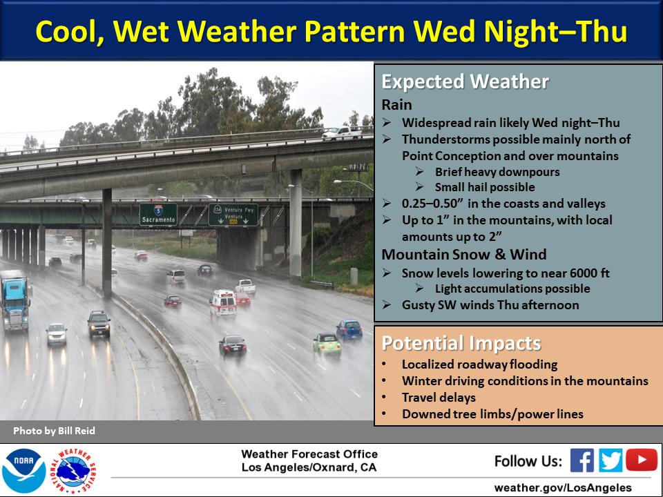
Folks it is the middle of May, and we have about .50″ to 1″ of rain forecasted and snow levels down to 6′ in SoCal??? HUH??? Here is the Euro model’s output of rain through the end of next week…..insane!
<Click to Enlarge>
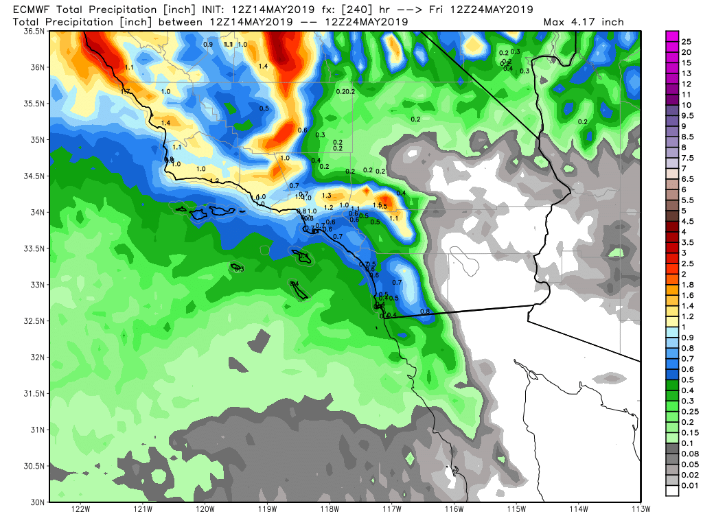
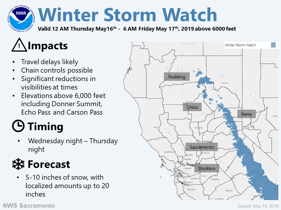
As you can see on the Euro map, SoCal, and frankly anywhere in California will be getting anywhere from 1/2 inch of rain to 2″ of rain. The Sierra’s, up to 1 foot of snow above 7K could fall. Is this the middle of May? Many posts ago, I discussed how the Southern Jet was the dominate force with the MJO this winter, and how the teleconnections patterns favored the West Coast to get hit directly by the jet stream. Well folks, the MJO and the Southern Jet are at it again, and they still think it is winter…. not spring transiting to summer. Very interesting teleconnection patterns are going on in the Pacific as we speak, which as been the theme this winter. The NWS Sacramento office is even hoisting a Winter Storm Watch. Will the Donner Summit be closed once again?? Say it ain’t so!
<Click to enlarge>
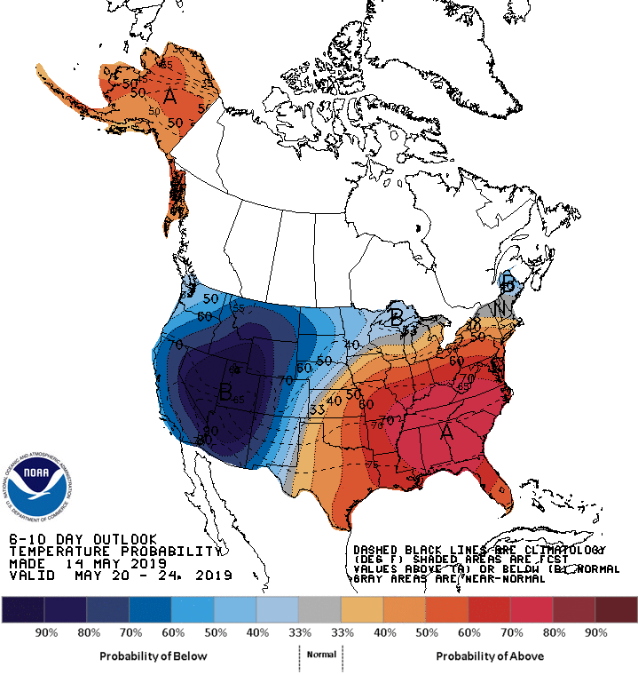
When I come up for air, I will discuss my thoughts on the summer and the fall/winter of 2019-2020. Currently, the SST’s look very similar to last year with a weak El Nino brewing. For now, this pattern might be around until the end of the month. Look at the CPC’s forecast through the start of Memorial Day weekend….more of the same, trough in the west and high pressure in the east:
<Click to Enlarge>

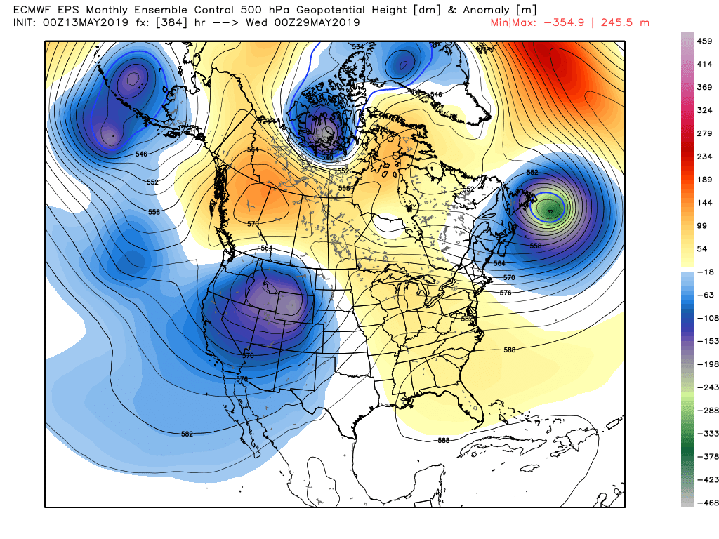
Here is the EPS Ensemble Control forecast though Memorial Day weekend, reinforcing the CPC’s forecast:
<Click to Enlarge>
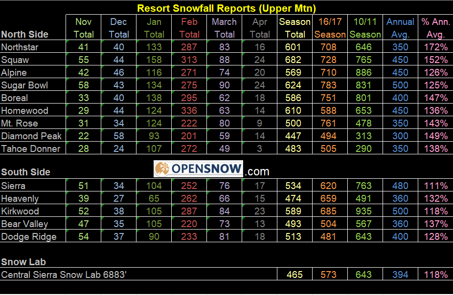
It is safe to say this has been an epic and unusual winter that just doesn’t want to end. As for the snow and skiing, most resorts are all but closed except about a handful, but here is BA’s final snow report from Opensnow.com
What an epic winter it has been!!!
<Enlarge>
PGA CHAMPIONS WEATHER:
For those of you who are going to the PGA, the weather looks to be improving by the day, after 3″ of rain has fallen in the last few days on the course and in Long Island. Temps will moderate everyday. Here is the NWS NYC’s forecast for Farmingdale, NY: https://forecast.weather.gov/MapClick.php?lat=40.73228000000006&lon=-73.44578999999999#.XNsxSNNKh0s
GFS-FV-3
For those that are curious about NOAA and the new American model called the – GFS-FV3, below is an article from the Washington Post regarding the delay and the new release date for this model. Enjoy!
Stay safe and stay dr. Will update hopefully in the next week!!! Meanwhile, enjoy winter this week!!
-JM
