Spring is here, but for some parts of the West, It is still Winter….But for how long??
Weather Followers,
Hope everyone is enjoying the spring weather out West and in the Northeast. I am sorry for slacking on my discussion posts, as work and family life has consumed my free time. However, wanted to get a discussion out this week, as there are a lot of changes in the weather/teleconnections patterns for the next few weeks. I will be discussing the short term, medium range-long range forecasts and snow reports. Let’s get into it:
Short Term – As I discussed last week on my last post, I was forecasting the first week of April to be active in the West Coast, and in SoCal. Well I was a week off, as it has been very active this past week, as the Sierra’s got another 1′ to 3′ of snow at high resort elevations, to continue the winter train of snow/rain. Even I-80 through the Sierra’s were escorting cars through, which as been the theme the winter. Rain made it down to the Central coast, but really stopped there. I was in SF this week, and they were in between weather systems, as the weather was cool and felt like February, not the end of March. However, for those that want spring and warmer weather, there is is a big change coming this weekend in SoCal, as high pressure is going to return, with 70s/80s and some inland might reach the 90s. As we head into spring and summer, the MJO (see last discussion about it) has been dead and hasn’t influenced the jet stream for the past couple of weeks. This has basically cut off the train of storms into SoCal, but Northern California has still been active and will continue to be somewhat active next week, getting brushed by some weak storms from the Northwest. That is about to change, as the pattern is shifting from a -EPO (Eastern Pacific Oscillation) to a positive one. This in turn will flip the PNA(Pacific North American) teleconnection pattern from negative to positive and bring high pressure to the west coast and warmer temps by the end of next week. Below are some illustrations and a website if you are curious about the EPO:
<Click to enlarge>
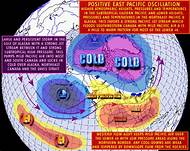
As you can see, this pattern will be setting up at the end of next week. Here is the link that explains what an EPO is:
– https://blog.weatherops.com/what-is-the-eastern-pacific-oscillation
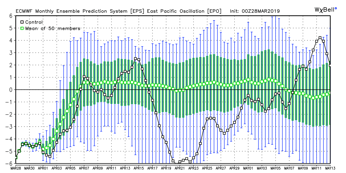
With the EPO set to go positive and the PNA going positive, it is going to be warm across the country in the next few weeks. See illustrations below:
<Click to enlarge>

<click to enlarge>
<Click to Enlarge>
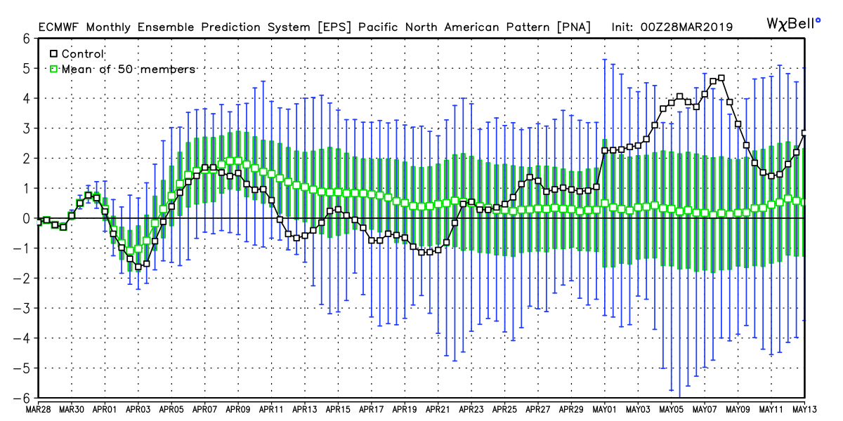
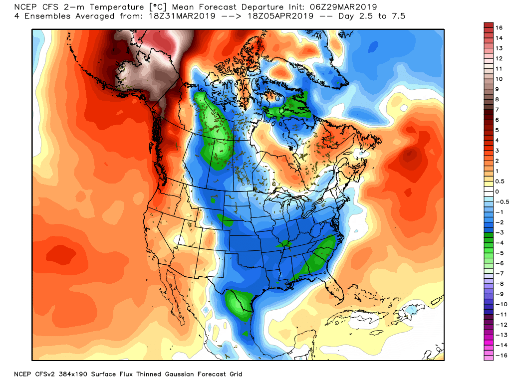
As you can see in these teleconnection patterns, the change in patterns will gradually get warmer and drier in the west under this pattern. The east coast will start to get colder this weekend with some cold rain and snow might fall in the upper northeast…..but will gradually start to warm up through the end of next week/weekend for that region. Below is the CFS model through the 5th of April. Look at the western half of the country warm up and the east coast is still cool:
<click to enlarge>
Enjoy the beach weather out west!!!
Long Range:
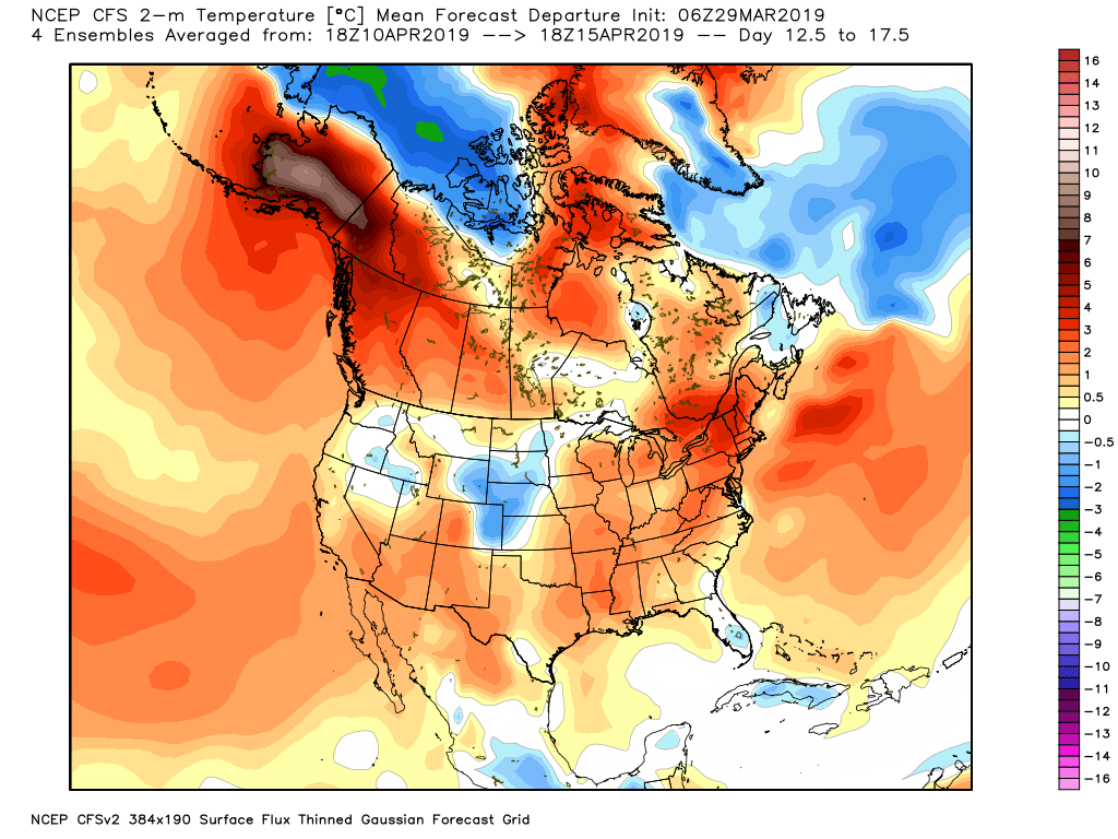
After the first week of April, I see warm temps throughout the country as spring sets in. However, I am looking at some teleconnection signs around the middle of April (15th to the 20th) that the pattern might shift back to an active one out west, as the EPO is forecasted to turn negative and the PNA might head down to neutral. Below is the CFS for the 2nd week of April…..warm weather is evident over most of the country:
<click to enlarge>
The below model run is what I am looking at for a pattern change. The European EPS model for April 20th is showing a trough of low pressure over the West Coast and high pressure back east:
<click to enlarge>
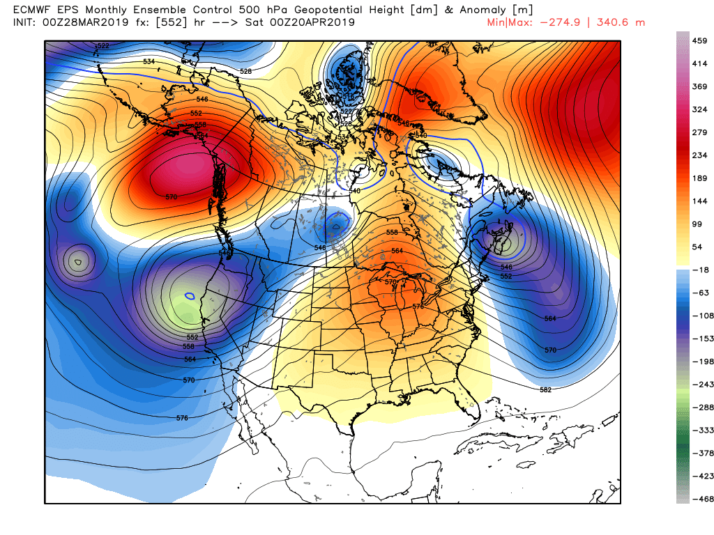
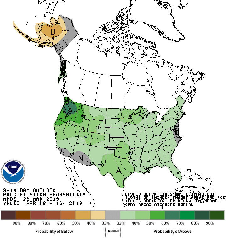
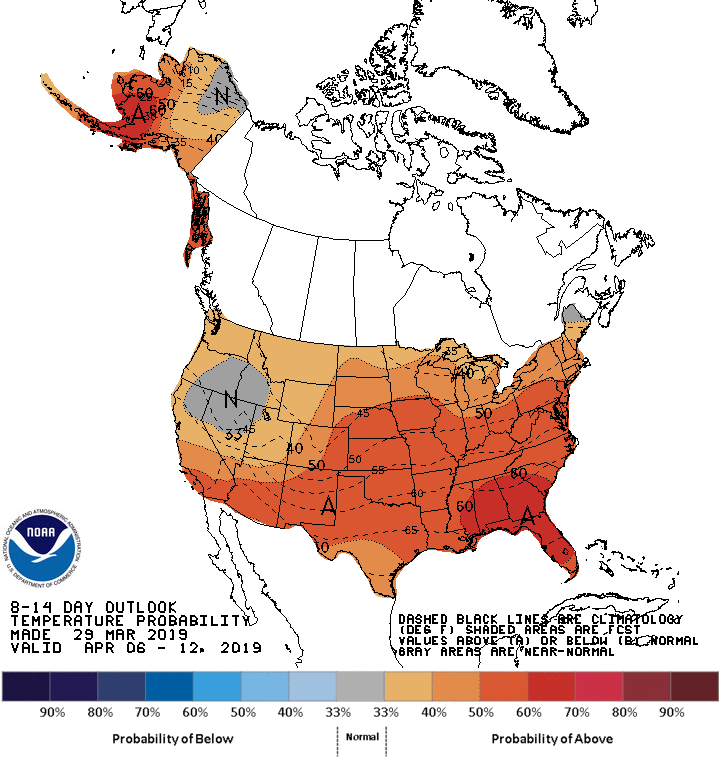
This is something to watch if a more active pattern comes back to the west coast. As we head deeper into spring the forecast models are less reliable and the jet stream heads further north into Canada. I know some of you wrote and asked me if I think the rain is coming back to SoCal. 10 days ago I thought it would…..today, I am not so sure we will get another strong storm this winter season. I am holding out hope that SoCal could get something by the middle of April, but it is too soon to know if and how much. Northern California looks like they might be active off and on in April, so that is good news for the snow pack. The models were pointing to an active pattern for SoCal for next week, but flipped back to high pressure. Now, they are showing a weak storm system that will probably fall apart as it pushes south of Pt. Conception in the middle of the week. Again, mother nature is going to do what she wants to do, and we might not know what she wants to do until it happens…..so the jury is still out! Stay Tuned! For now, here is the NOAA’s CPC outlook for the next few weeks:
<click to enlarge>
Snow Report – Below is my buddy BA’s snow update from his site at http://www.opensnow.com
<click to enlarge>

As you can see, very impressive totals in the Sierra’s this winter. Some places like Mammoth, Squaw/Alpine will be open all the way through the 4th of July or August. For those that want to hit SoCal skiing before it closes, I believe they are trying to keep most resorts open through Easter Sunday, (April 21) Check their websites out for more details. What an epic season it has become!! I will share my Mt. Baldy pictures in my next post!
For those of you who have not yet followed me on twitter, my handle is @realwxforcast. Have a good weekend. Next update sometime next weekend.
–JM
