Active Weather Returns in the West, while the Northeast Warms up!
Weather Followers,
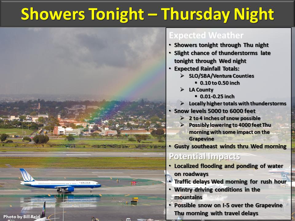
Quick Update as I am getting through the day. Pattern is changing out West from 80 to 90 degree weather, to more cooler/showery weather throughout the week. The weather will be more active north of Pt. Conception, but nevertheless, the pattern is changing starting tonight. See below the graphic from the NWS Service:
<Click to Enlarge>
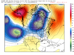
This weekend gets murkier, as the models are struggling to bring in bigger storms south of Pt. Conception into SoCal. NorCal will have a decent shot of snow/rain. Here is a quick glimpse at the Euro EPS weeklies released yesterday. I will have more later tonight on this, but really I am targeting the last weekend of March into the first week of April to bring in stronger storms into SoCal. As you can see below, this looks to be about right:
EPS Euro Forecast, first week of April. Looks pretty active.
<Click to enlarge>
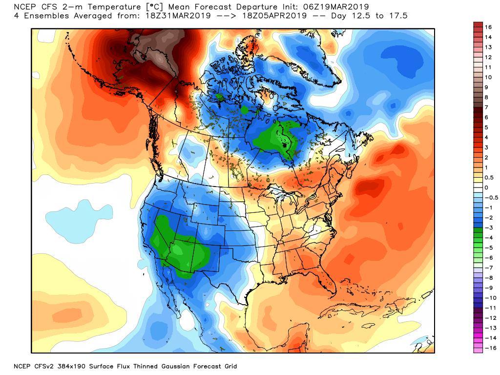
Here is the GFS Ensembles from earlier today. Again, trough in the west and high pressure in the East:
<Click to Enlarge>
Another update later tonight, but if I were a betting man, I believe the first week of April will really be active in SoCal.
–JM
