Heavy snow In the Northeast, as the CA Braces for another AR!!
Weather Followers – Hope everyone had a good weekend. Quick update tonight, as work has gotten in the way of posting something more extensive. Below I will briefly recap the snow storm in the northeast from yesterday as well as the AR that is poised to hit CA:
Northeast Snow Storm:
– Nice snowmaker for those that are in the Northeast. The further north you went, the more snow you got. Here are the totals and graphics from the moderate storm yesterday, as this was the biggest storm of the season for the Northeast. It is nice to see, as all of the action has been in the West Coast. Here are the totals:

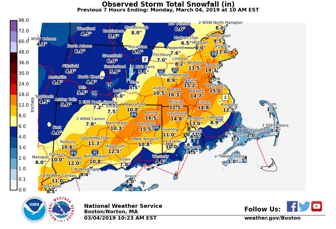
NWS NY Snow area totals: https://forecast.weather.gov/product.php?site=NWS&issuedby=OKX&product=PNS&format=CI&version=1&glossary=1&highlight=off
These are great totals. Moving forward, this might be the biggest storm of the season and last snow fall. Stay tuned, as changes are under the way starting next week across the country.
California AR:
Forecast on track for the AR poised to hit CA tomorrow. The main plume of the AR is poised to hit the central coast, as there are already evacuations in Santa Barbara. Below are the forecasted rain totals from the NWS LAX:

As you can see, the further south you go, there is less rain. For the LA area, I believe the rain will start after rush hour tomorrow and the heavy rain will fall between midnight and 7 am, Wednesday morning. Heavy rain, T-Storms, possible hail and strong winds will occur during the rush hour Wednesday morning, but taper off in the afternoon. Below is the NWS LAX office infographic for the pending storm:
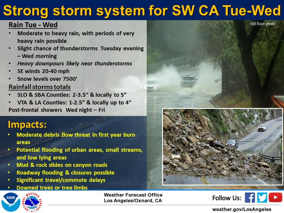
After this storm, scattered showers will fall off and on throughout the week in SoCal, through Friday. Saturday looks cool and dry, with another possible storm Sunday night/Monday. However, models are backing off of this storm currently, but then again, the models are over 7 days out, so they are not at accurate and will flop around throughout the week. I will update everyone on this possible storm for Sunday/Monday later this week. In the meantime, be safe tomorrow if you are anywhere in CA, as mother nature is still not done with this winter.
Long Range:
Pattern is going to be changing next week, so I will discuss that in the next post. As you can see, the West Coast will start to dry out, which is much needed! East Coast starts to heat up! Stay Tuned!
–JM
