AR’s to effect CA through the extended, while the Northeast might finally get some snow!
Weather Followers – Hope everyone is trying to stay dry and warm, as we are about to enter a period of very wet weather in CA and in SoCal. In addition, the Northeast might get some snow/sleet with a few systems from the Pacific through the extended, so there is a lot to discuss. Let’s dig into the short-term forecast and then discuss the long term.
Short Term/Recap
As I discussed a few days ago, the AR pounded Northern California north of I-80 from SF to Reno, dumping copious amounts of rain See the NWS SFO office infographic below, as this is an insane amount of rain for any area:
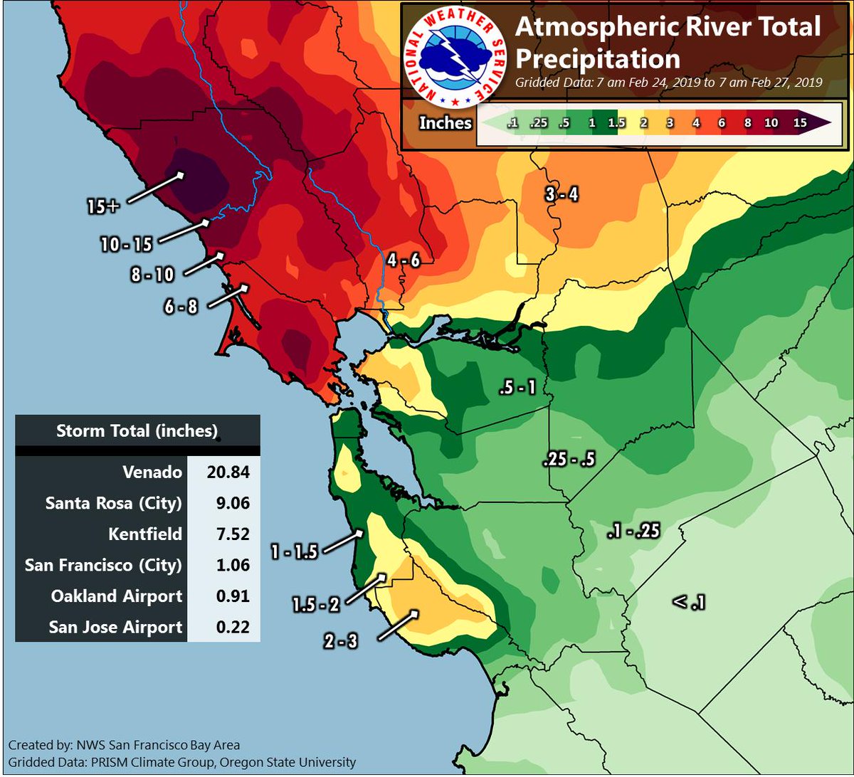
As you can see, the areas ranged from .22″ to 20.84″! Wow. The Sierra’s got dumped on as well. Look at the snow totals through today from my buddy BA at Opensnow.com:
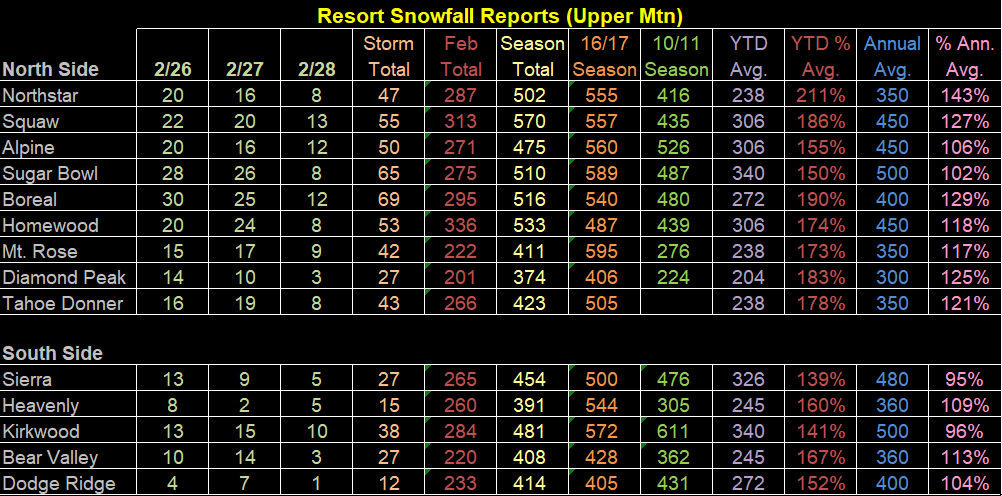
Squaw Valley is up to 570″ for the season, over 300″ for the month of February, which started 10/1/18. Insane numbers. I am projecting them to get close to 900″ this winter which would be a record. Mammoth Mountain has 574″ at the top of the mountain, so they are 4″ ahead of Squaw currently. Both of these mountains are going to crush their records for most snow fall by the end of this winter! Skiing on labor Day anyone??
Moving on, the AR that pounded Northern California is weakening and moved through SoCal early this morning and dropped about a quarter of an inch. A weak ridge of high pressure will pop up tonight in California, and will break down as the next trough of low pressure comes in. NorCal might get 2″ to 3″ of rain with it, SoCal might get half of that. Here are the preliminary numbers from the NWS for tomorrow nights/Saturdays storm and what is to expect for next week (I will get that to you in a minute)
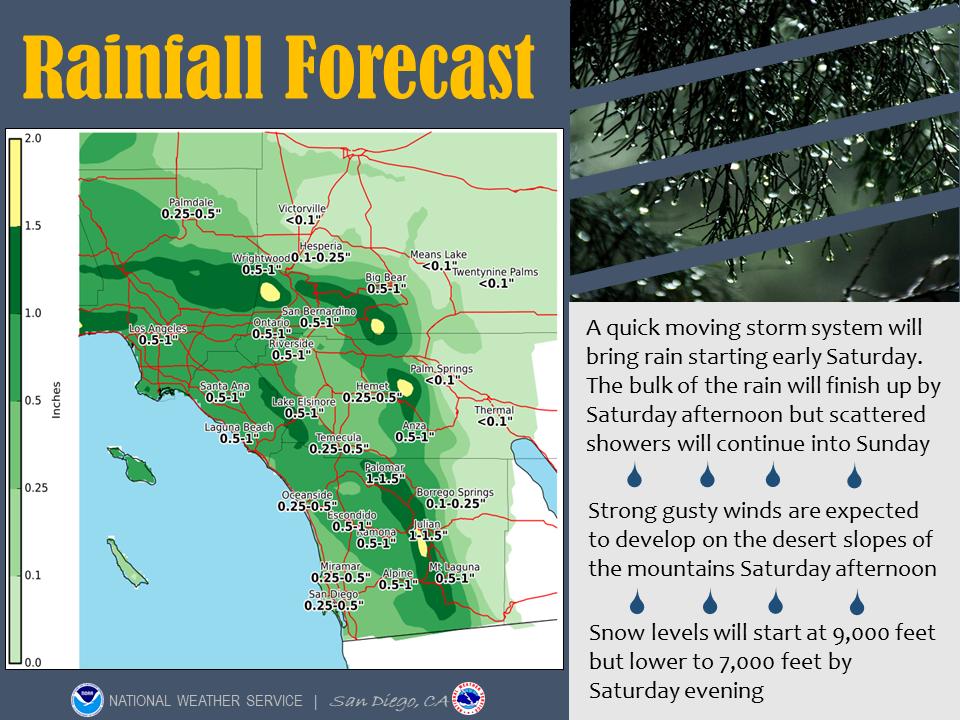
This first Slide is from the NWS SD, for those of you that are South of LAC
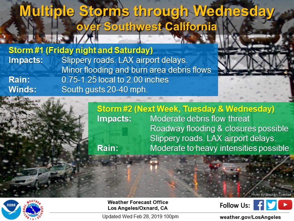
This slide is from the NWS LAX. A bit higher totals for this weekend’s storm.
Here is the Snow Sierra Forecast Map from NWS Sacramento:
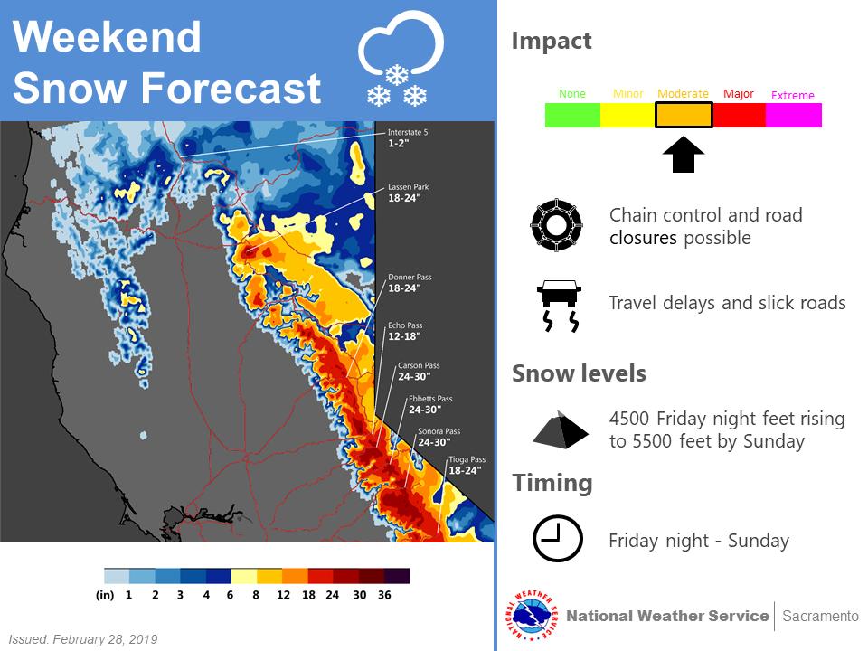
Impressive totals. Unfortunately, the snow levels will be above 7000Ft or thereabout, so only the Sierra’s will get signifiant snow fall. Locally in SoCal, the snow levels might be above 8000 feet, which are above resort levels. After this storm clears out Saturday afternoon, the snow levels in SoCal will lower to 4k to 5k feet. Sunday thru Monday will be mostly clear and dry.
Long Range: Currently the long range is 7 to 10 days out as anything beyond that is challenging to pin down. That being said, there is already chatter in the news about a big AR poised to strike CA next week, from Tuesday thru Thursday…. but this time it is currently forecasted to hit the Central Coast and then sag to SoCal. See the CFSv.2 image below:
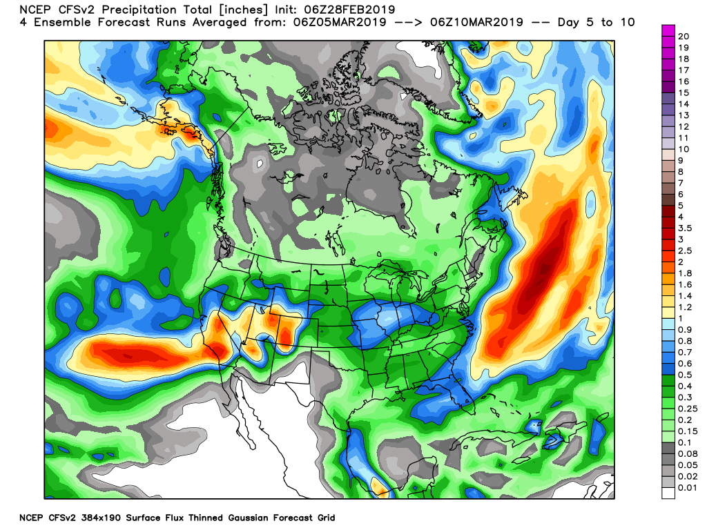
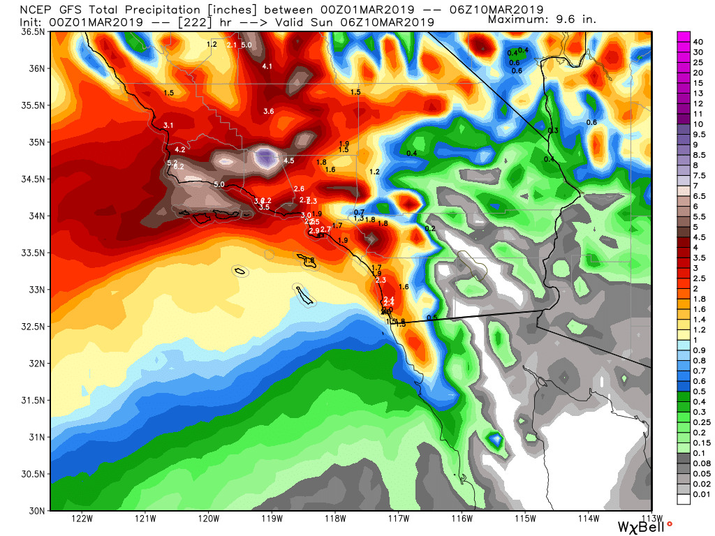
That is an impressive image. Here is the latest 0Z GFS and the Euro Model Runs from 3/1/19 through March 10th for accumulated precipitation :
GFS 0Z run through March 10th:
The Euro 0Z model through March 10th:

As you can see, the AR train keeps flowing into CA. To prepare all of you, even the Climate prediction Center is forecasting this pattern for the next 10 to 14 days, with below average temps:

To give those of you who are the burn areas with an idea of how much rain will fall, Here is the 7 day Weather Prediction center’s graphic. Parts of SoCal in valleys and coastal areas could receive 3″ to 5″ of rain through the end of next week…..Per the graphic below:
Weather Prediction Center precipitation total through 7 days:
What a winter it has become. I know I promised all of you in my last post I will discuss what is mostly driving this weather pattern and what the MJO is. I hope to get that discussion tomorrow and/or over the weekend.
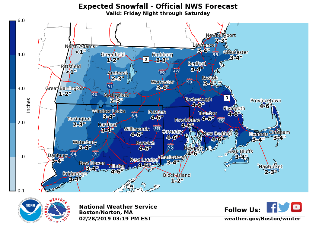
New York/Northeast Weather: Things will start to get active in the Northeast, leading to chances of Snow in the NYC/Tri-state area and Boston. Here are some images from the NWS in NYC and Boston forecasting some snow for the region. I discussed this chance a few weeks ago that the early part of March would set up for the Northern/Polar Jet to interact with the Southern Jet. I don’t know if it will set up for the Nor’easter benchmark of 40N 70W, but the pattern will be active as you can see below:

I will try to update tomorrow briefly for the weekend storm in CA, AR’s in California for next week and a possible snow in the northeast!
Have a good night!
–JM
