As Upper Midwest Gets Ready for the Polar Vortex, the West Coast prepares for Another Wet Storm Cycle!!
Weather Followers,
Hope most of you are staying warm, if you are not in CA. This is going to be a busy week weather wise, as there are several items up for discussion on the docket today:
-The massive PV that is going to slam the Upper Midwest/Midwest and some portions of the Northeast!
– The Blizzards in the Midwest.
– Wet Weather to return to the West Coast
The PV/Blizzard:
As I discussed last week, most of the action through the end of the month was the Polar Vortex (PV) and the amount of snow and ice that was going to effect the Midwest/Northeast. Well, it is happening now, as the parts of the Midwest and Upper Midwest are going to feel like it is the ice age. Look at these graphics, as the PV is really going to set some records in these regions:
(Click to Enlarge)

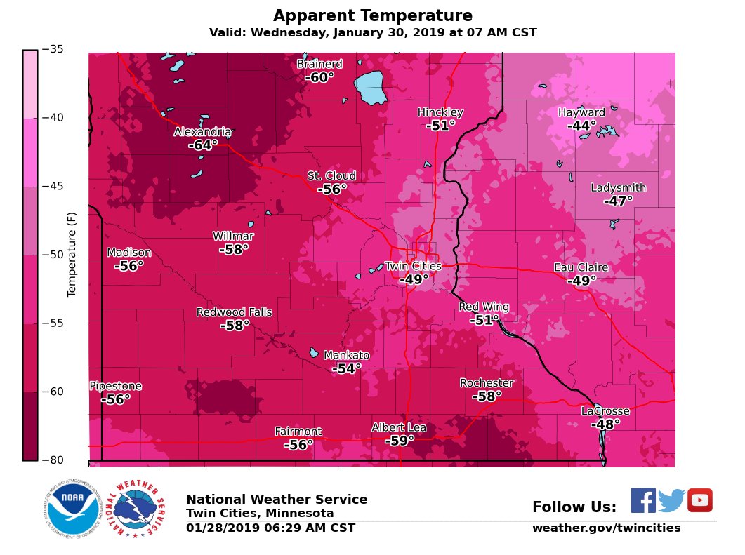
These graphics are from the NWS in MSP and Duluth, MN. I have been in extreme cold/weather before, but this is something I can’t comprehend. Very dangerous cold/snow and records will fall temps wise this week. Furthermore, the PV will also extend to the northeast, as extreme cold will be the weather talk of the national through the better part of this week. See graphic below for weather temps in NYC Tri-state area:
(Click to Enlarge)
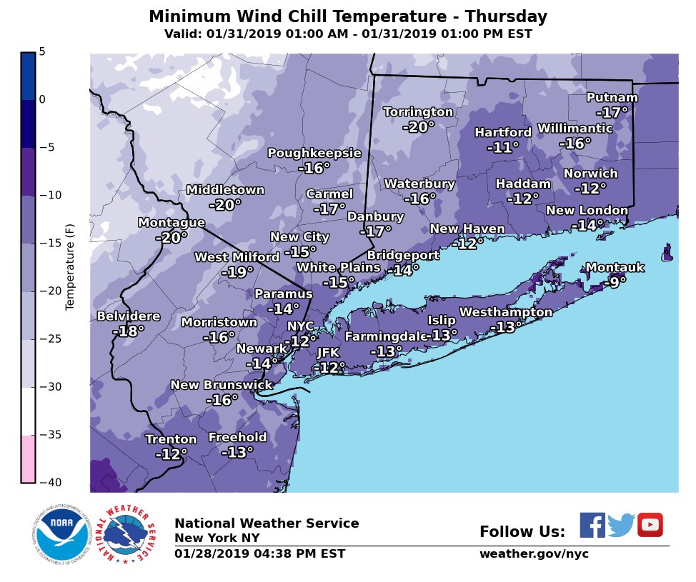
For those people that are in the midwest/northeast, be prepared for life threatening cold through the end of this week. Moving forward, the teleconnection patterns are changing, as temps will moderate by the weekend, as the pattern in North American will be flipping from a +PNA to a -PNA. See illustration below:
(Click to Enlarge)
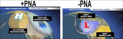
As you can see in this image above, the West coast is emerging from a +PNA pattern that brought dry/warm/high pressure to all of CA for the past 10+ days,…..transitioning to a -PNA pattern which will set up a long wave trough off the coast of CA. As I have discussed this year, the cold air has not been trapped that long in the northeast, due to the southern pacific jet stream. This jet will dislodge the PV, and temps will moderate for parts of the country. As the same time, the PNA index, seen below from the Euro Models, is forecasted to be Negative for most of Feb and March. Before we jump ahead of ourselves, I don’t really want to forecast anything more than 2 weeks out, but this is a good sign that the Southern Jet is going to be a major player in the weather come Feb and March.
(Click to Enlarge) PNA Pattern from Wx Bell
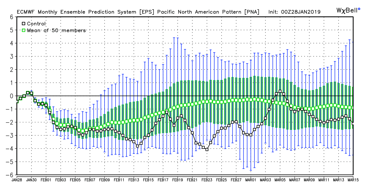
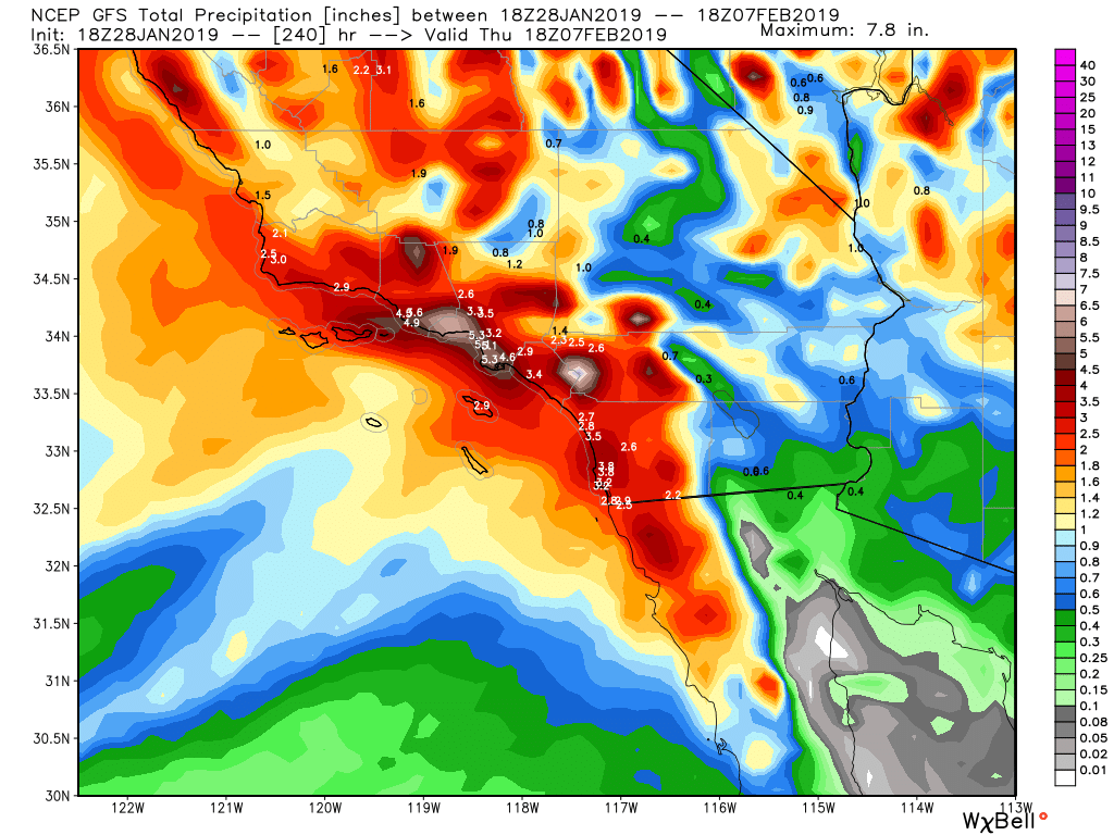
As you can see, the PNA index is forecasted to be negative. This might be the year that California doubles down on their rain totals…….as look what the Euro and GFS are forecasting through Feb 7th for SoCal:
Below are the graphics from each model from Wx Bell, showing you the rain totals from today through the 7th of Feb that are forecasted. Impressive! Again, even if we got half amount of rain they are forecasting, it will still great. Snow levels might be 6500+ to start out with in California, but will drop throughout the week.
(Click to enlarge)

Long Term:
Some of you asked me what is Feb going to be like weather wise. Below is the CFSv.2 from earlier today. It is showing rain in the west and the east coast and temps cooler than normal on the West Coast and warmer on the East Coast. Something to chew on as we head into Feb!!
(Click Below)
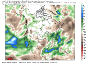
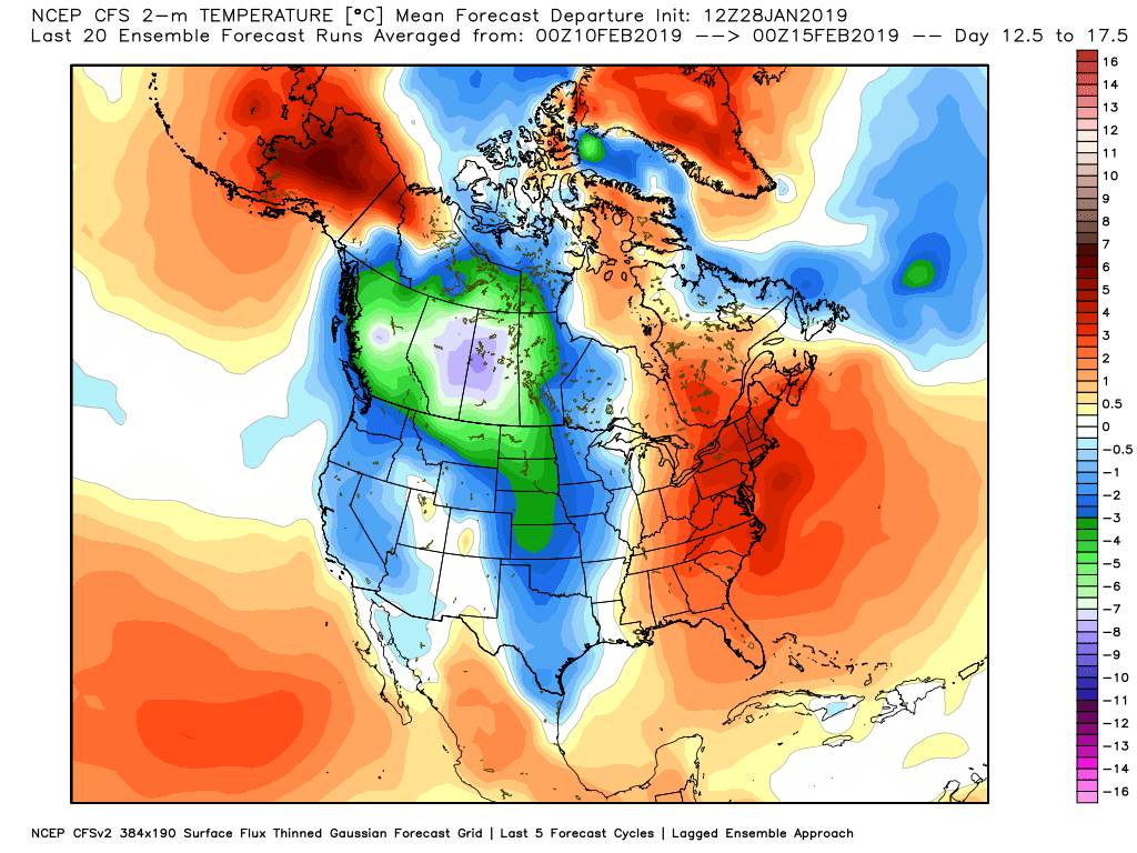
I will show the EPS Euro Weeklies on my next discussion on Wednesday and compare. Regardless, the pattern is changing!!
Recap of CA rain/snow totals through today and LA rain fall!!
Currently DTLA/USC Station is at 7.07″ for the season, which started on 10/1/18, per the LA Almanac. Not to shabby, as we have passed what we got last season. Normal is 14.93″ for the water year, so we are almost half way there, and looking to add to the totals starting Thursday of this week. Click here to get all the totals historically: http://www.laalmanac.com/weather/we13a.php
As for snow in the Sierra and Tahoe resorts, my buddy BA puts this graphic on www.opensnow.com, and here are the totals through today for the season:
(Click to Enlarge)
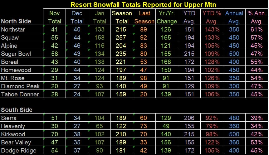
Snow pack is in pretty good shape heading into Feb, as the days are going to get longer and the sun angle is getting higher.
Stay Warm my friends!
Next update Wednesday, updating the PV and the CA storms!
–JM
