
As the PV Retreats Back to the Arctic Circle, the West Coasts Prepares for the Next Wet Cycle.
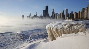
Weather Followers – What a wild few days it has been regarding the Polar Vortex (PV) and how it has effected most of the country. Wild weather from -79 degrees in MN and SD, to a snow squall storm impacting the NYC-Tri city area and the northeast today. Crazy stuff!! For those of you are interested in what the PV is, Judah Cohen, Director of Seasonal Forecasting at AER [Atmospheric and Environmental Research, is a PV expert and he has made a video explaining what causes it and what the effects are. I have put the video on the bottom of this discussion for those of you who are interested about this phenomenon.
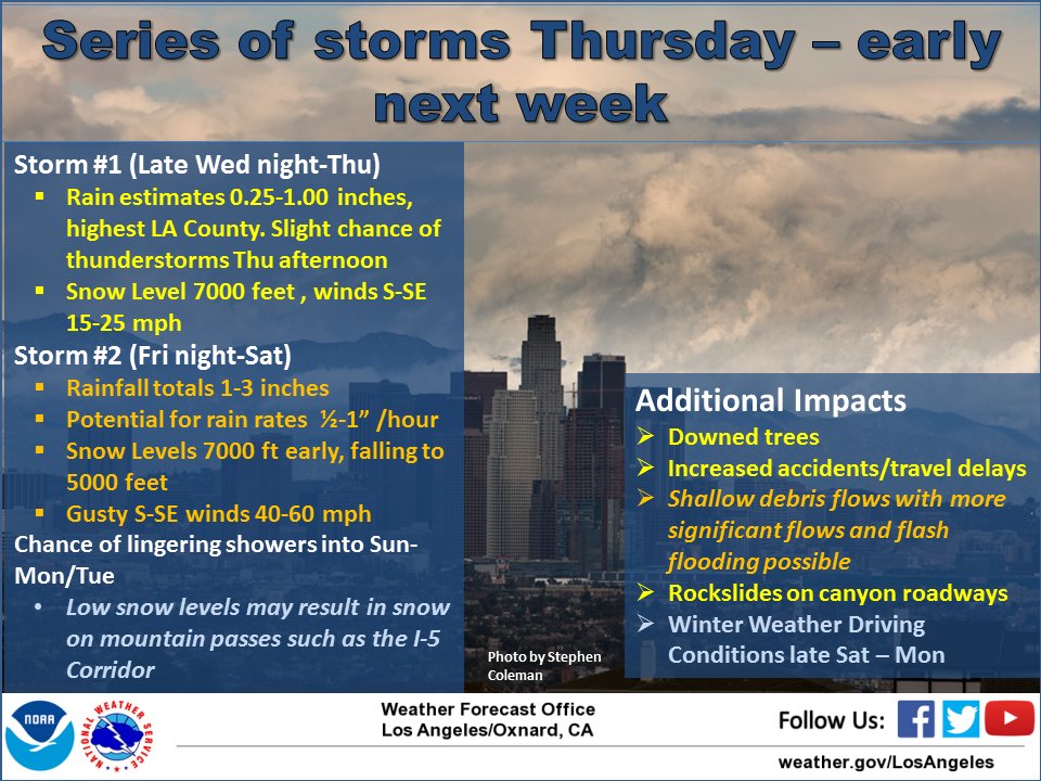
Short Term Forecast: – As the PV begins to dissipate, all attention will be on the West Coast, as a new series of storms is poised to hit CA starting tonight. For SoCal, below is the NWS forecast for the next few days. 3 storms will be effecting the area, with storm #2 forecasted to be the strongest. See NWS Graphic below:
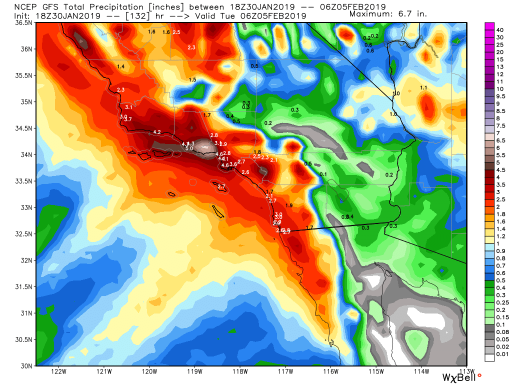
GFS rainfall totals through the 7th. Impressive numbers so far!
Everything else looks on track for this weekend storms. If anything changes, I will post a discussion. Expect snow levels anywhere between 4K to 7K this weekend. For those of you in the burn areas…..be careful and listen to the local agencies for debris and mudflow.
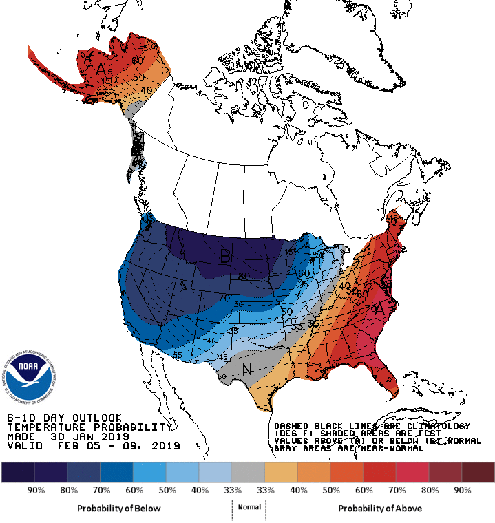
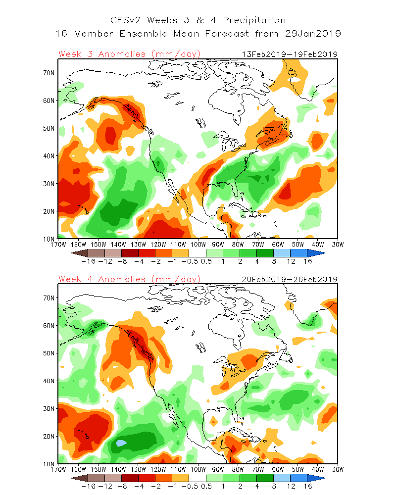
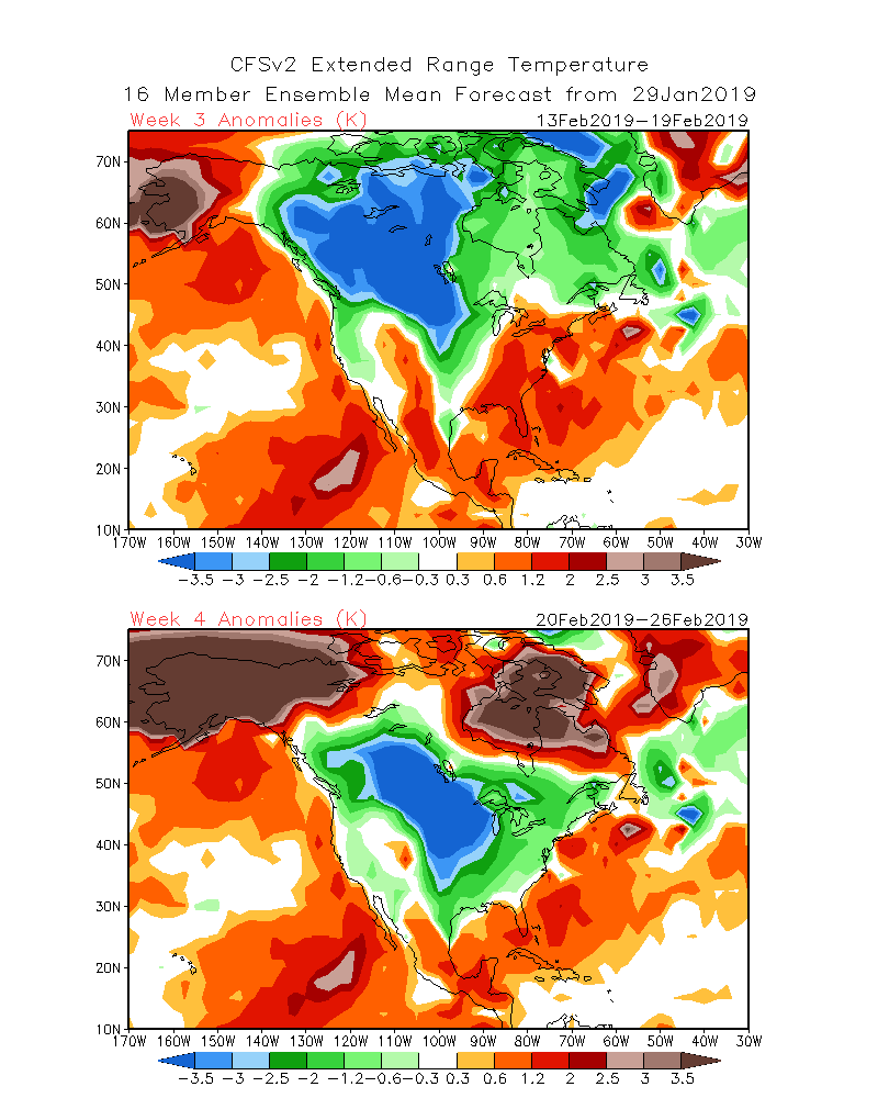
Long Range Outlook:
The CPC and the CFSv.2 have forecasted a very active and cold pattern setting up for the western 2/3’s of the country. Something to chew on as the southern jet stream is very active and removing any prolonged cold/low temps in the eastern part of the country. This bears watching as we move forward to Feb and March…..

For those of you who are interested in the PV, please see Judah’s video below:
Thanks for the Video Judah!
Next update tomorrow or Friday! Stay warm!!!
–JM
