East Coast Prepares for an Ice/Sleet/Snow Storm, While the West Coast starts to dry out
Quick update followers –
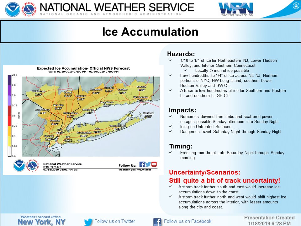
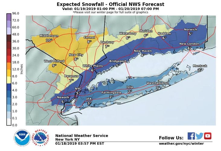
I will update everyone on the past week’s storms in CA, and post snow totals and rain totals on Monday. There will be a 2+ week dry period and a break of storms out West, as all attention will be focused on the Midwest and Northeast. The main stories are the several big storms/Polar Vortex is starting tomorrow and going through the end of the month. I would guess, every 3 day or so, these regions will be under the gun. Below are the NWS NYC graphics for the pending storm. One of the reasons this is not going to be all snow is the fact that the southern branch of the jet stream is very active this winter due to El Nino, and it is still bringing warm moist pacific air, which is colliding with the low pressure systems from Canada, ie. the PV. See below:
(click to Enlarge)
(click to Enlarge)
(click to Enlarge)

If you are in these areas, be prepared for ICE and Sleet, more than snow. This will make traveling a serious hazzard. More updates this weekend on next week’s storm, which looks like more of a traditional coastal storm! For up realtime information, please visit www.weather.gov.
The NWS will give you all the details as the weather changes by the minute. Out West, Enjoy the Sunshine starting next week!!
More later……
–JM
