California is Bracing For Last Storm of the Wet Storm Cycle……. The Northeast gets their PV!!
Quick Update Weather followers,
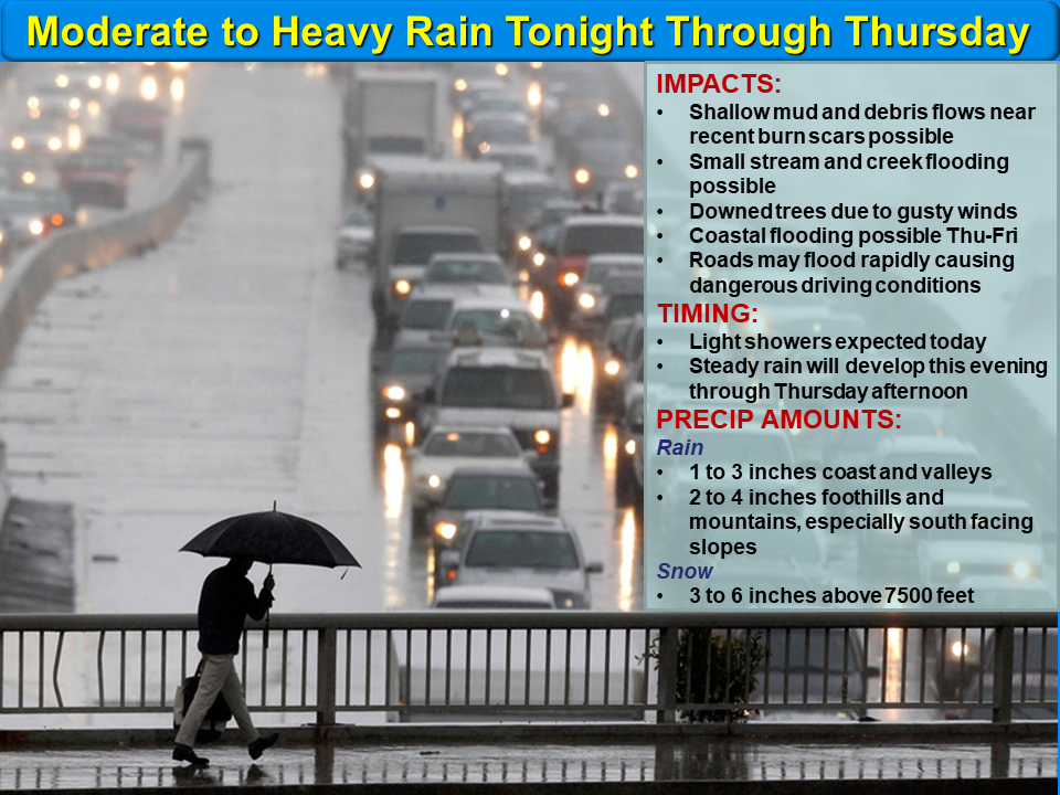
Last storm of this wet cycle is now entering California, with blizzard conditions expected later this evening through tomorrow night in the Sierra’s, and heavy rain on the coast and valleys. If you are in SoCal, below is the update from the NWS:
(Click to Enlarge)
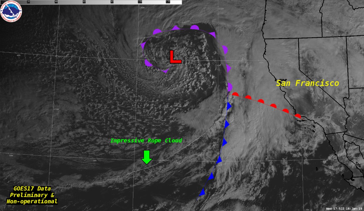
The difference with this storm, versus the ones earlier this week, is it has a sub-tropical fetch as you can see on the NWS SF satellite photo below. This will allow more moisture to get entrenched into the upper level low, as it spins closer to the CA coast. The burn areas will be under the gun this evening going into tomorrow, as heavy rain will enter SoCal overnight and into tomorrow morning, as the low pressure system moves close to CA coast.
(Click to enlarge)
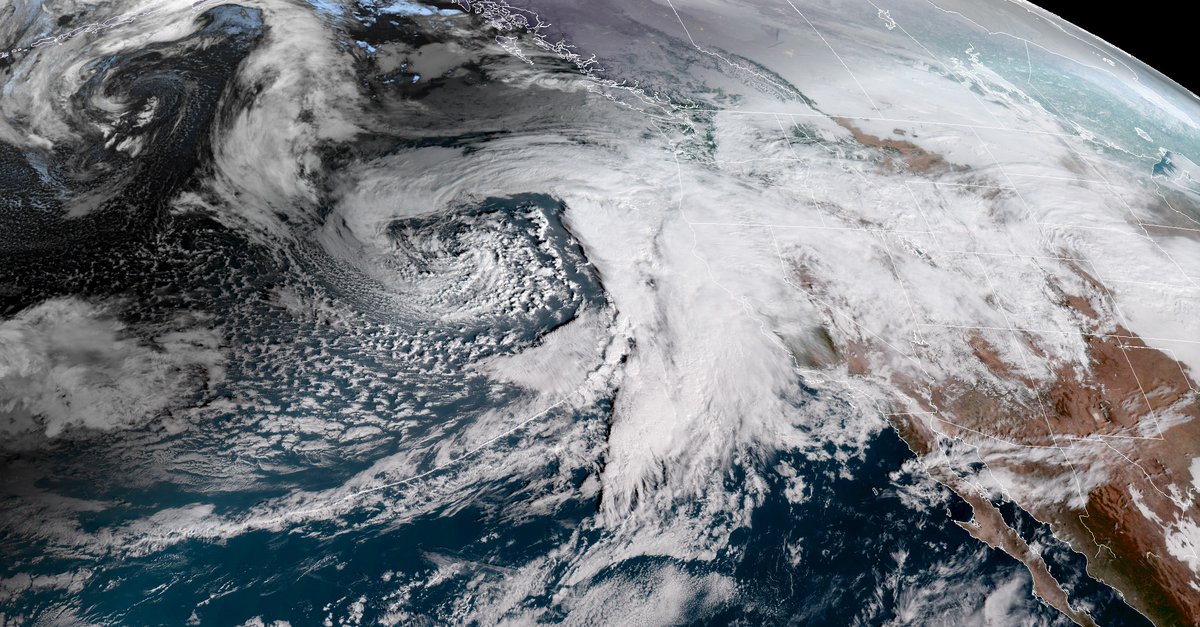
Here is another picture of the storm, bearing down on the state of CA. Pretty impressive upper level low, with a subtropical fetch:
(Click to enlarge)
– If you are going up to the Sierra’s tonight/tomorrow, please be prepared for blizzard conditions. I have talked to people that are in Mammoth and Lake Tahoe area and it is a complete blizzard conditions. Check with Caltrans and the CHP before you go into these areas, as most of the roads in and out of the Sierras are under chain control. See below for more information in and around Mammoth on the current storm up to the Lake Tahoe basin:
(Click to Enlarge)
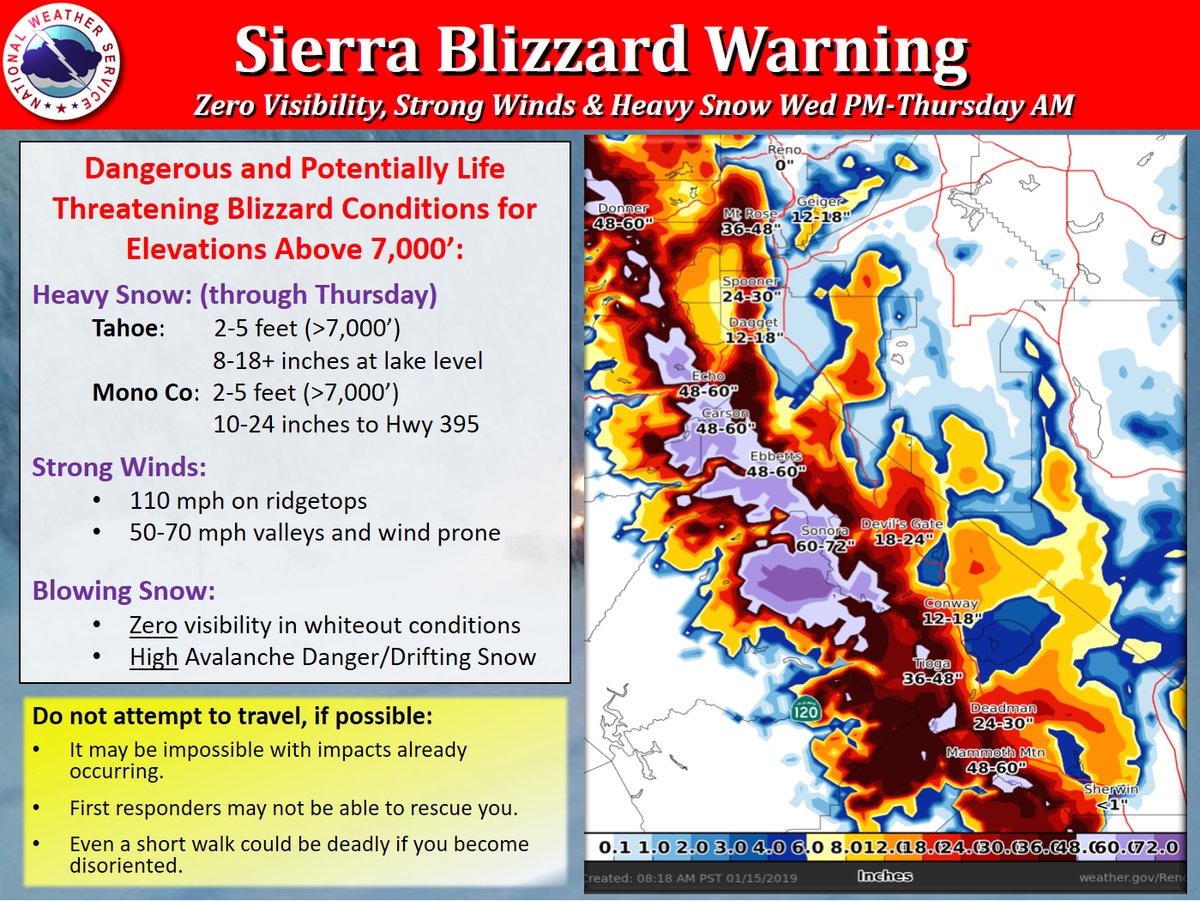
More information on the Sierra’s
(Click to Enlarge)

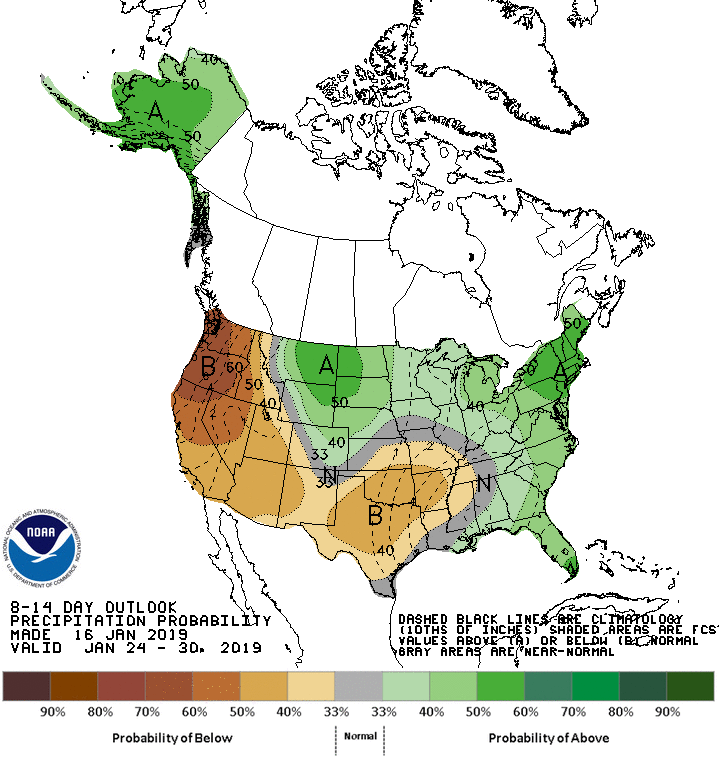
After this storm, things will dry out for California for at least 2 to 3 weeks, as most of the action weather wise will be focused on the Midwest/East Coast/Northeast….as the Polar Vortex is going to effect these regions with severe cold and snow/ice and sleet. They will be getting their long awaited winter!!! More on this on my weekend discussion. Below is the 10-14 Day CPC NOAA outlook. I am forecasting this pattern to last into the first week of Feb:

For more information about the pending storm throughout the day/night, I recommend going to : www.weather.gov
The NWS will give you updates in real time regarding the storm and when the intense rain will be hitting throughout the evening/overnight. I hope the burn areas are unscathed tonight! Be prepared if you are in these areas.
Next update this weekend. Be Safe!
-JM
