Atmospheric River (AR) to Deliver a Direct Hit to Central/Northern Southern California in the West, while the 4th Nor’Easter of this month is poised Strike the Northeast!!
Weather Followers,
Hope all of you are safe and staying dry. Quick update tonight, as I wanted my followers on both coasts to know what to expect tomorrow. Lets start with the 4th Nor’easter to strike the northeast this month.
Nor’easter #4 for the Northeast in March!!!
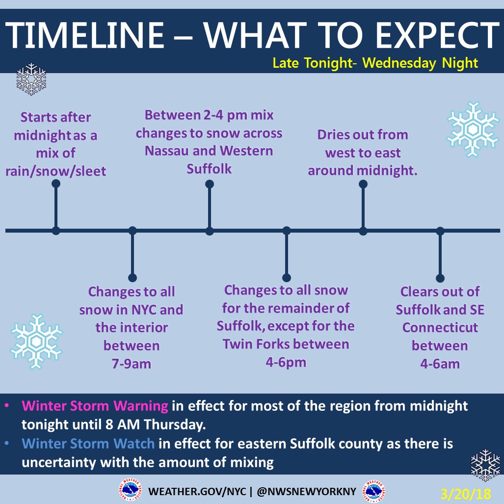
Below are the details of the storm, as the coastal low pressure that has moved up the mid-atlantic states is poised to strike the Northeast. Depending on the track of the Coastal Low pressure, snow levels will vary. Below is the update form the NWS in NY, regarding the timeline. Earlier indications had for 10″-18″ of snow from NYC to CT, to Long island. However, those totals were reduced due to the track of the Low. See below (Click to enlarge):
Here are some of the totals that are forecasted. I do believe that these numbers are overdone, due to the warm air at the surface, interacting with cold air aloft. That being said, time will tell overnight how much cold air works in, depending on where the coastal low tracks. Here are the totals for the next 24 hours for the Nor’easter:
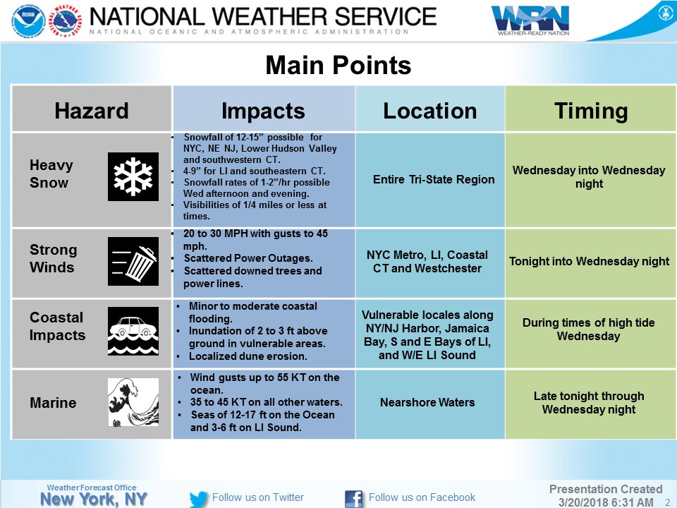
We will know tomorrow if these totals that are forecasted by the NWS are accurate. Nevertheless, this is a serious storm so be careful out there.
California Atmospheric River (AR) Storm:
In my discussion Sunday night, the media was hyping this storm up as the storm of the decade. At the end of my discussion, I wrote there was some indications that I saw on the weather models and the wind patterns that indicated the main AR would head further north of LA County, and end up north of Pt. Conception. Well, that is exactly what it did. Hardly any rain fell in LA County today, and in fact, very light totals were recorded in Ventura County. Even in the burn areas in Montecito received light to moderate rain, and no mudslides occurred. This is great news, as the main AR plume of tropical moisture had very little dynamic with it today and no lift/orographics. Moving forward, overnight should be calm , and then tomorrow (Wed) am, the second round of the AR will effect the areas between the north part of Ventura County, all the way to San Luis Obispo. Although rain will effect LA County and the OC, it will be light in nature and showery. There will be no concerns for the burn areas. As we transition into Wednesday night into Thursday, the main Low pressure that has been sitting off the coast of CA will open up and move into Southern California as a closed low pressure, and bring very heavy rain from late Wednesday night into Thursday. As the low opens up, it will push the AR plume of tropical moisture southward, which will effect LA County, OC, IE and San Diego. The NWS has put out the following warnings below (click to enlarge)
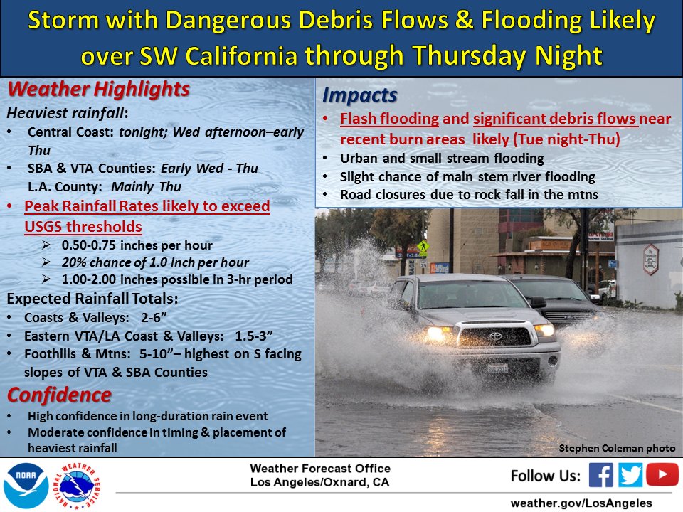
As you can see, Wed Night/Thursday will be the most dynamic rain we have had this year. That is where we can have the burn areas be effected by mudslides and debris flow. I do think these numbers are a bit overdone for LA County, so I am looking for 1″ of rain total for Downtown LA through Friday. Let’s see if I am right.
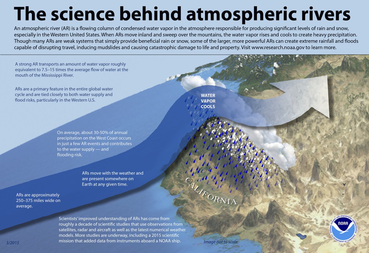
For those of you who wonder what an AR is, and if the Pineapple express is the same thing, the Pineapple Express is an example of the AR. The AR is the technical term. See below for a diagram of what an AR is:
Next Update tomorrow, as I will discuss the long range forecast, which looks VERY COLD for the Northeast/NYC, and warm and dry for the West Coast/CA
Be safe on both coasts!!!
Dr. J
