Strong Atmospheric River to produce the Strongest Storm in Nearly a Decade to Hit Southern California!! Burn Areas in SoCal are in the Bullseye!!!
Weather Followers – More updates tomorrow, but the strongest storm in nearly a decade is poised to hit Southern California starting Tuesday through Friday of this week!! A strong Atmospheric River will effect SoCal, and some of the forecast models show the burn areas are in the bullseye of the storm!!! If you are in those areas, please listen to local law enforcement agencies, or the local OEM for evacuation orders ! I will release more information tomorrow as the forecast models come better into play for the storm this week starting on Tuesday, but the NWS has released this alert below (click to Enlarge):

Some of the forecast models are showing these rain total through this weekend. Below is the GFS (Click to enlarge):
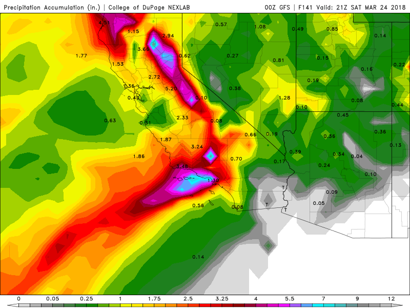
These rain totals might produce rain totals that are equivalent to a 100 year storm, that this forecast model is putting out. On the other hand, the North American Model (NAM), has these total through Thursday morning (Click to Enlarge):
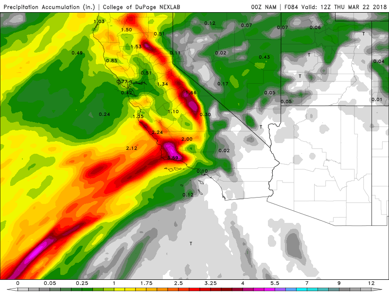
Major discrepancy as far as where the bullseye is. That being said, as of the writing of this discussion, I do believe the bulk of the rain is going to be north of LA County through Ventura/Santa Barbara/San Luis Obispo Counties. That could change in the next 12-24 hours, but that is my gut feeling. Anything south of LAC will get rain, but nothing like the people will get in the central coast of CA. Will update tomorrow, but wanted to keep all of you updated. For more up to the minute updates, please follow me on twitter:
@realwxforecast
www.twitter.com/realwxforecast
Dr. J
