Actual Weather to continue to effect CA; Nor-Easter poised to Slam the Northeast!!!
Weather Followers,
I hope you are excited about the weather change in CA, as the rain/snow is a big change to having zero winter so far in CA. However as I have discussed the last few weeks, we are right in the beginning of a very active pattern, that will effect all of CA most of the month of March.
Short Term Forecast Highlights:
– The Tri-State Area/Northeast is going to hit with a moderate Nor’Easter, which will produce mostly rain. The storm that went through CA yesterday, is going to pick up steam as it rolls through the US, and slams into the Northeast. If the Polar Vortex was in the northeast, they would be getting feet of snow instead of a few inches of rain. However, heavy rain, wind and costal flooding is in the cards from Thursday through Saturday of this week. 2″ to 4″ of rain is on tap, so for those of you in the Tri-state area, be careful!!
– California is going to get a very good taste of winter, as the days of Hot/Fires/Santa Ana Winds/bone dry conditions are over. This past two days, all of CA experienced record low temps, record hail, and 1′ to 2′ feet of snow in the Sierra. Even the mountains of Southern California got 6″ to 10″ of snow at the resort levels, with higher totals in the higher elevation. I believe it has been 1 year since SoCal has experienced weather like this. The next major storm is poised to hit CA, starting tomorrow night in NorCal, and then slide down to SoCal. Preliminary indications by all forecast models are from 2′ to 4′ of snow in the Sierras at 5000Ft and above, with anywhere from 2″ to 4″ of rain at the Costal/Valleys area. SoCal will receive less rain/snow than NorCal, with half of those amounts falling above. However, we will take anything we can get, as times are pretty dire with a lack of rain/snow wise this winter. Temps will be well below normal, and driving conditions will be very dangerous from Thursday through Friday night. Folks, we need 5 to 6 more of these type of storm that will effect CA later this week, by the end of winter to make a dent in what experts say is one of the driest winters event in CA. Although the weather in CA has been winter like recently, it hasn’t really rained in SoCal over the last year, with the exception of those rogue 48 hours storms in January. For those of you in the burn areas, keep an eye on this storm pattern. As for now, I don’t see it producing the amount of rain in the short amount of time that occurred in January, however, things can change in the next 48 hours. For up to the minute forecast, visit the NWS at www.weather.gov
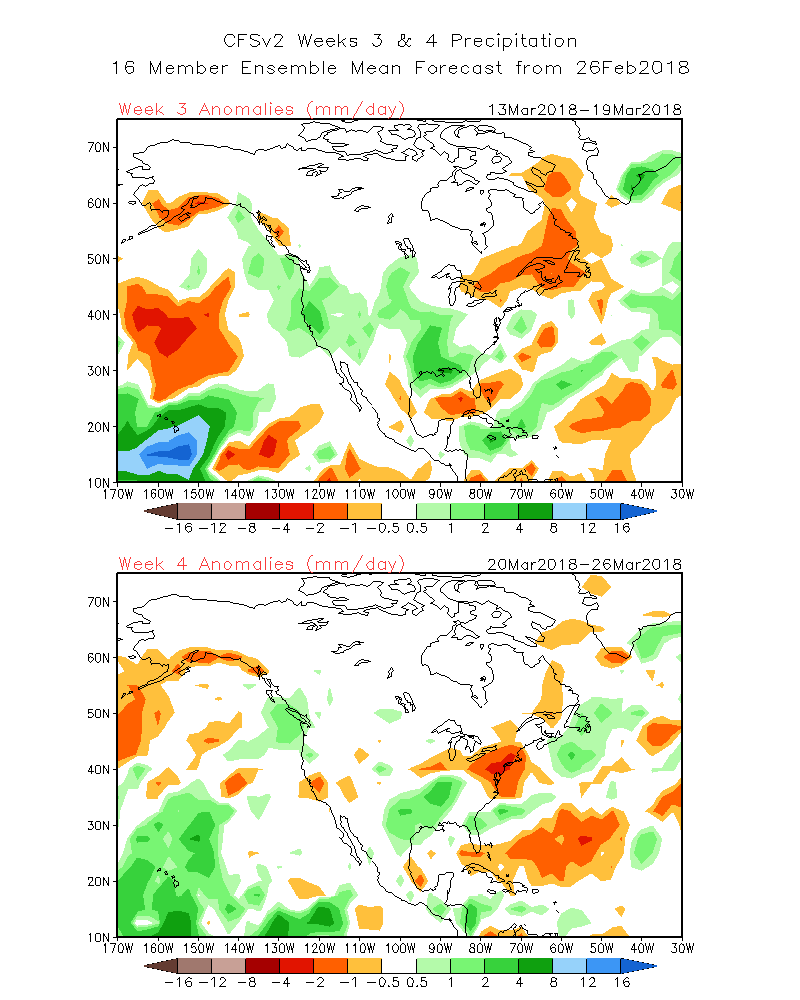
Long Term Forecast – There will be a break of rain/snow with moderate temps and dry weather of about a week or so from this weekend to the end of the following week. the Long range CFSv.2 forecast models show below average temps and normal to slightly above precipitation
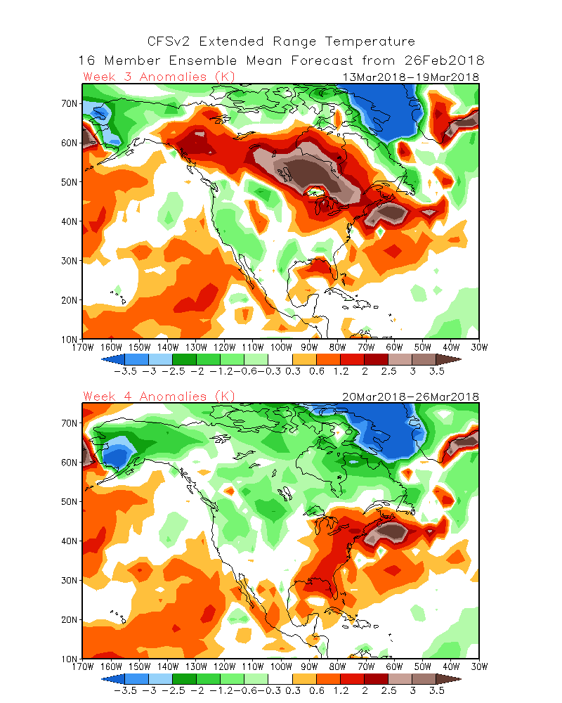
Below is the CFSv2 for the middle of March to the last week of March. As you can see, the pattern is pretty progressive as rain/snow comes back into the picture by the middle of the month. More on this pattern later this week, as it evolves over the Pacific.
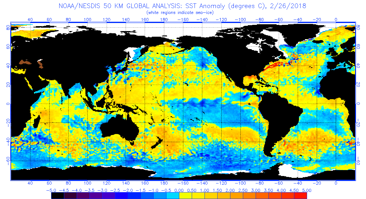
For those of you who want to know why the pattern change so abruptly, it is all about the Sea Surface Temps (SST). As you can see below, there are several factors in this image below that have changed our weather:
- La Nina is weakening, as warm water off of the coast of South America is starting to take shape and disrupt the cold SST’s at the equator.
- Colder water has evolved in the Gulf of Alaska and and even the coast of CA. This has removed a persistent high pressure tropical ridge in the eastern pacific, giving CA dry/how/warm weather most of the summer.
- By these factors, the subtropical Jet stream will be active, as it has mainly been suppressed this whole winter by theLA Nina conditions we have had. This is about to change, as March and April will see the subtropical jet more active into CA
More updates later this week. For interaction with me between post discussion, feel free to visit me on twitter: @realwxforecast
Stay Dry!
Dr. J
