Cyclogenesis, AKA Bombgenesis Nor’Easter Strikes the Northeast, while the West Coast waits for their first Major Storm System of the Winter!!!
A monster Cyclogenesis, AKA Bombgenesis Nor’Easter exploded off the east coast, slamming the tri-state from the Jersey Shore to Long Island, bringing the potential for up to a foot of snow and triggering winter storm and blizzard warnings across the Tri-State area. After experiencing this storm personally, I can tell you it was a blizzard for about 4-6 hours, and white out conditions. Boston got it the most, as they got up to 2 to 3 feet of snow, and major tidal flooding in the harbors. Crazy storm. See Pictures below for the NYC Storm:
Queens BLVD, Click to Enlarge
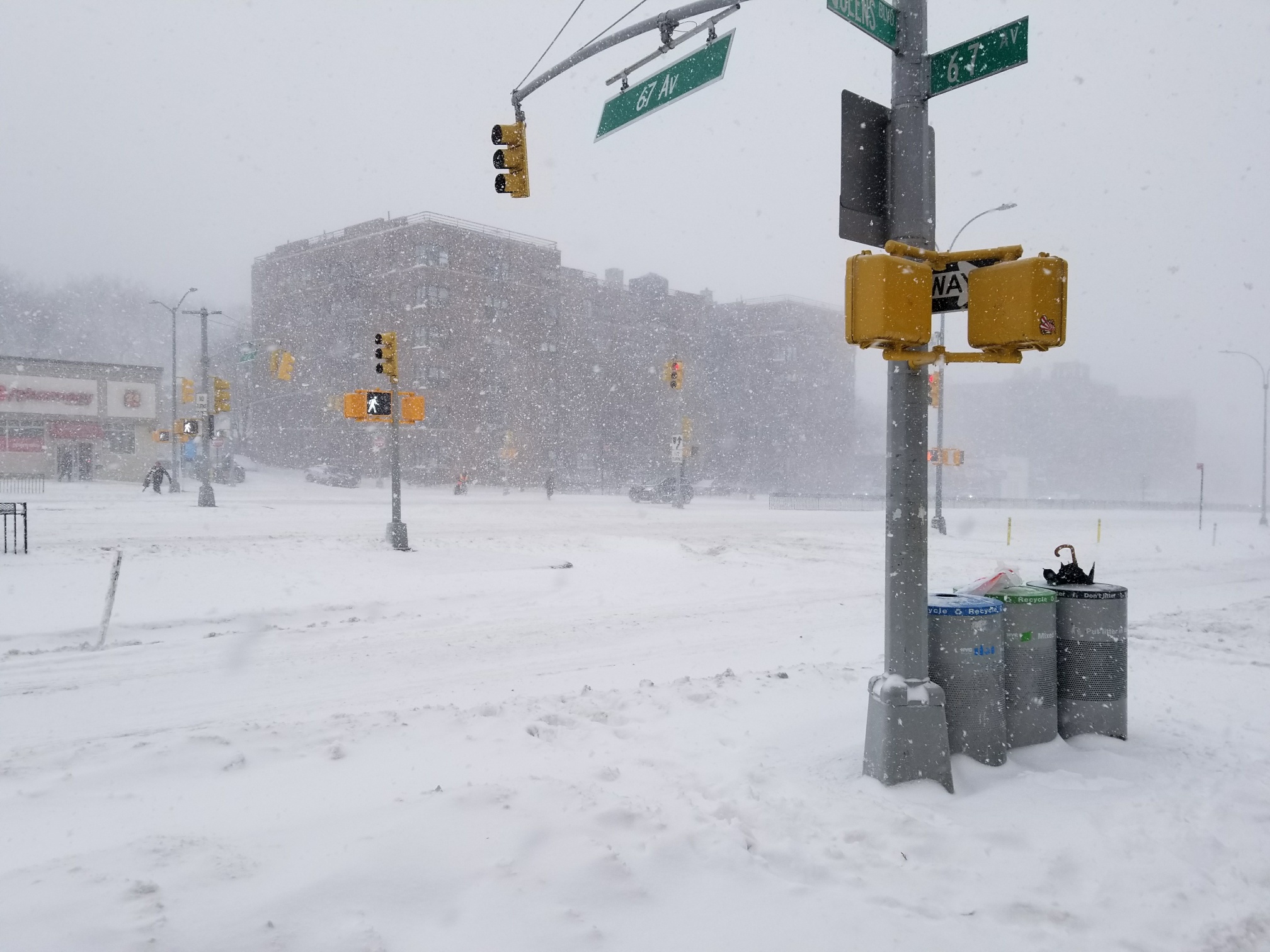
Queens:
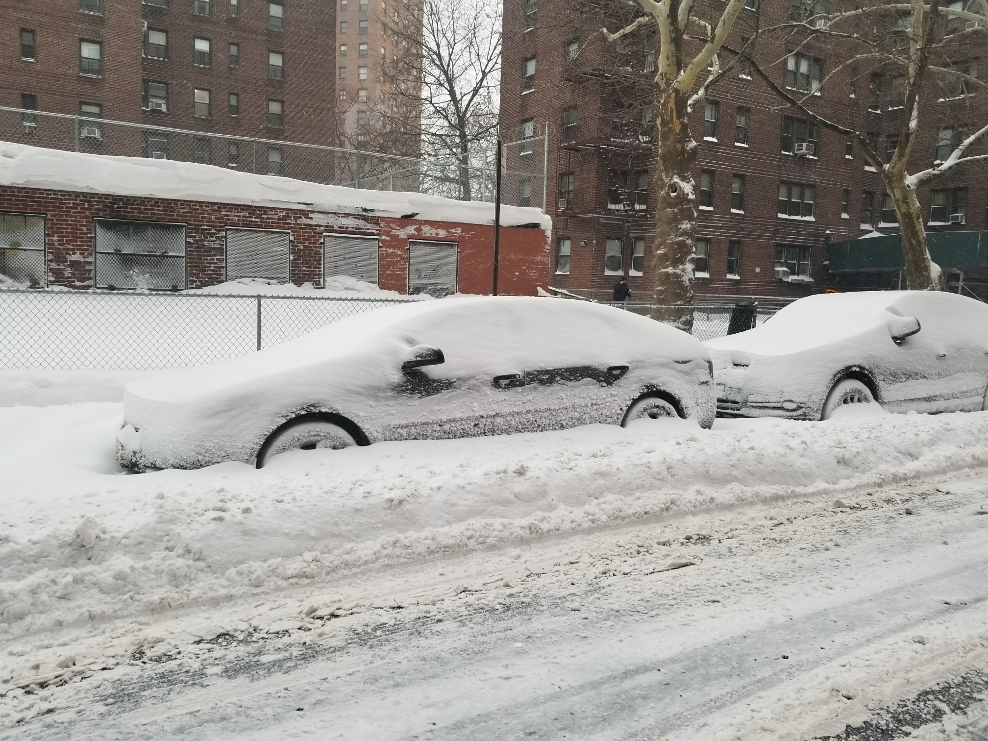
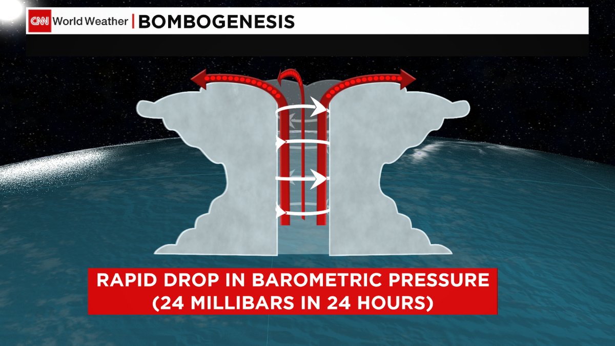
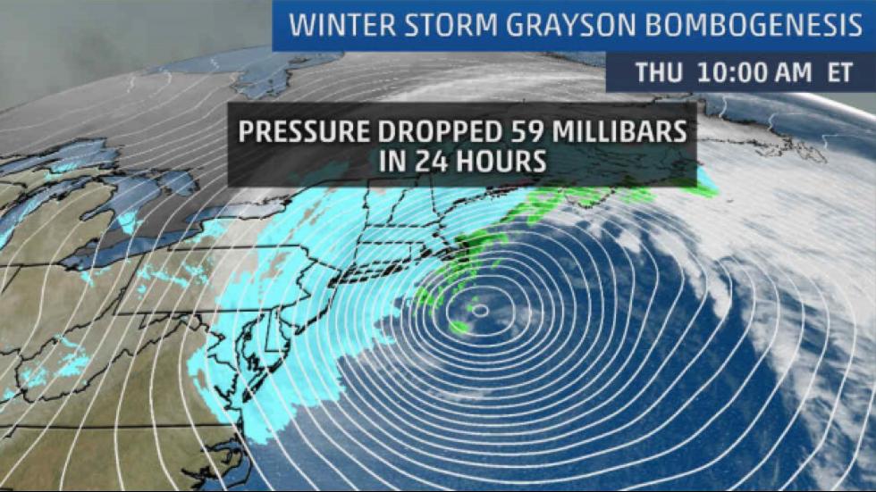
Depending where you are, the snow totals are on the NWS link below. I think it is ironic that I was discussing this scenario about a week ago, and bam, it happened. This was as close to a winter Hurricane as you can get, as the barometric readings were of a Category 3 Hurricane!!! Pretty cool as a hobbyist!!!! Some pictures below from Queens, graphic on what a Cyclogenesis, AKA Bombgenesis is and the NWS Updates on Snow:
Snow Totals – https://forecast.weather.gov/product.php?site=NWS&issuedby=OKX&product=PNS&format=CI&version=1&glossary=1&highlight=off
Click to Enlarge:
Click to Enlarge
Pretty Cool Stuff. For those of you in the Northeast, you will experience temps that will be the coldest in over 75 years. Look at the GFS Model Below:
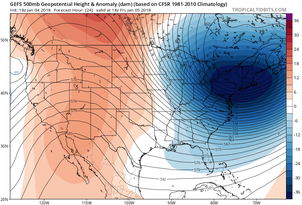
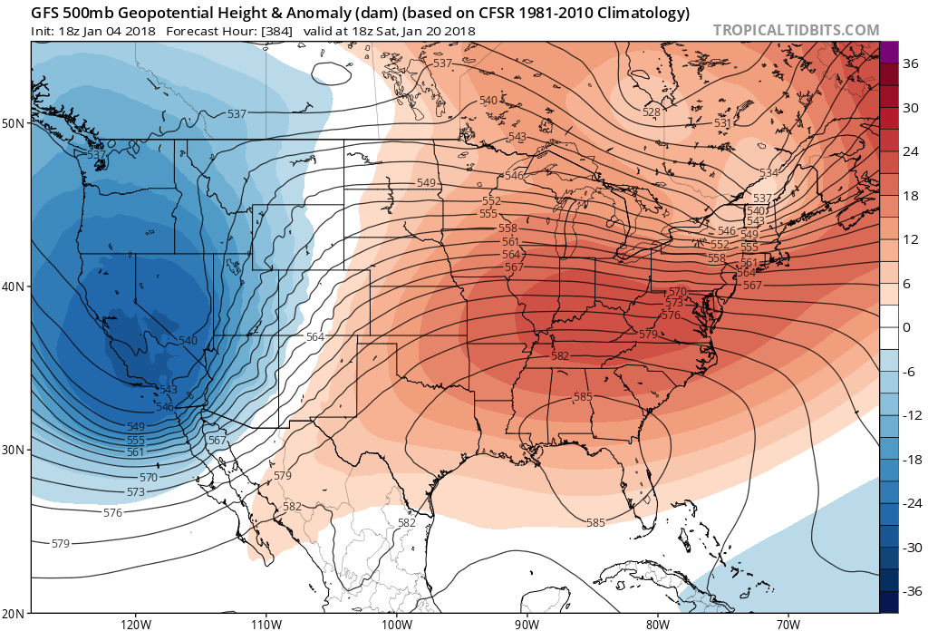
This is a serious PV!!!! The temps in the Northeast have not been over 30 degrees in 15 days. Unreal! Brutal temps. Tune into the NWS for more info, www.weather.gov. Wind Chills are running -20 to -30. Unreal!!! Temps moderate next week, but still below average. However, there is some hope by the middle of the month, as the pattern is forecasted to flip and Cold/Wet weather is headed to CA, while the Midwest/Northeast thaw out. See Below:
Jan 20th Forecast: Pattern to Change!!
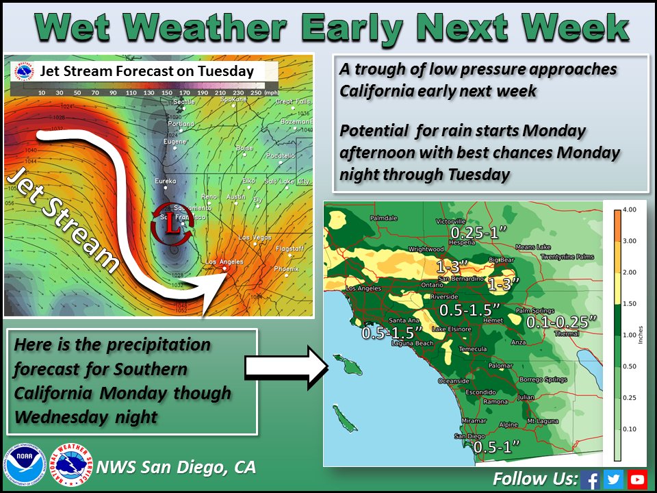
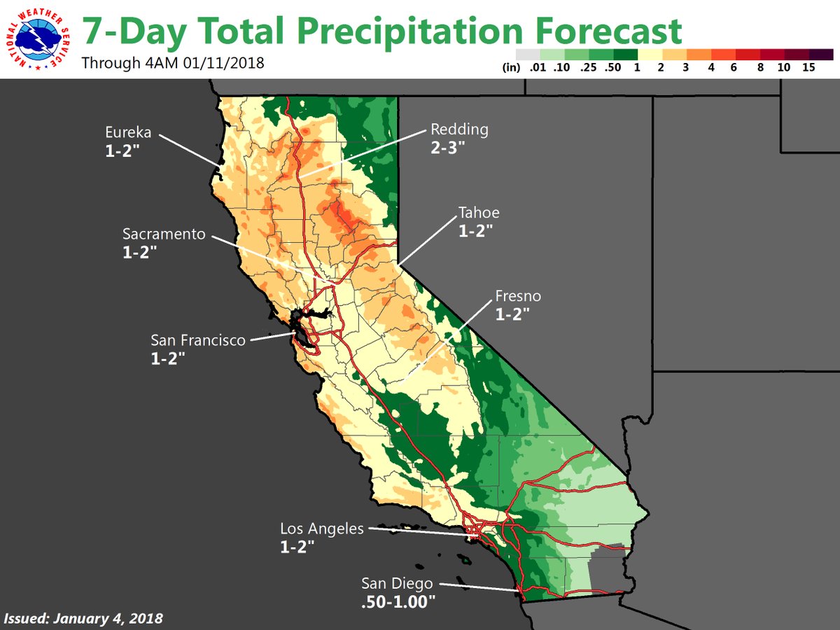
As for CA, things will start to change this weekend, as CA will start to get a series of storms all over the state. See the rain totals below, and even rain/high elevation snow in So Cal is in the cards. See NWS graphic below:
Pattern Change in CA for next week:
How much Rain could be get in CA next week??
I will update the status of the CA storms for next week, this weekend. In the meantime for those of you in the Northeast, please stay warm and be careful. It is brutal out there.
Dr. J
