Phil says 6 More Weeks of Winter….Will he be right??
Hope everyone enjoyed a safe SuperBowl, as I started writing this blog in the middle of it, as the game was over at half. As for the weather, there have been some major events this past week. Lets highlight it:
- The Northeast had two good storms this week, last Sunday’s blizzard which dumped anywhere from a foot of snow in NYC to over 2 ft in NY, CT, and upstate NY. Today, they got another good storm, as anywhere from 4″ to 10″ fell all over the tri-state area.
- The Midwest also got into the action with snow, as they got a foot in some areas.
- As for the West Coast, it has been mild and dry for the last week or so, as the last storm cycle dumped over 10+ feet of snow in the Sierra’s, and copious amounts of rain along the central coast, where the AR was aimed at. That being said, what does it mean for the rest of the month? Lets discuss and find out if Phil is right.
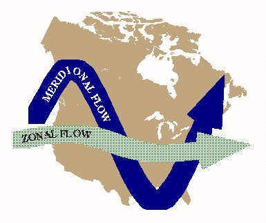
Currently the Global Models from today runs are showing both the GFS and Euro Models handing the long wave trough, parked back east with Polar vortex air. Most of the models are in agreement that the pattern is blocked out west due to the high pressure ridge, which has sent the Jetstream up and over the ridge out west into the Midwest and into the north east. This is a perfect example of the Meridional Flow
So, how long is this pattern going to be around? Will NYC break their February their snow record?
The answer is very possible. Currently, the models are trying to figure out what the next few weeks look like, but with a change from Winter to Spring coming, they are have a challenging time figuring out what mother nature is going to set up. For example, look the difference for this week between the Euro Ensemble Model and the GFS Ensemble Model
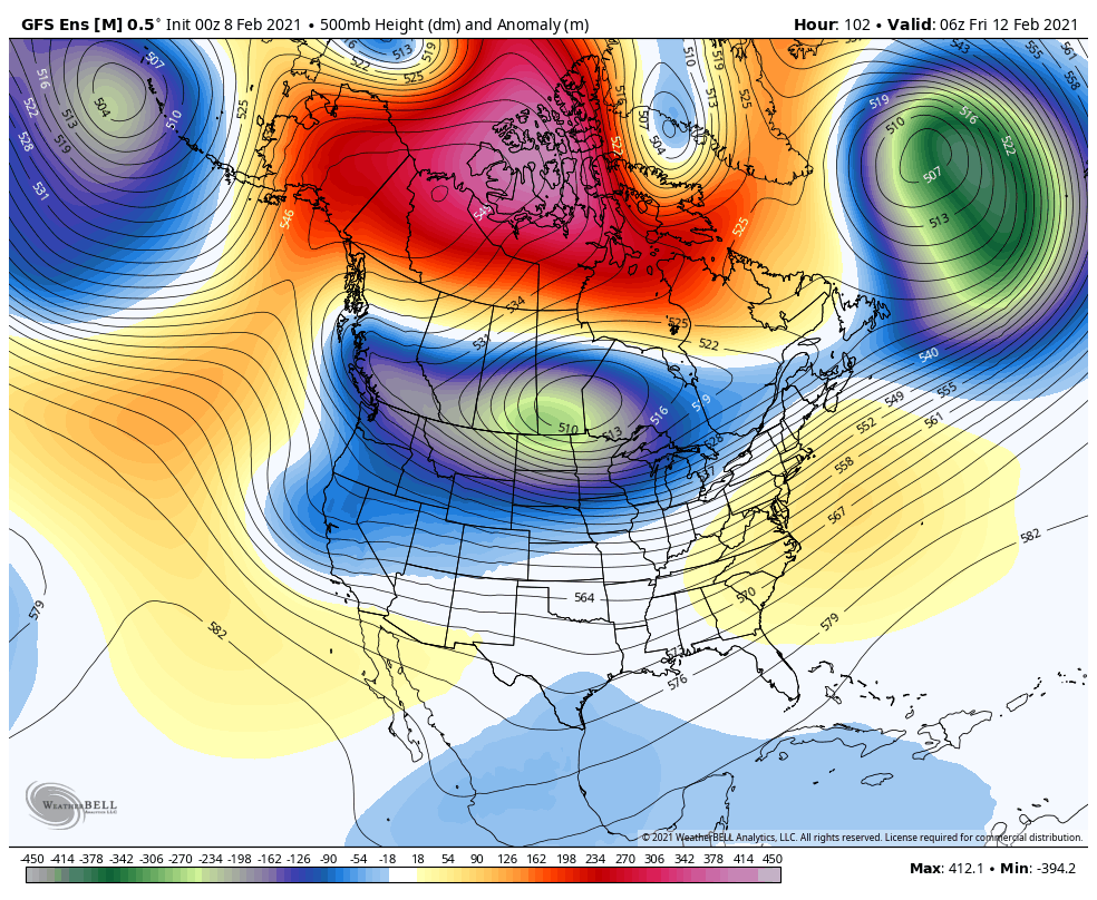
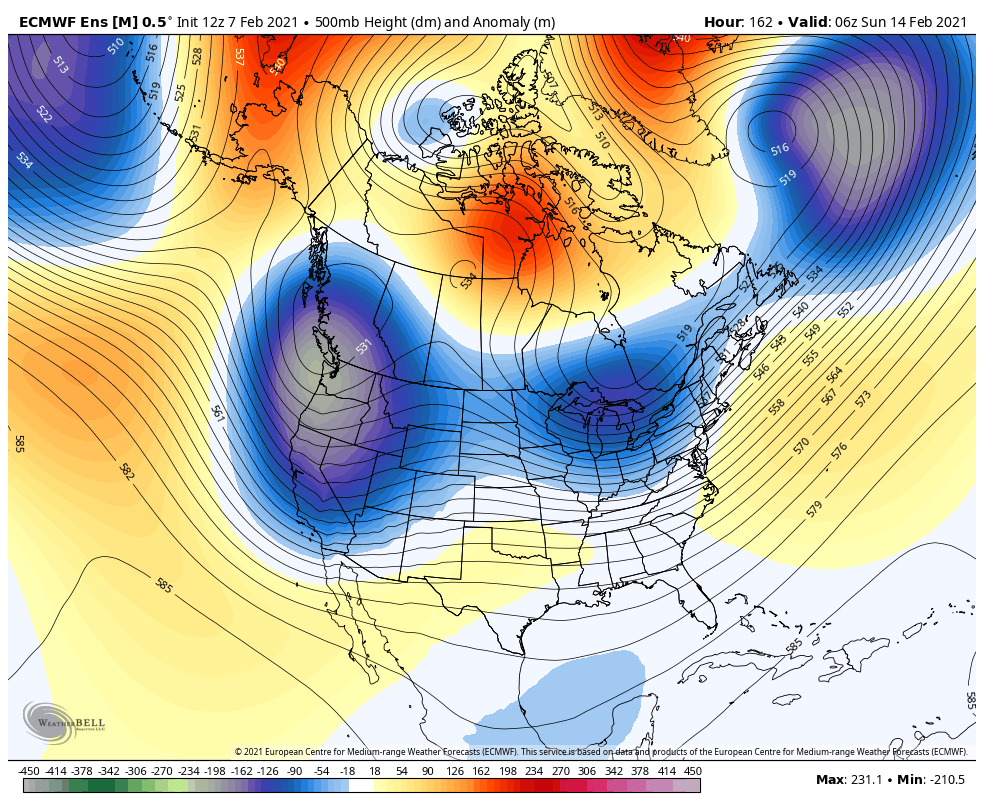
As you can see, both models show the mean high pressure ridge moving west off the West Coast and allow colder/possible weak to moderate storms to enter California. The Euro keeps the cold going, but really it depends where the ridge sets up in the long range thru the Holiday weekend. If this holds true, Tahoe and the Sierra’s could get some nice storms, not monster storms, but nice storms, and light rain will fall in NorCal, and weaken as it progresses into SoCal. We will see how this setups this week. However, I don’t see any 80s next weekend in the forecast for the LA area, but at this time last week I thought that would set up. However, do I say dare say rain showers might be in the cards??? This is good as it will keep the SoCal snow pack intact and no mid winter thaw to occur.
For the Midwest/Northeast, the Polar Vortex will continue for the extended time period, as snow chances for both regions will continue for the next 10-14 day period, which is what the models are showing. I do think NYC will get their February record of snow fall by the end of the Month. Something to watch.
Long Range – After Presidents weekend, the models are all over the place. The GFS Extended models are showing this for the weekend of the 20th (2 weeks from now)
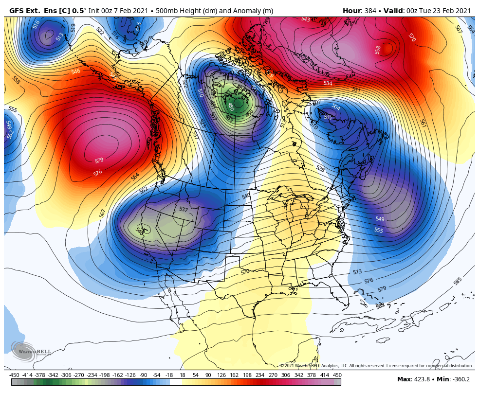
Again, this is subject to change, but I do see the ridge on the West Coast migrating north, and the jet stream undercutting the ridge and bringing active weather into California by the end of the month. This is depicted on the above image.
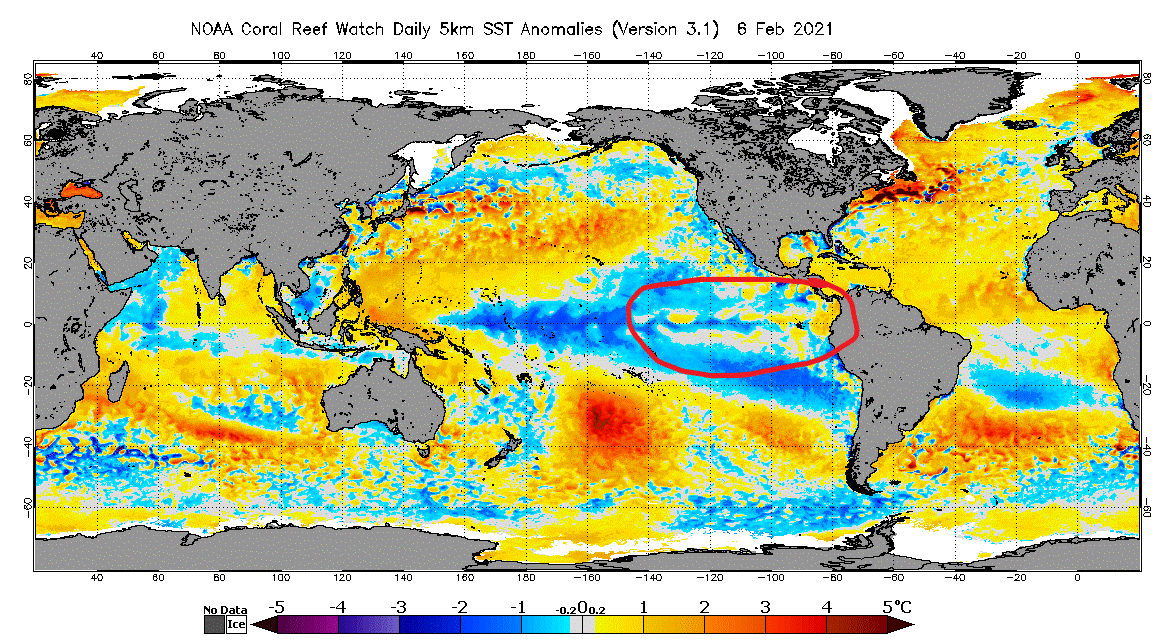
La Nina – Much as been talked about La Nina this winter in the media. It has really created an erratic winter of weather. From the drought in California, to 10+ feet of snow in a week after 90 degree weather, to the blizzards in the Northeast, it has been interesting. However, as we transition from Winter to Spring, Phil might be onto something. As you can see below, the SST’s (Sea Surface Temps) along the La Nina region are weakening, as I circled in RED. I have been monitoring this all winter and in the last month, it has progressed. Yes, it is still there but it is dissipating. I suspect, as we head into March, the teleconnection patterns that have been suppressed by the cooler La Nina waters, like the MJO (see my last discussion about the MJO), will become active again. Time will tell, but it is interesting to watch.
Next update later this week, as the models sort themselves out for the weather pattern for the next 10 days.
Stay Safe!
JM
