Heavy Rain in the West Forecasted for later this week…While a Possible Coastal Low in the East!!!
Weather followers,
Hope everyone that is in California is drying out a bit, as quite a bit of rain/higher elevation snow has fallen. With the storm door open for the next 7-10 days due to the long wave trough in the pacific and high pressure by the Aleutian islands, things look very active in the West Coast, especially California. Below are some highlights, as the West Coast is in for a very active week, and the Northeast might have their first coastal storm later this weekend.
– Most of you have asked me how much snow has fallen in Tahoe. Thanks goes out to BA of Opensnow.com in Tahoe for this graphic:
(Click to Enlarge)
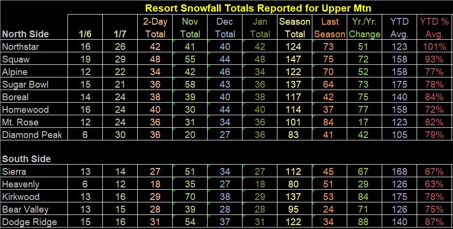
As you can see, we are making a dent into the drought and below snow fall totals for this water year, which started on October 1, 2018. With more snow in the forecast for the Sierra’s, the snow pack is in good shape to get to above average by the end of this wet storm cycle. I will update this later this week, as there is a snow storm forecasted every 2 days currently.
– By now, the readers on TV have been touting a several storms impacting CA starting on Friday through early next week. With a weak storm hitting SoCal Wednesday (most of the action will be north of Pt. Conception), all eyes turn to this Friday through Tuesday of the following week. Models are having a hard time getting a handle of how much rain/snow is going to fall, but here are the European and the American GFS forecasts from earlier today for that time period through the extended. Notice how much rain they are forecasting:
European Models, thru Jan 17th, total amount of rain. (Click to Enlarge)

That looks to be roughly 2″ to 4″ of rain in SoCal, forecasted to fall. Now look at the American GFS Model, same time period:
GFS Model (Click to Enlarge)
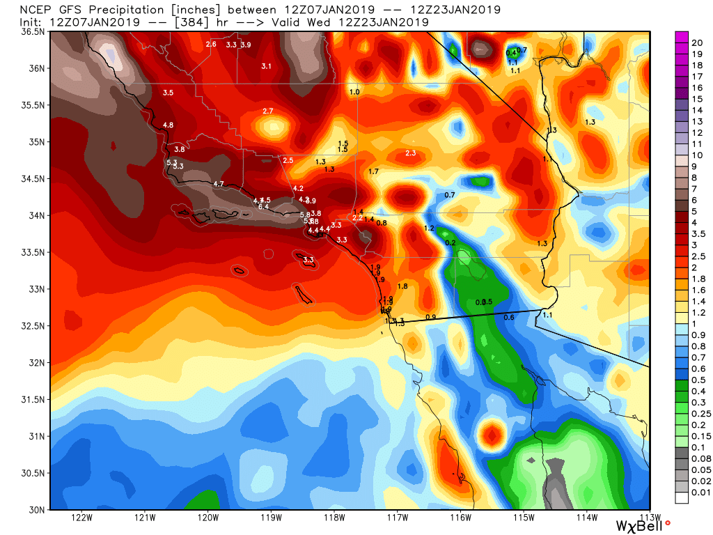
According to the GFS, 4″ to 7″ of rain is forecasted to fall through the middle of next week. Folks, I feel this is a big overdone, as the GFS model, due to the government shutdown, is having some forecasting issues. Click the link below to read the article about the GFS Model, which is not good at all.
That being said, even if the GFS is overdone and half of the rain/snow forecasted falls, there might be some serious hydrological issues in the burn scar areas. This is something that I will monitor as the storms evolve over the pacific throughout the week. I should know more by Wednesday as to what these next rounds of storms look like in terms of wind/rain & snow.
– Just as California braces for another 10 days of wet weather, the Northeast might be getting their first coastal storm this weekend. More on their storm later this week, but some snow is in the forecast as the models try to get a handle on what is going to happen. Stay Tuned.
Extended Forecasts:
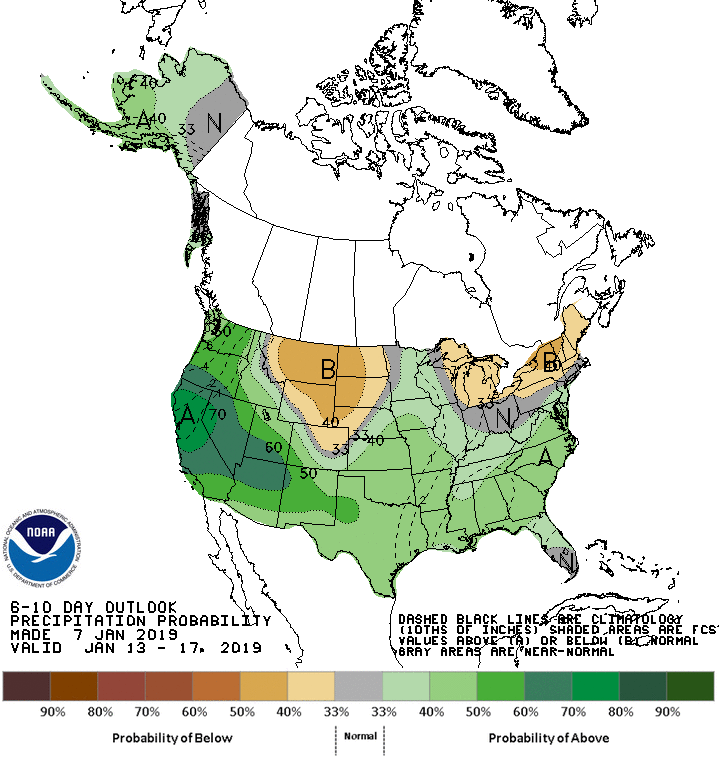
Below is the CPC’s Extended 6 to 10 day forecast….Look at how much rain is forecasted in the CPC’s forecast for the West Coast:
(Click to Enlarge)
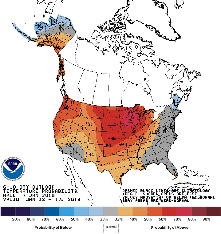
After the 15th or 17th of this month, I am forecasting a shift of the active weather to the Midwest/Northeast, as the West Coast will be under high pressure and dry out for a 10-14 day period. Look at the EPS Ensemble Models showing this on their extended forecast:
(Click to Enlarge)
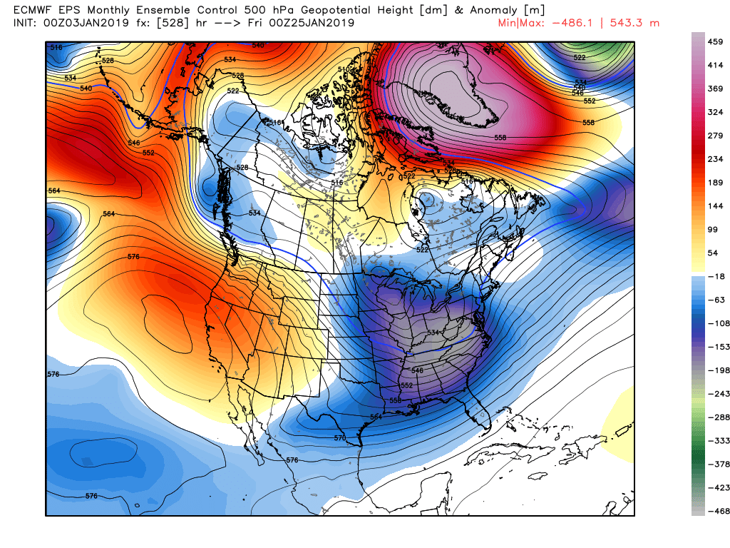
As you can see above, the pattern flips to a West Coast high pressure ridge and a Midwest/Northeastern trough. Look for this to be a good sign of very active wintry weather to effect these regions and get Boston and NY some needed snow! Time will tell how long this flip of the pattern stays around, as the southern jet stream, enhanced by El Nino has made is challenging for all of the bitter cold/snow to really stay in the Northeast this winter. A flip of the pattern back to a stormy West Coast might happen in early February. Stay Tuned!!!
Next update on Wednesday, as the models should have some more clarity on the weekend’s storms out West!
–JM
@realwxforecast
