Big Changes are Headed for the West Coast for the First Weekend of 2019!
Hope everyone had a happy and safe New Years! As we transition to the first week of 2019, big changes are headed for West Coast, as the pattern is looking more and more likely to be wet starting this weekend. After traveling to the East Coast last week and experiencing above normal temps and rain off and on, most people in the Northeast are wondering where their winter is? As evident during New Years Eve, it was 48 degrees and pouring at Time Square! As the same time, the SouthWest/Western half of the US got nailed with bitter cold/snow all the way from Northwest down Arizona, New Mexico and Texas. Snow levels were down to 2000 ft. Insane. So this begs the questions, what is next and why is this happening?? There are a few reasons why everything is a bit abnormal to start off 2019.
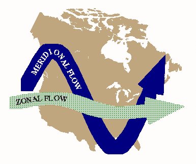
– One reason is there is very little blocking (High Pressure) in North America currently. As previous posts I have discussed the difference between Meridional Flow and Zonal Flow in relations to the jet stream and blocking. In the past 5 winters in the US, we have had Meridional Flow persist and dominate the Midwest/Northeast with Snow and the Polar Vortex. Currently, due to a moderate to weak El Nino, we have more of a zonal flow, which is sending in moderate pacific mild air into the rest of the country, suppressing the Polar Jet Stream to the north. See the image below:
(Click to Enlarge)
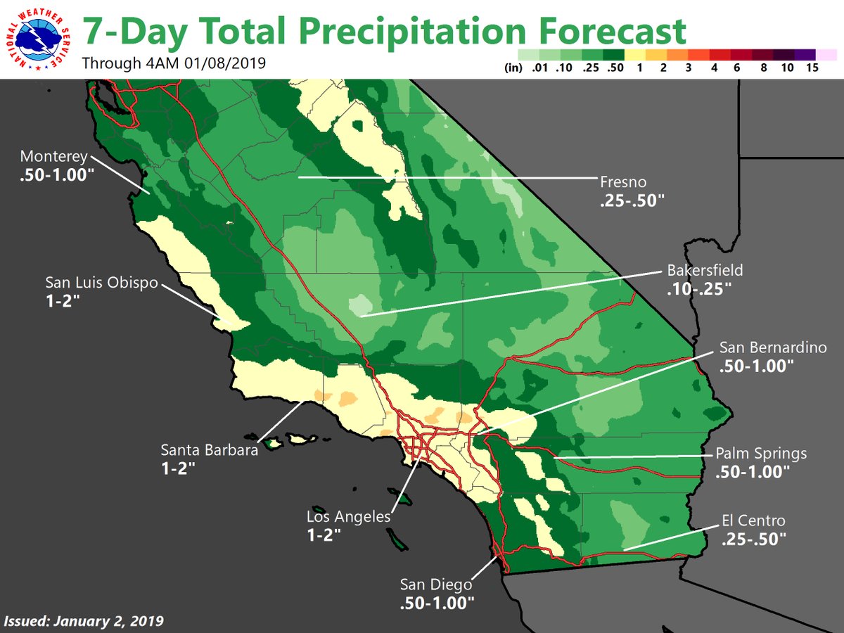
In another twist, the Meridional flow has retrograded to the West, which sentArctic air down the Western/Southwestern regions of the US, and forced more tropical (Gulf of Mexico) air to the northeast. This has been taking place for the last week or so, which is why Los Angeles had record lows of 38 New Years Eve night and southern Arizona has more snow on the ground than the cities in the northeast. This type of pattern combined with a weakening El Nino has enhanced the southern jet stream, and will allow for some decent storms to hit California and SoCal starting on Saturday, and then again next week. Below is the NWS Graphic for this weekend’s storm, with rain fall projections:
(Click to Enlarge)
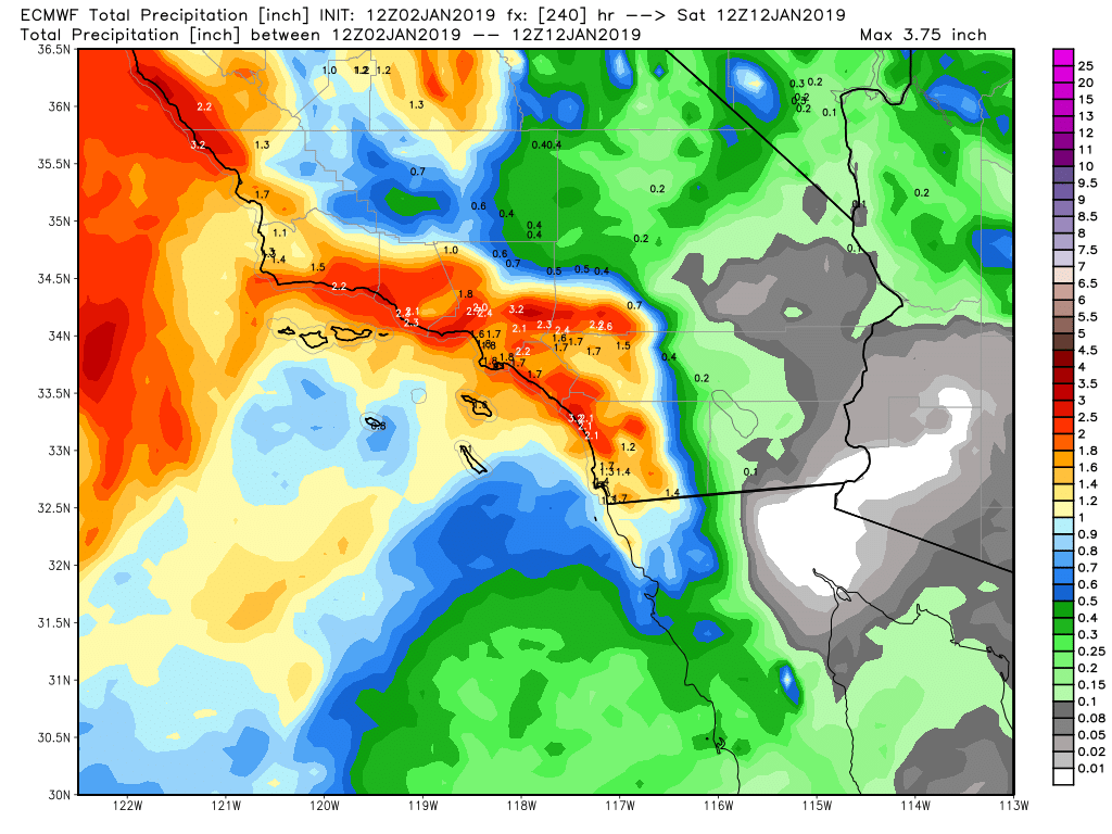
Here is the European Model from for the same time period through the 9th of January. they are showing a bit more rain:
(Click to Enlarge)
To recap, There is a storm system poised to hit SoCal this Saturday through Sunday, and another one from Tuesday/Wednesday of next week. Snow levels for this weekend will be anywhere from 3K to 5K, depending when the front hits and blows through. I will update this on Friday, to see if the storm doesn’t lose it punch when it hits Point Conception and drags southward.
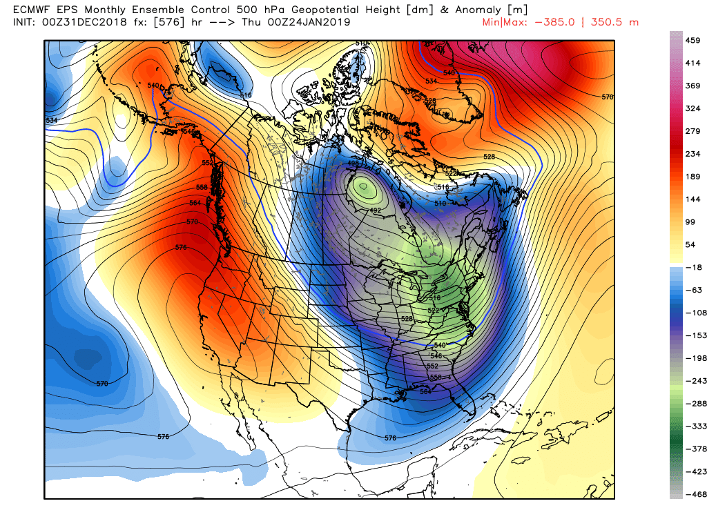
Long Range – For those of you who are in the Northeast and in the Tri-Cities area of NY (you know who you are) and are waiting and looking for any signs of snow and a cold winter, the EPS (European long range models) are showing some pattern changes that might make you happy the 2nd and 3rd weeks of this month. Look at this model for January 13th and for January 24th
(Click to Enlarge)

(Click to Enlarge) January 24th
The pattern will flip, but when and where is anyone’s guess. Interesting stuff regardless.
For all of my followers, have a great start to 2019!!! Happy New Year!
Next Update on Friday
-JM
