Hurricane Rosa to Effect SoCal Weather, LA’s First Meaningful Rain in 6 Months!!!
Weather Followers – Hope you have all been well. Although it has been awhile since I have posted on the blog, I have been active on my twitter feed, @realwxforecast If you are not on there, check it out!! In the last post I released, I discussed how I wouldn’t be surprised if a hurricane effected SoCal, and Baja to the very warm SSTs off the coast of SoCal……well, I was close.
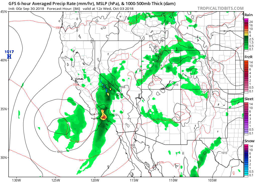
As most of you know from the news media, Hurricane Rosa is poised to hit the eastern part of the southwest US and Baja CA. As you can see on the map below, there is a lot of precipitation coming to SoCal. Concurrent to Rosa, there is a cut off low tracking down the California coast, that will tap into residual moisture from Rosa, as a decent storm might produce .25″ to 1.5″ of rain through Wednesday south of Pt. Conception. If you live in Arizona, and southeastern California, you are going to get pounded by the reminiscence of Rosa. Please see the NOAA’s Weather Prediction forecast for precipitation through next Friday…….looks impressive if this verifies.
WPC Precipitation Forecast through Friday. (Click in enlarge)

For SoCal, here is the cut-off low pressure frontal system from the GFS, showing that Tuesday night/Wednesday will be the most active.
Main SoCal weather front from the GFS, courtesy of Tropical Tidbits:
Since it is late currently, I will update this forecast tomorrow am and look at what the models show, as this is a very complex system. Bottom line is for those that are in the burns areas, and/or near the burn areas south of Pt. Conception, monitor the NWS. If the cut-off low pressure gets more moisture from Rosa, this could be a big system.
Until tomorrow AM!
