High Elevation Snow in CA this this weekend…….Long Term Forecast in Flux;
Hope everyone had save and wonder Thanksgiving. Quick Update this AM –
- Short Term forecast –
High pressure in the west that gave CA record breaking temps this past week has moved east, which will allow some weather to impact CA. Look for high snow levels in the sierra, with rain in the bay area. Maybe 1′ to 3′ of snow to fall above 8′ feet. This is much needed, as the snow was melting this weekend in the high country. As for SoCal, as usual, will get the tail end of this system, with cooler weather and maybe a PHIZZLE (mist and light rain) or two Sunday night. For the East Coast, pretty benign weather, with dry conditions and normal temps.
Long Term –
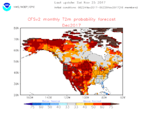
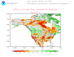
The long term forecast is in flux, as both the European & American models are fighting with each other.What I can tell all of you is the CFSV2 is forecasting a very warm/dry December for the west coast, per the graphic below:
December Temperature Forecast (Click to Enlarge)
December Precipitation Forecast (Click to Enlarge)
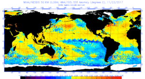
As I have been touting for the last week or so, this winter in CA will be bone dry and very warm, as long as the warm blob is present in the eastern pacific (See below). As for the Northeast, the end of December… winter will really set in with snow/bitter cold temps! Get your snow blowers while they are on sale for Black Friday weekend deals!!!
There is the warm blob, front and center just below the Aleutian Islands!! As long as the Blob is there, SoCal will be bone dry and 80 to 90 degree temps off and on throughout this winter and the Northeast will be pounded by Snow/Cold temps!!! I have you covered!
Next update tomorrow night!!!
Dr. J


