
Major Heat Wave to Hit California this weekend through next week; Mild on the East Coast!!!
After traveling for the past few weeks, not much has changed weather wise on either coast. After a late September snow fall in the Rockies, and cooler weather out west, October has been hot on both coasts, with 10-15 degrees above normal in both places. Unfortunately, not much is going to change for the foreseeable future. With California and the West coast under very hot with dry air, most of the wine country in the vicinity of Napa is gone, burnt to the ground. Our hearts go out to the people out there, as this is the worst disaster in the history of California. And looking forward for the next few weeks weather wise, things are going to get worse for the firefighters. See the 6 to 10 day NOAA Outlook:
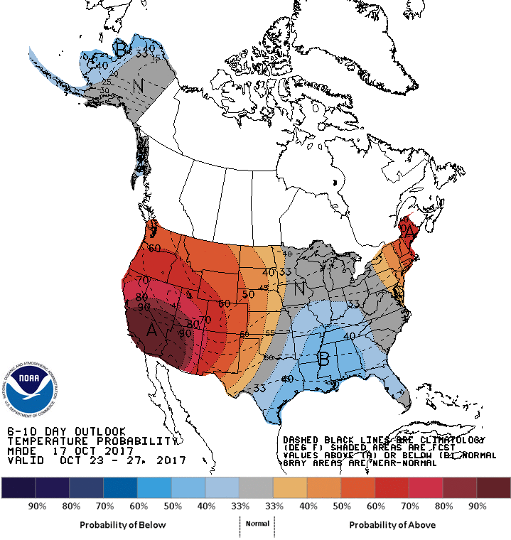
(CPC 6 to 10 day forecast) Click to enlarge
After a weak trough of low pressure effects northern California this weekend, the Southwest is going to bake, with temps close to 25 to 30 degrees above normal. In fact, records will fall next week in Southern California, with downtown temps close to 105 for the start of the WS game at Dodger Stadium. All the west coast will be under high pressure, with very hot temps. The Northeast will also be above average for this time of year, with temps running in the mid to high 70’s, with nighttime lows in the 50th. That is warm for this time of year. Not much is going to change for the 8 to 14 day temps:
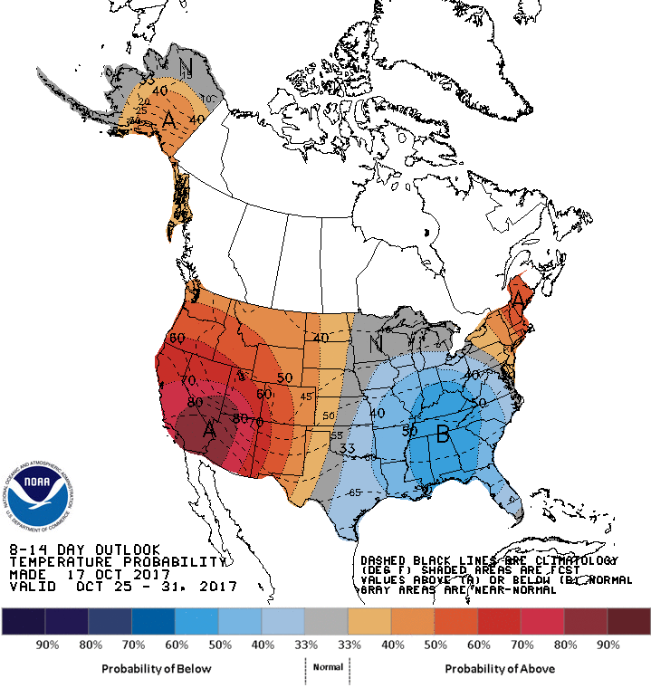
(CPC 8 to 14 day forecast) Click to enlarge
As you can see, the West is still under huge high pressure and the southeast cools, which the northeast is still under warm temps for this time of year. What does this all mean?
Inter-seasonal Outlook:
The jury is still out for this winter. I am looking at the SST (sea surface temps), which will dictate a lot of the weather for this winter. However, I know that November will very similar to October, as you can see on the below CFSv.2 forecast model:
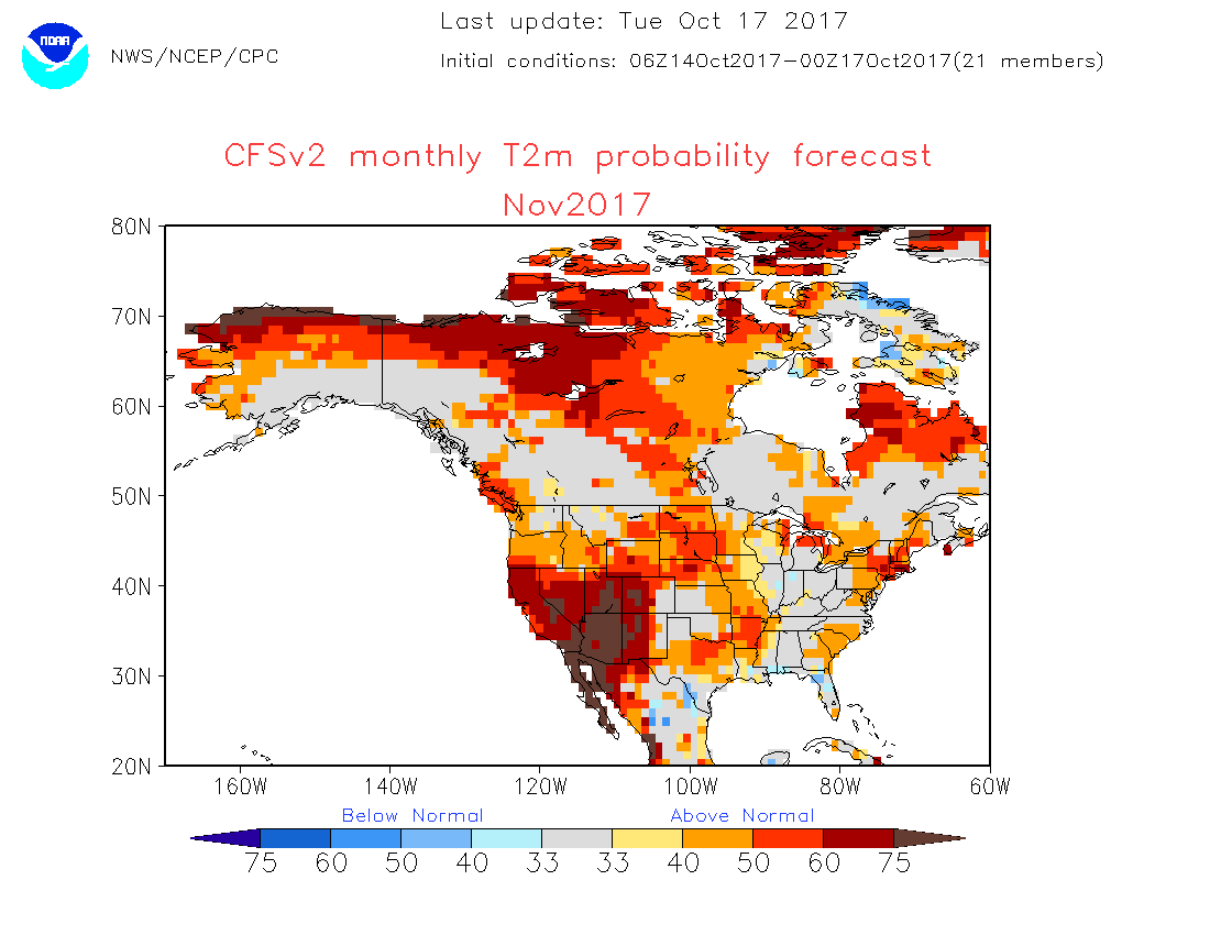
(Click to enlarge)
Like October, the southwest still be hot, windy and above average in temps for the month of November. Fires will continue to burn all over the west, as well as new fires will start due to the low humidity, hot temps, and windy conditions. In addition, the northeast will be above normal temps as well on this forecast model, which is unusual for this time of year. This could go down as the warmest fall ever recorded if the forecast models verify. Look for above average temps for most of the southwest for November. If I had to go out on a limb, I would be predicting a very warm start to the winter and very dry for the West Coast. There are some rumors about a La Nina forming in the equatorial waters, but I am not sold on how strong that is going to be until next month. More later about that…………
Stay Cool. Will update later this week on the major heatwave and will focus a little bit on the winter. For now, November looks warm for both coasts!
–JM
