
The Main Event is Right on the Doorstep of Southern California!!!! Be Prepared!!!!
Update at 22:17 PST :
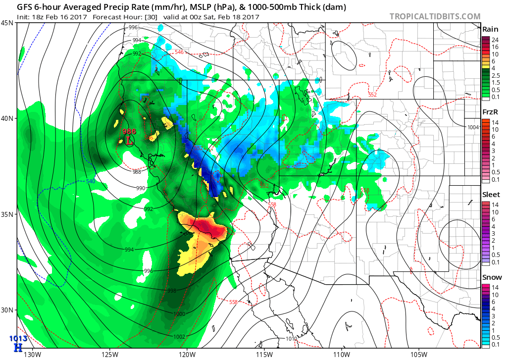
The NAM (North American Model) just got released, and below is the graphic. This model is forecasting close to 5″ of rain by Monday, which seems in line with what I have forecasted. Pt. conception looks to be around 6″, so it is clear that this storm is not moving that quickly. Moderate rain will start to effect the LA County area by midnight tonight, and will last close to 24 hours.

(click to enlarge)
IR GOES Satellite Imagery – Look at how much moisture is coming into Southern California
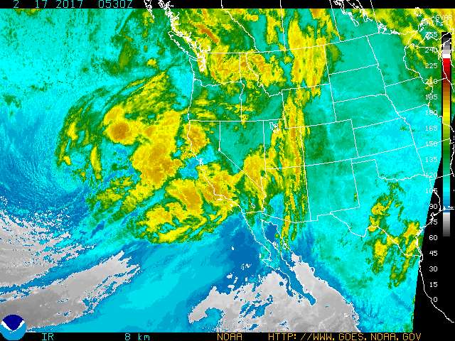
(click to enlarge)
Next update tomorrow am! Be Safe!
_____________________________________________________________________________________________________________________________________
Get ready folks…… the time has come!!!! Here we go with the start of what looks to be a very an impressive period of rain and wind across Southern California. The initial band of rain will be weak with a light amounts of precipitation through this evening. Currently, the rain is currently near the Santa Barbara area, and will slide down the coast to hit LAC by this evening. By later tonight, rain rates will ramp up in intensity later tonight into Friday Night as the storm slams into So Cal!!!!
Forecast Models are all in track for a big event tonight through Saturday Morning. Timing/Notes…..
***Rain Starts Thursday PM through the evening. Overnight Thursday through Friday am, rain becomes VERY HEAVY AND INTENSE!!
**Heavy Period is between Friday 8 am Through Friday night at 10 PM. Friday night into Saturday am, will be showery of nature, and maybe some possible T-Storms.
***Heavy Rain
***Heavy Wind
***Heavy Snow above 7500 ft, Friday morning, then falling to 6K Feet by Saturday AM.
***Serious Mudslides, winds, floods and hydrological issues are going to be the news makers for the next 36 hours!!
THIS IS THE STRONGEST STORM I HAVE SEEN TO HIT THE LA AREA SINCE 1997!!!!!
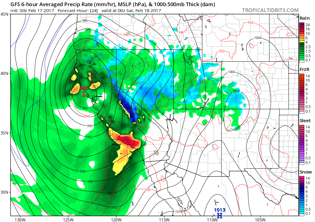
Below are the Forecast Models for the Main Event: Notice the Red Area!!! LA COUNTY is the bulls-eye!!!!
(Click the Image to enlarge)
How much rain can we expect??? The Forecast Models show this much for Southern California through Saturday at 4 am. I think Downtown LA will get 5+” of rain from Tonight through Saturday night (48 hr. Period), as Saturday will be showery, but tomorrow will be the main event. I am predicting the storm will slow down (negative tilt) and dump more rain than is forecasted…..time will tell!!! Here is NWS Hydrological forecast:

(click to enlarge)
Looks like LA will get about 4″ of rain through 4 PM local time tomorrow. Therefore, I am predicting roughly 5″ of LA, and 12″ in the mountains below 7500 ft.
For detailed information of your city, go to www.weather.gov – National Weather Services. They currently have 16 warnings up now!
More later when I look at the models tonight!
Be Prepared and Be Safe!!
